
Dawsons Landing 🇨🇦
-
Nautical Twilight begins:05:32 amSunrise:06:47 am
-
Sunset:08:11 pmNautical Twilight ends:09:26 pm
-
Moonrise:07:20 pm
-
Moonset:02:26 am
-
Moon over:11:02 pm
-
Moon under:10:53 am
-
Visibility:89%
-
 Waxing Gibbous
-
Distance to earth:387,955 kmProximity:41.7 %
Moon Phases for Dawsons Landing
-
poor Day
-
minor Time:01:26 am - 03:26 am
-
major Time:09:53 am - 11:53 am
-
minor Time:
 06:20 pm -
08:20 pm
06:20 pm -
08:20 pm
-
major Time:10:02 pm - 12:02 am
Tide Clock
Tide Graph
Times
| Tide | Time | Height |
|---|---|---|
| low | 05:38 am | 3.74 ft |
| high | 12:11 pm | 11.32 ft |
| low | 05:30 pm | 7.28 ft |
| high | 11:27 pm | 13.29 ft |
| Date | Major Bite Times | Minor Bite Times | Sun | Moon | Moonphase | Tide Times |
|---|---|---|---|---|---|---|
|
Thu, 04 Sep
|
09:53 am -
11:53 am
10:02 pm -
12:02 am
|
01:26 am -
03:26 am
06:20 pm -
08:20 pm
|
R: 06:47 am S: 08:11 pm |
R: 07:20 pm S: 02:26 am |
Waxing Gibbous |
low: 05:38 am
, 3.74 ft
high: 12:11 pm
, 11.32 ft
, Coeff: 43
low: 05:30 pm
, 7.28 ft
high: 11:27 pm
, 13.29 ft
, Coeff: 64
|
|
Fri, 05 Sep
|
10:44 am -
12:44 pm
10:51 pm -
12:51 am
|
02:50 am -
04:50 am
06:38 pm -
08:38 pm
|
R: 06:49 am S: 08:09 pm |
R: 07:38 pm S: 03:50 am |
Waxing Gibbous |
low: 06:15 am
, 2.95 ft
high: 12:39 pm
, 12.14 ft
, Coeff: 52
low: 06:13 pm
, 6.2 ft
|
|
Sat, 06 Sep
|
11:34 am -
01:34 pm
11:28 pm -
01:28 am
|
04:16 am -
06:16 am
06:52 pm -
08:52 pm
|
R: 06:50 am S: 08:07 pm |
R: 07:52 pm S: 05:16 am |
Full Moon |
high: 12:12 am
, 14.01 ft
, Coeff: 72
low: 06:49 am
, 2.36 ft
high: 01:08 pm
, 13.02 ft
, Coeff: 61
low: 06:53 pm
, 5.09 ft
|
|
Sun, 07 Sep
|
12:17 am -
02:17 am
12:23 pm -
02:23 pm
|
05:42 am -
07:42 am
07:04 pm -
09:04 pm
|
R: 06:52 am S: 08:04 pm |
R: 08:04 pm S: 06:42 am |
Full Moon |
high: 12:55 am
, 14.5 ft
, Coeff: 77
low: 07:22 am
, 2.07 ft
high: 01:38 pm
, 13.85 ft
, Coeff: 70
low: 07:34 pm
, 4.04 ft
|
|
Mon, 08 Sep
|
01:05 am -
03:05 am
01:12 pm -
03:12 pm
|
07:08 am -
09:08 am
07:16 pm -
09:16 pm
|
R: 06:54 am S: 08:02 pm |
R: 08:16 pm S: 08:08 am |
Full Moon |
high: 01:37 am
, 14.7 ft
, Coeff: 79
low: 07:56 am
, 2.13 ft
high: 02:09 pm
, 14.6 ft
, Coeff: 78
low: 08:15 pm
, 3.18 ft
|
|
Tue, 09 Sep
|
01:54 am -
03:54 am
02:02 pm -
04:02 pm
|
08:36 am -
10:36 am
07:29 pm -
09:29 pm
|
R: 06:55 am S: 08:00 pm |
R: 08:29 pm S: 09:36 am |
Waning Gibbous |
high: 02:20 am
, 14.53 ft
, Coeff: 78
low: 08:29 am
, 2.56 ft
high: 02:41 pm
, 15.12 ft
, Coeff: 84
low: 08:57 pm
, 2.59 ft
|
|
Wed, 10 Sep
|
02:44 am -
04:44 am
02:55 pm -
04:55 pm
|
10:06 am -
12:06 pm
07:45 pm -
09:45 pm
|
R: 06:57 am S: 07:58 pm |
R: 08:45 pm S: 11:06 am |
Waning Gibbous |
high: 03:04 am
, 14.04 ft
, Coeff: 72
low: 09:04 am
, 3.31 ft
high: 03:16 pm
, 15.39 ft
, Coeff: 87
low: 09:43 pm
, 2.36 ft
|


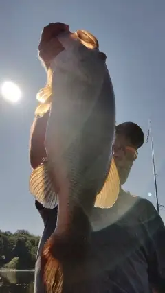
uploaded by: Steven Butcheck

uploaded by: Joey Piercefield

uploaded by: Hoza

uploaded by: John Matthews

uploaded by: JoEllen Disterhaupt

uploaded by: JoEllen Disterhaupt

uploaded by: Charlie Pifer

uploaded by: Charlie Pifer

uploaded by: Charlie Pifer

uploaded by: Charlie Pifer
Best Fishing Spots in the greater Dawsons Landing area
Beaches and Bays are ideal places for land-based fishing. If the beach is shallow and the water is clear then twilight times are usually the best times, especially when they coincide with a major or minor fishing time. Often the points on either side of a beach are the best spots. Or if the beach is large then look for irregularities in the breaking waves, indicating sandbanks and holes. We found 25 beaches and bays in this area.
Charcoal Bay - 6km , Sandell Bay - 8km , Fish Trap Bay - 9km , Oyster Bay - 9km , Morgan Bay - 9km , Taylor Bay - 9km , Johnston Bay - 10km , Sleepy Bay - 11km , Scandinavia Bay - 11km , Frypan Bay - 12km , Gildersleeve Bay - 13km , Henderson Bay - 14km , Pierce Bay - 14km , Joe's Bay - 14km , Finn Bay - 14km , Big Frypan Bay - 14km , Sunshine Bay - 14km , Wilson Bay - 14km , McPhee Bay - 14km , McClusky Bay - 15km , Rocky Bay - 15km , Fishhook Bay - 15km , Frigate Bay - 16km , Bleak Bay - 17km , Kelp Bay - 18km
We found a total of 100 potential fishing spots nearby Dawsons Landing. Below you can find them organized on a map. Points, Headlands, Reefs, Islands, Channels, etc can all be productive fishing spots. As these are user submitted spots, there might be some errors in the exact location. You also need to cross check local fishing regulations. Some of the spots might be in or around marine reserves or other locations that cannot be fished. If you click on a location marker it will bring up some details and a quick link to google search, satellite maps and fishing times. Tip: Click/Tap on a new area to load more fishing spots.
McLeod Point - 2km , Edna Mathews Island - 2km , The Haystack - 5km , Ethel Island - 5km , Ida Island - 5km , Doris Lake - 6km , Blair Island - 6km , Hemasila Inlet - 6km , Charcoal Bay - 6km , Florence Island - 7km , Stone Point - 7km , Walbran Island - 8km , Sandell Bay - 8km , Good Hope Lakes - 8km , Fish Trap Bay - 9km , Oyster Bay - 9km , Morgan Bay - 9km , Fleming Point - 9km , Pendleton Island - 9km , Taylor Bay - 9km , Hoy Lake - 10km , Agnes Lake - 10km , Geetla Inlet - 10km , Johnston Bay - 10km , Sandell Lake - 10km , Elsie Lake - 11km , Waterfall Inlet - 11km , Welch Island - 11km , Sleepy Bay - 11km , Geetla Point - 11km , Scandinavia Bay - 11km , Fish Egg Inlet - 12km , Frypan Bay - 12km , Gildersleeve Bay - 13km , Mantrap Inlet - 13km , Philip Inlet - 13km , Morrow Island - 13km , Bosquet Point - 13km , Penrose Island - 13km , Mullion Lake - 13km , Rivers Inlet - 13km , Hardy Inlet - 13km , Henderson Bay - 14km , Pierce Bay - 14km , Joe's Bay - 14km , Lone Island - 14km , Finn Lake - 14km , Sulphur Arm - 14km , Finn Bay - 14km , Big Frypan Bay - 14km , Sunshine Bay - 14km , Ripon Island - 14km , Wilson Bay - 14km , Ralph Point - 14km , McPhee Bay - 14km , McClusky Bay - 15km , Addenbroke Point - 15km , Rocky Bay - 15km , Cookson Lake - 15km , Canniff Point - 15km , Fishhook Bay - 15km , McAllister Point - 15km , Bald Islet - 16km , Cleve Island - 16km , Dyer Islets - 16km , Exposed Anchorage - 16km , Fury Island - 16km , Fury Point - 16km , Frigate Bay - 16km , Sulky Point - 16km , Ash Lake - 16km , Bilton Island - 16km , Draney Inlet - 16km , Owikeno Point - 16km , Spit Point - 17km , Bird Island - 17km , Bleak Bay - 17km , Curlew Point - 17km , Folly Islet - 17km , Frigate Islet - 17km , Grey Islets - 17km , Heathcote Island - 17km , Ironside Island - 17km , Karslake Point - 17km , Stormy Point - 17km , Stunted Islets - 17km , Surf Point - 17km , Crooked Island - 17km , Fire Islets - 17km , Joachim Island - 17km , Maze Islets - 17km , Schooner Retreat - 17km , Secure Anchorage - 17km , Elizabeth Lagoon - 18km , Rouse Point - 18km , Dimsey Point - 18km , Kelp Bay - 18km , Bull Island - 19km , Calf Islet - 19km , Elizabeth Lake - 20km
Comments