
How to use our fishing calendar
Planning your next fishing trip in Magherafelt, United Kingdom ? Today is a poor day for fishing. Our comprehensive fishing almanac combines our popular solunar bite times, moon times, sunrise and sunset times, nearby tide tables, and a 7-day fishing calendar so you always know the best fishing times in your area. We analyse major and minor solunar bite times, rate each day on a five-star scale, and pair it with localized weather forecasts so you can quickly tell whether today is a good day to fish without juggling multiple tabs. Be sure to bookmark this page so you never miss a bite. view bite times...
- Check our unique Solunar Clock for precise solunar bite times and the best moon phases.
- Use the Tide Clock section to sync bite times with high and low tide tables.
- Analyze the forecasted weather conditions, such as wind, barometric pressure and rain to plan your fishing session.
- Jump to the 7-Day Fishing Calendar for an extended fishing forecast, then explore nearby fishing spots on the interactive map.
Magherafelt in County Londonderry is a prime base for coarse and game fishing in Northern Ireland, with easy access to Lough Neagh, the Lower Bann and a network of productive stillwaters. Anglers target everything from specimen pike and wild brown trout to bumper bags of roach and bream, with reliable year-round sport. The mix of big open loughs, canals and rivers around Magherafelt rewards anglers who match tactics to conditions and local fish behaviour. read more...
Sun and Moon Times
-
Nautical Twilight begins:Sunrise:
-
Sunset:Nautical Twilight ends:
-
Moonrise:
-
Moonset:
-
Moon over:
-
Moon under:
-
Visibility:71%
-
 Waning Gibbous
-
Distance to earth:368,430 kmProximity:87.5 %
Moon Phases for Magherafelt
-
poor Day
-
major Time:04:19 am - 06:19 am
-
minor Time:12:46 pm - 02:46 pm
-
major Time:04:33 pm - 06:33 pm
-
minor Time:08:20 pm - 10:20 pm
Tides Times for Fishing: Wed, 2 Sep
Tide Clock
Tide Graph
Times
| Tide | Time | Height |
|---|---|---|
| low | 04:20 am | 2.07 ft |
| high | 10:29 am | 5.94 ft |
| low | 04:38 pm | 2.2 ft |
| high | 11:13 pm | 6.46 ft |
Current Fishing Weather
Wind Speed and Direction
Wind Direction:
Wind Speed:
Wind Direction and Speed are one of the most important aspects for choosing a fishing spot. An offshore wind can help land-based anglers with longer casting distances, while an onshore wind will make kayak fishing safer. Often fish will also move to certain feeding areas depending on the wind direction. Check out the long term wind forecast at the charts below.
Fishing Barometer
Atmospheric Pressure:
Change since midnight:
Trend for next 6 hours:
Atmospheric or Barometric Pressure affects fish activity. The best fishing can be had on a rising barometer and also the time just before it is falling. A steady barometer in the higher ranges can also mean good fishing. A falling or low barometer reading without much change is usually not a very good time for fishing.
UV Effect on Fishing
As a rule of thumb, the higher the UV index, the deeper fish will move. Shallow water fishing is best done at times with a low UV index. When the UV is high, stick to early mornings, late evenings and shaded areas. The effect is less noticable in deeper water, but often a higher UV index can produce good results in the deep.
7 Day Fishing Weather
| Date | Major Bite Times | Minor Bite Times | Sun | Moon | Moonphase | Tide Times |
|---|---|---|---|---|---|---|
|
|
-
-
|
-
-
|
R: S: |
R: S: |
Waning Gibbous |
low:
, 1.71 ft
high:
, 6.3 ft
, Coeff: 69
low:
, 1.64 ft
high:
, 7.02 ft
, Coeff: 86
|
|
|
-
-
|
-
-
|
R: S: |
R: S: |
Waning Gibbous |
low:
, 2.07 ft
high:
, 5.94 ft
, Coeff: 60
low:
, 2.2 ft
high:
, 6.46 ft
, Coeff: 73
|
|
|
-
-
|
-
-
|
R: S: |
R: S: |
 Third Quarter Moon |
low:
, 2.56 ft
high:
, 5.51 ft
, Coeff: 50
low:
, 2.79 ft
|
|
|
-
-
|
-
-
|
R: S: |
R: S: |
Third Quarter Moon |
high:
, 5.87 ft
, Coeff: 59
low:
, 3.08 ft
high:
, 5.12 ft
, Coeff: 41
low:
, 3.22 ft
|
|
|
-
-
|
-
-
|
R: S: |
R: S: |
Third Quarter Moon |
high:
, 5.45 ft
, Coeff: 49
low:
, 3.44 ft
high:
, 5.31 ft
, Coeff: 46
low:
, 3.05 ft
|
|
|
-
-
|
-
-
|
R: S: |
R: S: |
 Waning Crescent |
high:
, 5.41 ft
, Coeff: 48
low:
, 3.44 ft
high:
, 5.81 ft
, Coeff: 57
low:
, 2.69 ft
|
|
|
-
-
|
-
-
|
R: S: |
R: S: |
Waning Crescent |
high:
, 5.58 ft
, Coeff: 52
low:
, 3.12 ft
high:
, 6.3 ft
, Coeff: 69
low:
, 2.3 ft
|
|
|
-
-
|
-
-
|
R: S: |
R: S: |
Waning Crescent |
high:
, 5.81 ft
, Coeff: 57
low:
, 2.66 ft
high:
, 6.79 ft
, Coeff: 80
|
Fishing Overview Magherafelt
Fishing around Magherafelt centres on Lough Neagh, the Lower Bann and a scattering of productive stillwaters and game fisheries within a short drive of town. The area is best known for its big-water coarse fishing and powerful pike, but it also offers authentic Irish brown trout river sport and accessible rainbow trout venues. Understanding how conditions on the lough and river systems change through the year is the key to consistent catches.
Seasonal patterns are strongly influenced by water temperature and levels. From late March through May, pike around the western and north-western shores of Lough Neagh move into shallower bays, flooded margins and river mouths, making this the prime time for lure and deadbait fishing. Summer brings prolific bags of roach, bream and hybrids on the Lower Bann and feeder streams as fish graze on insect life and mussel beds; early mornings and late evenings are usually most productive on bright days. Autumn is the big-fish window for both pike and bream, with baitfish shoaling tightly and predators responding well to larger profiles and darker lure colours. In winter, shorter feeding spells demand a slower, patient approach, with static deadbaits for pike and low-feed, dark groundbait mixes for roach and skimmers.
The main habitat types within easy reach of Magherafelt include the open expanses and stony shores of Lough Neagh, the steady flows and deeper bends of the Lower Bann, plus smaller loughs and stocked trout fisheries dotted around the countryside. On the lough, wind direction and strength dictate where baitfish and coarse shoals hold; a gentle onshore breeze pushing into a gravel point or harbour mouth is ideal. The Lower Bann is all about reading flow lines, deeper channels and slack water behind islands, bridges and bends where fish can hold without expending energy.
Effective tactics and techniques depend on the target. For pike, medium to heavy lure tackle covers a lot of water: soft shads, jointed crankbaits and spinnerbaits worked along drop-offs, reed fringes and river inlets are consistent producers. In coloured water, rattle lures and bright patterns help fish locate the bait; when clarity improves, more natural colours and slower retrieves work better. Deadbaiting with smelt, herring or roach on a float or simple ledger rig is particularly effective along Lough Neagh’s margins in cooler months when fish are less willing to chase.
Coarse anglers focusing on roach, bream and hybrids should think in terms of building a swim. On the Bann and local stillwaters, a feeder rod with a cage or method feeder allows you to concentrate groundbait on a tight area. Start with a few quick casts to deposit bait, then settle into a rhythm, adjusting hooklength length and hook size to match bites. In clearer water, a finer approach with lighter lines and smaller hooks can make a big difference, whereas in coloured or windy conditions, stepping up slightly in diameter improves presentation and control at range.
For trout, smaller game rivers and stocked fisheries near Magherafelt respond well to traditional wet flies and nymphs early in the season, switching to dries during strong hatches. On stillwaters, intermediate and floating lines with lures such as damsel patterns or small baitfish imitations let you cover different depths efficiently. Pay attention to wind lanes and inlets where food is funnelled, and vary retrieves until you find the speed the fish want.
Success around Magherafelt comes from watching the water carefully: note wind direction on Lough Neagh, colour and height on the Bann, and the presence of baitfish or surface activity. Combine those observations with adaptable rigs and you’ll tap into the area’s full potential for pike, coarse fish and trout throughout the year.
Interactive Fishing Map for the greater Magherafelt area
Beaches and Bays are ideal places for land-based fishing. If the beach is shallow and the water is clear then twilight times are usually the best times, especially when they coincide with a major or minor fishing time. Often the points on either side of a beach are the best spots. Or if the beach is large then look for irregularities in the breaking waves, indicating sandbanks and holes. We found 3 beaches and bays in this area.
Antrim Bay - 22.69563521217km , Washing Bay - 24.56116198188km , Sandy Bay - 28.98690317457km
Harbours and Marinas can often times be productive fishing spots for land based fishing as their sheltered environment attracts a wide variety of bait fish. Similar to river mouths, harbour entrances are also great places to fish as lots of fish will move in and out with the rising and falling tides. There are 1 main harbours in this area.
Portmore Lough - 30.25309689109km
We found a total of 40 potential fishing spots nearby Magherafelt. Below you can find them organized on a map. Points, Headlands, Reefs, Islands, Channels, etc can all be productive fishing spots. As these are user submitted spots, there might be some errors in the exact location. You also need to cross check local fishing regulations. Some of the spots might be in or around marine reserves or other locations that cannot be fished. If you click on a location marker it will bring up some details and a quick link to google search, satellite maps and fishing times. Tip: Click/Tap on a new area to load more fishing spots.
Moyola River - 5.80144059802km , Lough Beg - 9.59414150815km , Ballinderry River - 10.76264612493km , Stanierds Point - 13.41974787008km , Lough Fea - 15.17364324923km , Claudy River - 16.47539021567km , Arboe Point - 16.71635555028km , Lough Neagh - 19.54966496538km , River Main - 20.16952498504km , Kells Point - 20.9627432549km , Antrim Bay - 22.69563521217km , Braid River - 23.3952817395km , Dunore Point - 24.27079924049km , Torrent River - 24.51898957889km , Washing Bay - 24.56116198188km , Gartree Point - 24.58628838499km , Clogh River - 24.62005096445km , Altmore River - 25.24663274155km , River Blackwater - 26.41246548486km , Coney Island - 26.62155598626km , Rams Island - 26.95454952523km , Crumlin River - 26.97106912678km , Reedy Flat - 27.54428771291km , Tunny Point - 28.00264291126km , Glenavy River - 28.10148956877km , River Bann - 28.81634414516km , Sandy Bay - 28.98690317457km , Owenrigh River - 29.00301532874km , Owenbeg River - 29.00301532874km , Tolans Point - 29.58634582033km , Coneyglen Burn - 29.9210820376km , Broughderg River - 29.9210820376km , Portmore Lough - 30.25309689109km , Clady Water - 30.44230623569km , Ardmore Point - 30.7748127596km , Agivey River - 31.18008046865km , Lough Gullion - 31.73573391673km , Glenlark River - 31.8580546936km , Macosquin River - 33.03384009964km , Breckagh Burn - 33.70077384943km
 Harbours and
Marinas
Harbours and
Marinas
 Beaches
 Bays
Bays
 Wharfs
 Points,Reefs,etc
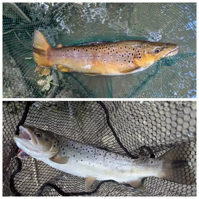
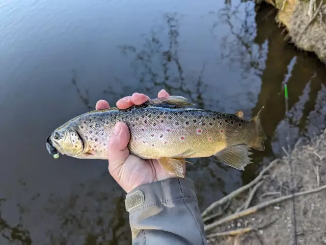
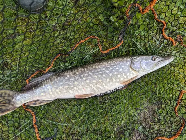
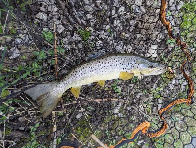
Latest Catches

uploaded by: SzatanEK666

uploaded by: SzatanEK666

uploaded by: SzatanEK666
uploaded by: John Needham

uploaded by: John Needham
uploaded by: John Needham

uploaded by: John Needham
uploaded by: John Needham
uploaded by: John Needham
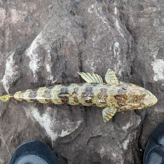
uploaded by: John Needham


Comments