


Umina 🇦🇺
-
Nautical Twilight begins:05:58 amSunrise:06:55 am
-
Sunset:05:07 pmNautical Twilight ends:06:03 pm
-
Moonrise:11:47 pm
-
Moonset:10:36 am
-
Moon over:04:51 am
-
Moon under:05:11 pm
-
Visibility:61%
-
 Third Quarter Moon
-
Distance to earth:365,867 kmProximity:93.5 %
Moon Phases for Umina
-
poor Day
-
major Time:03:51 am - 05:51 am
-
minor Time:09:36 am - 11:36 am
-
major Time:
 04:11 pm -
06:11 pm
04:11 pm -
06:11 pm
-
minor Time:10:47 pm - 12:47 am
Tide Clock
Tide Graph
Times
| Tide | Time | Height |
|---|---|---|
| high | 12:17 am | 4.86 ft |
| low | 06:42 am | 0.75 ft |
| high | 01:00 pm | 4.56 ft |
| low | 07:07 pm | 1.21 ft |
| Date | Major Bite Times | Minor Bite Times | Sun | Moon | Moonphase | Tide Times |
|---|---|---|---|---|---|---|
|
Thu, 17 Jul
|
03:51 am -
05:51 am
04:11 pm -
06:11 pm
|
09:36 am -
11:36 am
10:47 pm -
12:47 am
|
R: 06:55 am S: 05:07 pm |
R: 11:47 pm S: 10:36 am |
Third Quarter Moon |
high: 12:17 am
, 4.86 ft
, Coeff: 86
low: 06:42 am
, 0.75 ft
high: 01:00 pm
, 4.56 ft
, Coeff: 76
low: 07:07 pm
, 1.21 ft
|
|
Fri, 18 Jul
|
04:41 am -
06:41 am
05:01 pm -
07:01 pm
|
10:07 am -
12:07 pm
11:56 pm -
01:56 am
|
R: 06:54 am S: 05:08 pm |
R: - S: 11:07 am |
Third Quarter Moon |
high: 01:15 am
, 4.49 ft
, Coeff: 74
low: 07:33 am
, 0.95 ft
high: 02:01 pm
, 4.76 ft
, Coeff: 83
low: 08:21 pm
, 1.35 ft
|
|
Sat, 19 Jul
|
05:18 am -
07:18 am
05:54 pm -
07:54 pm
|
10:41 am -
12:41 pm
11:56 pm -
01:56 am
|
R: 06:54 am S: 05:09 pm |
R: 12:56 am S: 11:41 am |
Third Quarter Moon |
high: 02:22 am
, 4.2 ft
, Coeff: 64
low: 08:30 am
, 1.15 ft
high: 03:09 pm
, 5.02 ft
, Coeff: 92
low: 09:44 pm
, 1.35 ft
|
|
Sun, 20 Jul
|
06:14 am -
08:14 am
06:51 pm -
08:51 pm
|
01:07 am -
03:07 am
11:21 am -
01:21 pm
|
R: 06:53 am S: 05:09 pm |
R: 02:07 am S: 12:21 pm |
Waning Crescent |
high: 03:40 am
, 4.04 ft
, Coeff: 58
low: 09:35 am
, 1.31 ft
high: 04:19 pm
, 5.41 ft
, Coeff: 105
low: 11:02 pm
, 1.18 ft
|
|
Mon, 21 Jul
|
07:14 am -
09:14 am
07:50 pm -
09:50 pm
|
02:20 am -
04:20 am
12:09 pm -
02:09 pm
|
R: 06:53 am S: 05:10 pm |
R: 03:20 am S: 01:09 pm |
Waning Crescent |
high: 04:57 am
, 4.07 ft
, Coeff: 59
low: 10:40 am
, 1.35 ft
high: 05:22 pm
, 5.81 ft
, Coeff: 119
|
|
Tue, 22 Jul
|
08:18 am -
10:18 am
08:50 pm -
10:50 pm
|
03:31 am -
05:31 am
01:06 pm -
03:06 pm
|
R: 06:52 am S: 05:10 pm |
R: 04:31 am S: 02:06 pm |
Waning Crescent |
low: 12:08 am
, 0.95 ft
high: 06:03 am
, 4.2 ft
, Coeff: 64
low: 11:42 am
, 1.28 ft
high: 06:19 pm
, 6.17 ft
, Coeff: 131
|
|
Wed, 23 Jul
|
09:23 am -
11:23 am
09:51 pm -
11:51 pm
|
04:35 am -
06:35 am
02:12 pm -
04:12 pm
|
R: 06:51 am S: 05:11 pm |
R: 05:35 am S: 03:12 pm |
Waning Crescent |
low: 01:04 am
, 0.69 ft
high: 07:01 am
, 4.36 ft
, Coeff: 69
low: 12:38 pm
, 1.18 ft
high: 07:11 pm
, 6.4 ft
, Coeff: 139
|


uploaded by: JBWalker

uploaded by: primerone

uploaded by: primerone

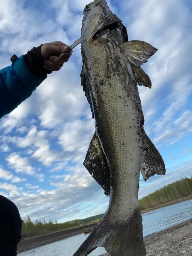
uploaded by: Michael Mitchell 1

uploaded by: Joey Piercefield

uploaded by: Joey Piercefield

uploaded by: Joey Piercefield

uploaded by: SzatanEK666
uploaded by: Rosemelzam

uploaded by: Eric Foster
Best Fishing Spots in the greater Umina area
Wharf's or Jetties are good places to wet a line and meet other fishermen. They often produce a fresh feed of fish and are also great to catch bait fish. As they are often well lit, they also provide a good opportunity for night fishing. There are 17 wharf(s) in this area.
Patonga Wharf - 3km , Merritts Wharf - 6km , Rawson Road Public Wharf - 6km , Pier Street Public Wharf - 6km , Veteran Hall Wharf - 6km , Bennetts Wharf - 7km , Lintern Street Public Wharf - 7km , Hastings Wharf - 7km , Central Wharf - 7km , Bonney Doon Wharf - 8km , Mount Pleasant Wharf - 8km , Humphreys Road Public Wharf - 8km , Byalla Lane Public Wharf - 8km , Saratoga Wharf - 8km , Woy Woy Bay Public Wharf - 8km , Bay View Wharf - 8km , Bill Fitch Jetty - 8km
Beaches and Bays are ideal places for land-based fishing. If the beach is shallow and the water is clear then twilight times are usually the best times, especially when they coincide with a major or minor fishing time. Often the points on either side of a beach are the best spots. Or if the beach is large then look for irregularities in the breaking waves, indicating sandbanks and holes. We found 51 beaches and bays in this area.
Pearl Beach Lagoon - 1km , Umina Beach - 1km , Ocean Beach - 1km , Broken Bay - 2km , Pretty Beach - 3km , Iron Ladder Beach - 3km , Lobster Beach - 3km , Patonga Beach - 3km , Hungry Beach - 3km , Ettalong Beach - 3km , West Head Beach - 4km , Tallow Beach - 4km , Fishermans Bay - 4km , Deadmans Bay - 4km , Correa Bay - 4km , Booker Bay - 4km , Brisk Bay - 4km , Phegans Bay - 5km , Horsfield Bay - 5km , Rileys Bay - 5km , Hardys Bay - 5km , Flannel Flower Beach - 5km , Flint and Steel Beach - 5km , Little Patonga Beach - 5km , Woy Woy Bay - 6km , Killcare Beach - 6km , Mackarel Beach - 6km , Putty Beach - 6km , Great Mackarel Beach - 6km , Parks Bay - 6km , Flint and Steel Bay - 6km , Resolute Beach - 6km , Shelly Beach - 6km , Little Wobby Beach - 6km , Croppy Beach - 6km , Lookout Bay - 7km , Currawong Beach - 7km , Snapperman Beach - 7km , Little Mackerel Beach - 7km , Murphys Bay - 7km , Palm Beach - 7km , Barrenjoey Beach - 7km , Bradleys Beach - 7km , Dead Horse Bay - 7km , Bradleys Bay - 7km , Parsley Bay - 7km , Cockle Bay - 7km , Bullimah Beach - 7km , Woy Woy Bay Public Wharf - 8km , Bay View Wharf - 8km , Waterfall Bay - 8km
We found a total of 100 potential fishing spots nearby Umina. Below you can find them organized on a map. Points, Headlands, Reefs, Islands, Channels, etc can all be productive fishing spots. As these are user submitted spots, there might be some errors in the exact location. You also need to cross check local fishing regulations. Some of the spots might be in or around marine reserves or other locations that cannot be fished. If you click on a location marker it will bring up some details and a quick link to google search, satellite maps and fishing times. Tip: Click/Tap on a new area to load more fishing spots.
Pearl Beach Lagoon - 1km , Iluka Lagoon - 1km , Umina Beach - 1km , Ocean Beach - 1km , Middle Head - 2km , Green Point - 2km , Broken Bay - 2km , Wagstaff Point - 2km , Lion Island - 3km , Elliot Island - 3km , Pretty Beach - 3km , Iron Ladder Beach - 3km , Lobster Beach - 3km , Patonga Beach - 3km , Patonga Wharf - 3km , Hungry Beach - 3km , Ettalong Beach - 3km , First - 4km , West Head Beach - 4km , Tallow Beach - 4km , Fishermans Bay - 4km , Deadmans Bay - 4km , Box Head - 4km , Correa Bay - 4km , Booker Bay - 4km , Flint and Steel Point - 4km , Brisk Bay - 4km , Phegans Bay - 5km , Third - 5km , Second - 5km , Three Heads - 5km , Horsfield Bay - 5km , Rileys Bay - 5km , Hardys Bay - 5km , Flannel Flower Beach - 5km , Blackwall Point - 5km , Saint Huberts Island - 5km , Flint and Steel Beach - 5km , Little Patonga Beach - 5km , Walker Point - 5km , West Head - 6km , Woy Woy Bay - 6km , Killcare Beach - 6km , Mackarel Beach - 6km , Putty Beach - 6km , Rocky Point - 6km , Merritts Wharf - 6km , Rawson Road Public Wharf - 6km , Pier Street Public Wharf - 6km , Oyster Islet - 6km , Retention Islet - 6km , Great Mackarel Beach - 6km , Parks Bay - 6km , Flint and Steel Bay - 6km , Resolute Beach - 6km , Veteran Hall Wharf - 6km , Pelican Island - 6km , Shelly Beach - 6km , Little Wobby Beach - 6km , Croppy Beach - 6km , Barranjoey Head - 6km , Dangar Island - 6km , Lookout Bay - 7km , Observation Point - 7km , Bennetts Wharf - 7km , Currawong Beach - 7km , Snapperman Beach - 7km , Coasters Retreat - 7km , Little Mackerel Beach - 7km , Soldiers Point - 7km , Murphys Bay - 7km , Palm Beach - 7km , Barrenjoey Beach - 7km , Little Pitt Water - 7km , Croppy Point - 7km , Juno Point - 7km , Bradleys Beach - 7km , Double Lagoon - 7km , Dead Horse Bay - 7km , Bradleys Bay - 7km , Parsley Bay - 7km , Flat Rock Point - 7km , Lintern Street Public Wharf - 7km , Gerrin - 7km , Hastings Wharf - 7km , Cockle Bay - 7km , Bullimah Beach - 7km , Central Wharf - 7km , Rileys Island - 7km , Mullet Point - 7km , Bonney Doon Wharf - 8km , Mount Pleasant Wharf - 8km , Humphreys Road Public Wharf - 8km , Byalla Lane Public Wharf - 8km , Saratoga Wharf - 8km , The Broadwater - 8km , Woy Woy Bay Public Wharf - 8km , Bay View Wharf - 8km , Waterfall Bay - 8km , Bill Fitch Jetty - 8km
Comments