-
Nautical Twilight begins:Sunrise:
-
Sunset:Nautical Twilight ends:
-
Moonrise:
-
Moonset:
-
Moon over:
-
Moon under:
-
Visibility:41%
-
 Third Quarter Moon
-
Distance to earth:376,162 kmProximity:69.3 %
Moon Phases for Miramichi
-
average Day
-
minor Time:12:02 am - 02:02 am
-
major Time:
 07:13 am -
09:13 am
-
minor Time:03:04 pm - 05:04 pm
-
major Time:07:33 pm - 09:33 pm
Tide Clock
Tide Graph
Times
| Tide | Time | Height |
|---|---|---|
| low | 08:14 am | 0.2 ft |
Wind Speed and Direction
Wind Direction:
Wind Speed:
Wind Direction and Speed are one of the most important aspects for choosing a fishing spot. An offshore wind can help land-based anglers with longer casting distances, while an onshore wind will make kayak fishing safer. Often fish will also move to certain feeding areas depending on the wind direction. Check out the long term wind forecast at the charts below.
Fishing Barometer
Atmospheric Pressure:
Change since midnight:
Trend for next 6 hours:
Atmospheric or Barometric Pressure affects fish activity. The best fishing can be had on a rising barometer and also the time just before it is falling. A steady barometer in the higher ranges can also mean good fishing. A falling or low barometer reading without much change is usually not a very good time for fishing.
UV Effect on Fishing
As a rule of thumb, the higher the UV index, the deeper fish will move. Shallow water fishing is best done at times with a low UV index. When the UV is high, stick to early mornings, late evenings and shaded areas. The effect is less noticable in deeper water, but often a higher UV index can produce good results in the deep.
| Date | Major Bite Times | Minor Bite Times | Sun | Moon | Moonphase | Tide Times |
|---|---|---|---|---|---|---|
|
|
-
-
|
-
-
|
R: S: |
R: S: |
Third Quarter Moon |
low:
, 0.2 ft
|
|
|
-
-
|
-
-
|
R: S: |
R: S: |
Waning Crescent |
high:
, 4.46 ft
, Coeff: 129
low:
, 0.23 ft
high:
, 2.13 ft
, Coeff: 20
low:
, 1.97 ft
|
|
|
-
-
|
-
-
|
R: S: |
R: S: |
Waning Crescent |
high:
, 4.07 ft
, Coeff: 111
low:
, 0.26 ft
high:
, 2.43 ft
, Coeff: 34
low:
, 1.67 ft
|
|
|
-
-
|
-
-
|
R: S: |
R: S: |
Waning Crescent |
high:
, 3.81 ft
, Coeff: 98
low:
, 0.33 ft
high:
, 2.79 ft
, Coeff: 51
low:
, 1.25 ft
|
|
|
-
-
|
-
-
|
R: S: |
R: S: |
Waning Crescent |
high:
, 3.67 ft
, Coeff: 92
low:
, 0.43 ft
high:
, 3.15 ft
, Coeff: 68
low:
, 0.82 ft
|
|
|
-
-
|
-
-
|
R: S: |
R: S: |
New Moon |
high:
, 3.58 ft
, Coeff: 88
low:
, 0.56 ft
high:
, 3.48 ft
, Coeff: 83
|
|
|
-
-
|
-
-
|
R: S: |
R: S: |
New Moon |
low:
, 0.46 ft
high:
, 3.51 ft
, Coeff: 85
low:
, 0.72 ft
high:
, 3.74 ft
, Coeff: 95
|
October Fishing Report
Cooler water and crisp mornings have October on the Miramichi fishing well. Recent rains have bumped flows, with slightly tea-stained visibility and steady fall conditions. Expect water to warm a touch by afternoon on sunny days, easing fish into the pools.
The Atlantic salmon fall run is active; swing medium to smaller wets like Green Machine, Black Bear Green Butt, Ally’s Shrimp, or coppery patterns. Bombers can still move fish when flows settle. Best action often comes during late-morning to mid-afternoon after cold starts, or at first/last light when the river is quiet.
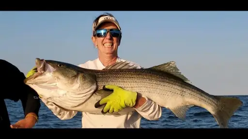
In the lower river and estuary, striped bass are schooling on cooling bait. Work the tide changes with soft-plastic paddletails, bucktails, or small metals; slow the retrieve as water temps drop, and watch for bird activity over nervous bait.
Top tip: Carry both floating and sink-tip options; depth control is key—adjust tip density or add split shot to keep your presentation just above fish holding on the seam edges.
Best Fishing Spots in the greater Miramichi area
We found a total of 40 potential fishing spots nearby Miramichi. Below you can find them organized on a map. Points, Headlands, Reefs, Islands, Channels, etc can all be productive fishing spots. As these are user submitted spots, there might be some errors in the exact location. You also need to cross check local fishing regulations. Some of the spots might be in or around marine reserves or other locations that cannot be fished. If you click on a location marker it will bring up some details and a quick link to google search, satellite maps and fishing times. Tip: Click/Tap on a new area to load more fishing spots.
Northwest Branch Napan River - 6.14351890234km , Strawberry Point - 7.18276579122km , Strawberry Marsh - 7.18276579122km , Beaubears Point - 7.18276579122km , Gallows Brook - 7.23740375129km , Sands Lake - 7.89766087379km , Carding Mill Brook - 7.94301084921km , Beaubears Island - 8.29040512014km , Schultz Point - 9.39597350515km , Southwest Miramichi River - 9.39597350515km , Northwest Miramichi River - 9.39597350515km , Wilsons Point - 9.39597350515km , Oxford Brook - 10.28343067928km , Miramichi River - 11.82314583199km , Macs Lake - 14.34107235082km , Barnaby Island - 15.34614842514km , Napan River - 15.83197494516km , Appleby Brook - 16.29668760243km , Vandy Brook - 16.36764298974km , Little Millstream - 16.66959511637km , Northwest Millstream - 16.66959511637km , Barnaby River - 16.90298617941km , Goodfellow Brook - 17.05343367093km , McBeath Brook - 17.05343367093km , Cushman Brook - 17.59282687618km , Goodfellows Point - 17.8294706811km , Semiwagan Stream - 17.94636520664km , Right Hand Branch Barnaby River - 18.14205495077km , Wiseman Brook - 18.86511590179km , Wilson Brook - 19.84366008005km , Little Black River - 21.63375890335km , Rosaireville Lake - 21.87248249148km , Jam Brook - 21.88646106431km , Crocker Lake - 23.06857809501km , North Branch Lake - 24.0971335169km , Doyles Brook - 25.07867760624km , Boom Point - 25.13873466826km , Peabody Brook - 25.19357710842km , Little Sevogle River - 25.28596471188km , Tozers Island - 25.58752667225km


Comments