Tatamagouche 🇨🇦
-
Nautical Twilight begins:03:55 amSunrise:05:22 am
-
Sunset:09:03 pmNautical Twilight ends:10:30 pm
-
Moonrise:08:02 pm
-
Moonset:03:44 am
-
Moon over:12:25 am
-
Moon under:11:53 am
-
Visibility:97%
-
 Full Moon
-
Distance to earth:403,842 kmProximity:4.4 %
Moon Phases for Tatamagouche
-
average Day
-
minor Time:02:44 am - 04:44 am
-
major Time:10:53 am - 12:53 pm
-
minor Time:07:02 pm - 09:02 pm
-
major Time:11:25 pm - 01:25 am
Tide Clock
Tide Graph
Times
| Tide | Time | Height |
|---|---|---|
| low | 04:02 am | 4.36 ft |
| high | 09:48 am | 6.99 ft |
| low | 04:40 pm | 1.71 ft |
| high | 11:40 pm | 6.73 ft |
| Date | Major Bite Times | Minor Bite Times | Sun | Moon | Moonphase | Tide Times |
|---|---|---|---|---|---|---|
|
Mon, 09 Jun
|
10:53 am -
12:53 pm
11:25 pm -
01:25 am
|
02:44 am -
04:44 am
07:02 pm -
09:02 pm
|
R: 05:22 am S: 09:03 pm |
R: 08:02 pm S: 03:44 am |
Full Moon |
low: 04:02 am
, 4.36 ft
high: 09:48 am
, 6.99 ft
, Coeff: 62
low: 04:40 pm
, 1.71 ft
high: 11:40 pm
, 6.73 ft
, Coeff: 57
|
|
Tue, 10 Jun
|
11:41 am -
01:41 pm
11:12 pm -
01:12 am
|
03:16 am -
05:16 am
08:06 pm -
10:06 pm
|
R: 05:22 am S: 09:04 pm |
R: 09:06 pm S: 04:16 am |
Full Moon |
low: 04:47 am
, 4.4 ft
high: 10:26 am
, 7.12 ft
, Coeff: 65
low: 05:23 pm
, 1.44 ft
|
|
Wed, 11 Jun
|
12:06 am -
02:06 am
12:31 pm -
02:31 pm
|
03:58 am -
05:58 am
09:04 pm -
11:04 pm
|
R: 05:21 am S: 09:05 pm |
R: 10:04 pm S: 04:58 am |
Full Moon |
high: 12:22 am
, 6.82 ft
, Coeff: 59
low: 05:31 am
, 4.36 ft
high: 11:05 am
, 7.28 ft
, Coeff: 68
low: 06:04 pm
, 1.28 ft
|
|
Thu, 12 Jun
|
01:02 am -
03:02 am
01:22 pm -
03:22 pm
|
04:51 am -
06:51 am
09:53 pm -
11:53 pm
|
R: 05:21 am S: 09:05 pm |
R: 10:53 pm S: 05:51 am |
Full Moon |
high: 01:01 am
, 6.89 ft
, Coeff: 60
low: 06:12 am
, 4.33 ft
high: 11:44 am
, 7.38 ft
, Coeff: 70
low: 06:46 pm
, 1.18 ft
|
|
Fri, 13 Jun
|
01:52 am -
03:52 am
02:12 pm -
04:12 pm
|
05:53 am -
07:53 am
10:32 pm -
12:32 am
|
R: 05:21 am S: 09:06 pm |
R: 11:32 pm S: 06:53 am |
Waning Gibbous |
high: 01:40 am
, 6.89 ft
, Coeff: 60
low: 06:53 am
, 4.27 ft
high: 12:23 pm
, 7.41 ft
, Coeff: 71
low: 07:26 pm
, 1.15 ft
|
|
Sat, 14 Jun
|
02:43 am -
04:43 am
03:03 pm -
05:03 pm
|
07:04 am -
09:04 am
11:03 pm -
01:03 am
|
R: 05:21 am S: 09:06 pm |
R: - S: 08:04 am |
Waning Gibbous |
high: 02:18 am
, 6.89 ft
, Coeff: 60
low: 07:34 am
, 4.23 ft
high: 01:02 pm
, 7.41 ft
, Coeff: 71
low: 08:06 pm
, 1.18 ft
|
|
Sun, 15 Jun
|
03:40 am -
05:40 am
03:52 pm -
05:52 pm
|
08:18 am -
10:18 am
11:03 pm -
01:03 am
|
R: 05:21 am S: 09:07 pm |
R: 12:03 am S: 09:18 am |
Waning Gibbous |
high: 02:55 am
, 6.89 ft
, Coeff: 60
low: 08:16 am
, 4.17 ft
high: 01:43 pm
, 7.35 ft
, Coeff: 69
low: 08:46 pm
, 1.31 ft
|
")


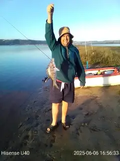
uploaded by: Grunter Hunter

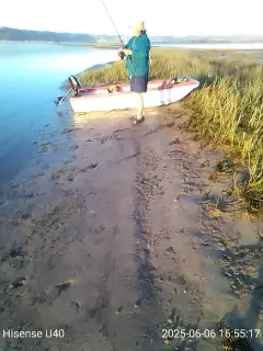
uploaded by: Grunter Hunter

uploaded by: Kosta Mitrovic

uploaded by: Joey Piercefield

uploaded by: arwood52130

uploaded by: Charles Crass

uploaded by: paddypaese

uploaded by: paddypaese

uploaded by: paddypaese

uploaded by: Bruce Chalapan
Best Fishing Spots in the greater Tatamagouche area
Beaches and Bays are ideal places for land-based fishing. If the beach is shallow and the water is clear then twilight times are usually the best times, especially when they coincide with a major or minor fishing time. Often the points on either side of a beach are the best spots. Or if the beach is large then look for irregularities in the breaking waves, indicating sandbanks and holes. We found 9 beaches and bays in this area.
Tatamagouche Bay - 4km , McNabs Bay - 6km , MacLeans Beach - 10km , Long Beach - 10km , The Flat - 12km , Murray Beach - 13km , Lazy Bay - 14km , Hortons Beach - 14km , Brown Bay - 16km
Harbours and Marinas can often times be productive fishing spots for land based fishing as their sheltered environment attracts a wide variety of bait fish. Similar to river mouths, harbour entrances are also great places to fish as lots of fish will move in and out with the rising and falling tides. There are 4 main harbours in this area.
Barrachois Harbour - 6km, Brule Harbour - 10km, Wallace Harbour - 16km, Fox Harbour - 19km
We found a total of 91 potential fishing spots nearby Tatamagouche. Below you can find them organized on a map. Points, Headlands, Reefs, Islands, Channels, etc can all be productive fishing spots. As these are user submitted spots, there might be some errors in the exact location. You also need to cross check local fishing regulations. Some of the spots might be in or around marine reserves or other locations that cannot be fished. If you click on a location marker it will bring up some details and a quick link to google search, satellite maps and fishing times. Tip: Click/Tap on a new area to load more fishing spots.
Steeles Island - 1km , Blockhouse Point - 2km , Sand Point - 2km , William Point - 2km , Hingley Point - 3km , Tatamagouche Bay - 4km , Thrumcap - 5km , Chambers Point - 5km , Kennedy Lake - 5km , Clarks Point - 6km , Dobson Creek - 6km , McNabs Bay - 6km , Emerys Island - 6km , Barrachois Harbour - 6km , McNabs Point - 7km , Reid Creek - 7km , Semple Creek - 8km , Seamon Creek - 9km , MacInnis Pond - 9km , Treen Point - 9km , Peninsula Point - 9km , Brule Point - 9km , Seal Island - 9km , Gravois Point - 10km , MacLeans Beach - 10km , Long Beach - 10km , Purdy Island - 10km , Brule Harbour - 10km , Briar Lake - 10km , Malagash Point - 11km , Weatherbies Point - 11km , Weatherbies Spit - 11km , Long Lake - 12km , Saddle Island - 12km , The Flat - 12km , Rocky Point - 12km , Amet Sound - 13km , Murray Beach - 13km , Mattatall Lake - 14km , Round Lake - 14km , Lazy Bay - 14km , Hortons Beach - 14km , Lazy Point - 15km , Caulfield Point - 15km , Mullins Point - 15km , Palmer Point - 15km , Duck Pond - 15km , Schooner Point - 15km , Whippey Lake - 15km , Gards Pond - 15km , Angel Point - 15km , Brown Bay - 16km , Wallace Harbour - 16km , Caribou Pond - 16km , Quarry Point - 16km , Whirleywaugh Lake - 16km , Clear Lake - 16km , Black Lake - 16km , Amet Island - 16km , Cape John - 16km , Reef Point - 16km , Archibalds Point - 16km , Macfarlane Point - 17km , Dougherty Point - 17km , Byers Ponds - 17km , Mackenzie Point - 17km , McIvers Head - 17km , Byers Lake - 17km , Oak Island - 17km , Shatter Lake - 17km , Johnston Lake - 17km , Little Lake - 17km , Silica Lake - 17km , Amet Spit - 17km , Oyster Island - 18km , Debert Lake - 18km , Jerry Island - 18km , Sunken Island - 18km , Irvine Lake - 18km , Musquash Lake - 18km , Betts Point - 19km , Fox Harbour - 19km , Smith Point - 19km , Rocky Lake - 19km , Guyon Lake - 19km , Farm Lake - 19km , MacRaes Lake - 19km , Juniper Lake - 20km , David Creek - 20km , Big Snare Lake - 20km , Moose Lake - 20km
Comments