
-
Nautical Twilight begins:Sunrise:
-
Sunset:Nautical Twilight ends:
-
Moonrise:
-
Moonset:
-
Moon over:
-
Moon under:
-
Visibility:100%
-
 Full Moon
-
Distance to earth:365,679 kmProximity:94 %
Moon Phases for Aransas Pass
-
average Day
-
major Time:12:19 am - 02:19 am
-
minor Time:
 06:53 am -
08:53 am
06:53 am -
08:53 am
-
major Time:12:40 pm - 02:40 pm
-
minor Time:
06:28 pm -
08:28 pm
Tide Clock
Tide Graph
Times
| Tide | Time | Height |
|---|---|---|
| high | 02:30 am | 1.57 ft |
| low | 08:59 am | 0.56 ft |
| high | 04:07 pm | 2.03 ft |
| low | 10:25 pm | 1.31 ft |
| Date | Major Bite Times | Minor Bite Times | Sun | Moon | Moonphase | Tide Times |
|---|---|---|---|---|---|---|
|
|
-
-
|
-
-
|
R: S: |
R: S: |
Full Moon |
high:
, 1.57 ft
, Coeff: 98
low:
, 0.56 ft
high:
, 2.03 ft
, Coeff: 150
low:
, 1.31 ft
|
|
|
-
-
|
-
-
|
R: S: |
R: S: |
Full Moon |
high:
, 1.61 ft
, Coeff: 101
low:
, 0.26 ft
high:
, 2.13 ft
, Coeff: 161
low:
, 1.57 ft
|
|
|
-
-
|
-
-
|
R: S: |
R: S: |
Waning Gibbous |
high:
, 1.67 ft
, Coeff: 109
low:
, 0.03 ft
high:
, 2.23 ft
, Coeff: 172
|
|
|
-
-
|
-
-
|
R: S: |
R: S: |
Waning Gibbous |
low:
, 1.77 ft
high:
, 1.8 ft
, Coeff: 124
low:
, -0.1 ft
high:
, 2.26 ft
, Coeff: 176
|
|
|
-
-
|
-
-
|
R: S: |
R: S: |
Waning Gibbous |
low:
, -0.13 ft
high:
, 2.26 ft
, Coeff: 176
|
|
|
-
-
|
-
-
|
R: S: |
R: S: |
Third Quarter Moon |
low:
, -0.1 ft
high:
, 2.23 ft
, Coeff: 172
|
|
|
-
-
|
-
-
|
R: S: |
R: S: |
Third Quarter Moon |
low:
, -0 ft
|
Best Fishing Spots in the greater Aransas Pass area
Beaches and Bays are ideal places for land-based fishing. If the beach is shallow and the water is clear then twilight times are usually the best times, especially when they coincide with a major or minor fishing time. Often the points on either side of a beach are the best spots. Or if the beach is large then look for irregularities in the breaking waves, indicating sandbanks and holes. We found 6 beaches and bays in this area.
Redfish Bay - 3.67318719879km , East Shore - 6.46306566377km , McCampbell Slough - 7.22794954434km , Quarantine Shore - 9.00112627196km , Kinney Bayou - 10.32848823811km , Port Bay - 12.93689295371km
Harbours and Marinas can often times be productive fishing spots for land based fishing as their sheltered environment attracts a wide variety of bait fish. Similar to river mouths, harbour entrances are also great places to fish as lots of fish will move in and out with the rising and falling tides. There are 14 main harbours in this area.
Conn Brown Harbor - 1.64237132715km, San Patricio County Navigation District Marina - 2.27776076636km, Fin and Feather Marina - 4.46311629553km, Palm Harbor Marina - 8.77276850264km, Humble Basin - 10.91787120921km, Inner Basin - 11.07232609794km, Port Aransas City Marina - 11.29576090578km, Deep Sea Headquarters Marina - 11.40128591412km, Bahia Marina - 11.52453767193km, La Quinta Turning Basin - 11.57091093259km, Sportsplex Marina - 11.81757802309km, University of Texas Marina - 12.49658930921km, Port Bay - 12.93689295371km, Island Moorings Marina - 12.95618993166km
We found a total of 40 potential fishing spots nearby Aransas Pass. Below you can find them organized on a map. Points, Headlands, Reefs, Islands, Channels, etc can all be productive fishing spots. As these are user submitted spots, there might be some errors in the exact location. You also need to cross check local fishing regulations. Some of the spots might be in or around marine reserves or other locations that cannot be fished. If you click on a location marker it will bring up some details and a quick link to google search, satellite maps and fishing times. Tip: Click/Tap on a new area to load more fishing spots.
Conn Brown Harbor - 1.64237132715km , San Patricio County Navigation District Marina - 2.27776076636km , Redfish Bay - 3.67318719879km , Stedman Island - 4.35387143365km , Fin and Feather Marina - 4.46311629553km , Ransom Island - 4.85046021543km , California Hole - 6.41743944443km , East Shore - 6.46306566377km , McCampbell Slough - 7.22794954434km , Shellbank Island - 7.4964089694km , Spears Lake - 8.4662181424km , Dagger Island - 8.56388297912km , Palm Harbor Marina - 8.77276850264km , Traylor Island - 8.7939191855km , Quarantine Shore - 9.00112627196km , Redfish Cove - 9.2309197608km , Estes Cove - 9.47879358525km , Talley Island - 10.09985876073km , Kinney Bayou - 10.32848823811km , Lydia Ann Island - 10.87395742914km , Humble Basin - 10.91787120921km , Inner Basin - 11.07232609794km , Ingleside Cove - 11.18118224863km , Salt Island - 11.2054325248km , Port Aransas City Marina - 11.29576090578km , Middle Pass - 11.29804946552km , Deep Sea Headquarters Marina - 11.40128591412km , Turtle Cove - 11.428984908km , Cooks Island - 11.52306381157km , Bahia Marina - 11.52453767193km , La Quinta Turning Basin - 11.57091093259km , Pelone Island - 11.68149489207km , Sportsplex Marina - 11.81757802309km , La Quinta Island - 12.11382694184km , The Cove - 12.16940309627km , University of Texas Marina - 12.49658930921km , Coyote Island - 12.52762807312km , Port Bay - 12.93689295371km , Island Moorings Marina - 12.95618993166km , Fresh Water Lake - 13.07075396517km

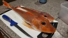
uploaded by: Steven Butcheck

uploaded by: Mark Totzke

uploaded by: tajiran

uploaded by: Mark Totzke

uploaded by: Mark Totzke

uploaded by: Mark Totzke

uploaded by: Michael Mayse

uploaded by: primerone

uploaded by: v l

uploaded by: Shin_Benfield


Comments