City Island 🇺🇸
-
Nautical Twilight begins:04:07 amSunrise:05:22 am
-
Sunset:08:31 pmNautical Twilight ends:09:46 pm
-
Moonrise:12:46 am
-
Moonset:12:48 pm
-
Moon over:06:47 am
-
Moon under:06:58 pm
-
Visibility:52%
-
 Third Quarter Moon
-
Distance to earth:368,561 kmProximity:87.2 %
Moon Phases for City Island
-
average Day
-
major Time:05:47 am - 07:47 am
-
minor Time:11:48 am - 01:48 pm
-
major Time:05:58 pm - 07:58 pm
-
minor Time:11:46 pm - 01:46 am
Tide Clock
Tide Graph
Times
| Tide | Time | Height |
|---|---|---|
| high | 04:45 am | 7.32 ft |
| low | 11:06 am | 0.43 ft |
| high | 05:20 pm | 7.68 ft |
| low | 11:47 pm | 0.72 ft |
| Date | Major Bite Times | Minor Bite Times | Sun | Moon | Moonphase | Tide Times |
|---|---|---|---|---|---|---|
|
Wed, 18 Jun
|
05:47 am -
07:47 am
05:58 pm -
07:58 pm
|
11:48 am -
01:48 pm
11:46 pm -
01:46 am
|
R: 05:22 am S: 08:31 pm |
R: 12:46 am S: 12:48 pm |
Third Quarter Moon |
high: 04:45 am
, 7.32 ft
, Coeff: 112
low: 11:06 am
, 0.43 ft
high: 05:20 pm
, 7.68 ft
, Coeff: 122
low: 11:47 pm
, 0.72 ft
|
|
Thu, 19 Jun
|
06:34 am -
08:34 am
06:46 pm -
08:46 pm
|
12:08 am -
02:08 am
01:00 pm -
03:00 pm
|
R: 05:22 am S: 08:32 pm |
R: 01:08 am S: 02:00 pm |
Third Quarter Moon |
high: 05:45 am
, 7.09 ft
, Coeff: 106
low: 12:02 pm
, 0.49 ft
high: 06:18 pm
, 7.78 ft
, Coeff: 124
|
|
Fri, 20 Jun
|
07:23 am -
09:23 am
07:37 pm -
09:37 pm
|
12:32 am -
02:32 am
02:15 pm -
04:15 pm
|
R: 05:22 am S: 08:32 pm |
R: 01:32 am S: 03:15 pm |
Waning Crescent |
low: 01:04 am
, 0.56 ft
high: 06:49 am
, 6.86 ft
, Coeff: 100
low: 01:04 pm
, 0.52 ft
high: 07:20 pm
, 7.87 ft
, Coeff: 127
|
|
Sat, 21 Jun
|
08:15 am -
10:15 am
08:31 pm -
10:31 pm
|
12:59 am -
02:59 am
03:32 pm -
05:32 pm
|
R: 05:22 am S: 08:32 pm |
R: 01:59 am S: 04:32 pm |
Waning Crescent |
low: 02:26 am
, 0.26 ft
high: 07:59 am
, 6.76 ft
, Coeff: 98
low: 02:13 pm
, 0.49 ft
high: 08:23 pm
, 8.01 ft
, Coeff: 130
|
|
Sun, 22 Jun
|
09:11 am -
11:11 am
09:32 pm -
11:32 pm
|
01:30 am -
03:30 am
04:53 pm -
06:53 pm
|
R: 05:22 am S: 08:32 pm |
R: 02:30 am S: 05:53 pm |
Waning Crescent |
low: 03:36 am
, -0.07 ft
high: 09:11 am
, 6.76 ft
, Coeff: 98
low: 03:26 pm
, 0.43 ft
high: 09:27 pm
, 8.14 ft
, Coeff: 134
|
|
Mon, 23 Jun
|
10:11 am -
12:11 pm
10:37 pm -
12:37 am
|
02:11 am -
04:11 am
06:12 pm -
08:12 pm
|
R: 05:23 am S: 08:32 pm |
R: 03:11 am S: 07:12 pm |
Waning Crescent |
low: 04:38 am
, -0.39 ft
high: 10:19 am
, 6.89 ft
, Coeff: 101
low: 04:33 pm
, 0.3 ft
high: 10:29 pm
, 8.27 ft
, Coeff: 137
|
|
Tue, 24 Jun
|
11:12 am -
01:12 pm
10:40 pm -
12:40 am
|
03:02 am -
05:02 am
07:23 pm -
09:23 pm
|
R: 05:23 am S: 08:32 pm |
R: 04:02 am S: 08:23 pm |
New Moon |
low: 05:35 am
, -0.62 ft
high: 11:21 am
, 7.02 ft
, Coeff: 104
low: 05:34 pm
, 0.2 ft
high: 11:29 pm
, 8.3 ft
, Coeff: 138
|

")


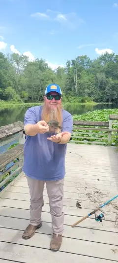
uploaded by: Tom Mikell

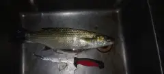
uploaded by: Saif Turk

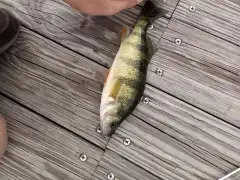
uploaded by: Joey Piercefield

uploaded by: Joey Piercefield

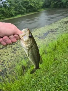
uploaded by: Mikeyo357

uploaded by: Stuart75

uploaded by: Charlie Pifer

uploaded by: Cludwig

uploaded by: BMGPITTBULL

uploaded by: BMGPITTBULL
Best Fishing Spots in the greater City Island area
Beaches and Bays are ideal places for land-based fishing. If the beach is shallow and the water is clear then twilight times are usually the best times, especially when they coincide with a major or minor fishing time. Often the points on either side of a beach are the best spots. Or if the beach is large then look for irregularities in the breaking waves, indicating sandbanks and holes. We found 8 beaches and bays in this area.
Pelham Bay - 2km , Orchard Beach - 2km , Eastchester Bay - 2km , Manhasset Bay - 5km , Little Bay - 6km , Little Neck Bay - 7km , Echo Bay - 7km , Bayside Marina - 8km
Harbours and Marinas can often times be productive fishing spots for land based fishing as their sheltered environment attracts a wide variety of bait fish. Similar to river mouths, harbour entrances are also great places to fish as lots of fish will move in and out with the rising and falling tides. There are 16 main harbours in this area.
City Island Harbor - 1km, Lower Harbor - 4km, Locust Point Marina - 4km, Hague Basin - 4km, Hayes Harbor Club - 5km, Wright Island Marina - 5km, Castaways Yacht Club - 5km, Neptune Boat Club - 5km, Imperial Yacht Club - 5km, Huguenot Yacht Club - 5km, New Rochelle Harbor - 5km, Davenport Neck - 6km, New Rochelle Municipal Marina - 7km, Shelter Harbor Marina - 7km, Ferris Creek - 7km, Bayside Marina - 8km
We found a total of 99 potential fishing spots nearby City Island. Below you can find them organized on a map. Points, Headlands, Reefs, Islands, Channels, etc can all be productive fishing spots. As these are user submitted spots, there might be some errors in the exact location. You also need to cross check local fishing regulations. Some of the spots might be in or around marine reserves or other locations that cannot be fished. If you click on a location marker it will bring up some details and a quick link to google search, satellite maps and fishing times. Tip: Click/Tap on a new area to load more fishing spots.
City Island - 0km , Rat Island - 1km , Rodman Neck - 1km , High Island - 1km , Belden Point - 1km , City Island Bridge - 1km , City Island Harbor - 1km , Pelham Bay - 2km , Hart Island - 2km , Turtle Cove - 2km , Orchard Beach - 2km , Chimney Sweeps Islands - 2km , Eastchester Bay - 2km , Pelham Bridge - 3km , Hunter Island - 3km , Hewlett Point - 3km , Twin Island - 3km , Goose Island - 3km , Cherry Tree Point - 3km , Weir Creek - 3km , Palmer Inlet - 3km , Lower Harbor - 4km , Locust Point - 4km , Throgs Neck - 4km , Pea Island - 4km , Hog Island - 4km , Locust Point Marina - 4km , Hague Basin - 4km , Barker Point - 4km , Travers Island - 4km , Glen Island - 4km , Columbia Island - 4km , Davids Island - 4km , Elm Point - 4km , Hayes Harbor Club - 5km , Manhasset Bay - 5km , Wright Island Marina - 5km , Castaways Yacht Club - 5km , Throgs Neck Bridge - 5km , Throgs Point - 5km , Neptune Boat Club - 5km , Plum Point - 5km , Baxter Creek Inlet (historical) - 5km , Imperial Yacht Club - 5km , Huckleberry Island - 5km , Huguenot Yacht Club - 5km , Sands Point - 5km , Neptune Island - 5km , Wright Island - 5km , New Rochelle Harbor - 5km , Little Bay - 6km , Titus Millpond - 6km , Pine Island - 6km , Old Ferry Point - 6km , Great Neck - 6km , Castle Hill Point - 6km , Whitestone Bridge - 6km , Cryders Point - 6km , Davenport Neck - 6km , Willets Point - 6km , Whitestone Point - 6km , Prospect Point - 7km , Tallman Island - 7km , Tank Island - 7km , Mill Pond - 7km , Centre Avenue Bridge - 7km , Premium Point - 7km , Powell Cove - 7km , Little Neck Bay - 7km , New Rochelle Municipal Marina - 7km , Toms Point - 7km , Shelter Harbor Marina - 7km , Beaufort Point - 7km , Harrison Island - 7km , Clason Point - 7km , Clifford Island - 7km , Sedge Island - 7km , Ferris Creek - 7km , Echo Island - 7km , Echo Bay - 7km , Duck Point - 7km , South Tenth Avenue Bridge - 8km , Manhasset Neck - 8km , Little Neck - 8km , Leeds Pond - 8km , Horseshoe Harbor - 8km , Oak Island - 8km , Premium Millpond - 8km , College Point - 8km , Bayside Marina - 8km , First Avenue Bridge - 8km , Fulton Avenue Bridge - 8km , Scott's Bridge - 8km , Umbrella Point - 9km , Deverman's Bridge - 9km , Cedar Island Inlet - 9km , Indian Pond - 9km , Cedar Point - 9km , Hunt's Bridge (historical) - 9km
Comments