


Dauterive Landing 🇺🇸
-
Nautical Twilight begins:05:17 amSunrise:06:15 am
-
Sunset:08:10 pmNautical Twilight ends:09:08 pm
-
Moonrise:11:57 pm
-
Moonset:12:01 pm
-
Moon over:05:39 am
-
Moon under:05:59 pm
-
Visibility:65%
-
 Third Quarter Moon
-
Distance to earth:366,823 kmProximity:91.3 %
Moon Phases for Dauterive Landing
-
poor Day
-
major Time:04:39 am - 06:39 am
-
minor Time:11:01 am - 01:01 pm
-
major Time:04:59 pm - 06:59 pm
-
minor Time:10:57 pm - 12:57 am
Tide Clock
Tide Graph
Times
| Tide | Time | Height |
|---|---|---|
| low | 04:16 am | 0.33 ft |
| high | 11:31 am | 1.21 ft |
| low | 05:56 pm | 0.43 ft |
| Date | Major Bite Times | Minor Bite Times | Sun | Moon | Moonphase | Tide Times |
|---|---|---|---|---|---|---|
|
Wed, 16 Jul
|
04:39 am -
06:39 am
04:59 pm -
06:59 pm
|
11:01 am -
01:01 pm
10:57 pm -
12:57 am
|
R: 06:15 am S: 08:10 pm |
R: 11:57 pm S: 12:01 pm |
Third Quarter Moon |
low: 04:16 am
, 0.33 ft
high: 11:31 am
, 1.21 ft
, Coeff: 68
low: 05:56 pm
, 0.43 ft
|
|
Thu, 17 Jul
|
05:27 am -
07:27 am
05:47 pm -
07:47 pm
|
12:05 pm -
02:05 pm
11:30 pm -
01:30 am
|
R: 06:16 am S: 08:10 pm |
R: - S: 01:05 pm |
Third Quarter Moon |
high: 12:30 am
, 0.92 ft
, Coeff: 32
low: 04:58 am
, 0.66 ft
high: 11:32 am
, 1.18 ft
, Coeff: 64
low: 06:48 pm
, 0.1 ft
|
|
Fri, 18 Jul
|
06:21 am -
08:21 am
06:40 pm -
08:40 pm
|
01:12 pm -
03:12 pm
11:30 pm -
01:30 am
|
R: 06:16 am S: 08:10 pm |
R: 12:30 am S: 02:12 pm |
Third Quarter Moon |
high: 02:48 am
, 1.05 ft
, Coeff: 48
low: 05:42 am
, 0.98 ft
high: 11:20 am
, 1.21 ft
, Coeff: 68
low: 07:44 pm
, -0.2 ft
|
|
Sat, 19 Jul
|
07:15 am -
09:15 am
07:37 pm -
09:37 pm
|
12:08 am -
02:08 am
02:22 pm -
04:22 pm
|
R: 06:17 am S: 08:09 pm |
R: 01:08 am S: 03:22 pm |
Third Quarter Moon |
high: 05:16 am
, 1.28 ft
, Coeff: 76
low: 06:40 am
, 1.28 ft
high: 10:19 am
, 1.31 ft
, Coeff: 80
low: 08:42 pm
, -0.43 ft
|
|
Sun, 20 Jul
|
08:11 am -
10:11 am
08:37 pm -
10:37 pm
|
12:51 am -
02:51 am
03:32 pm -
05:32 pm
|
R: 06:17 am S: 08:09 pm |
R: 01:51 am S: 04:32 pm |
Waning Crescent |
high: 06:52 am
, 1.51 ft
, Coeff: 104
low: 09:40 pm
, -0.62 ft
|
|
Mon, 21 Jul
|
09:12 am -
11:12 am
09:42 pm -
11:42 pm
|
01:43 am -
03:43 am
04:42 pm -
06:42 pm
|
R: 06:18 am S: 08:08 pm |
R: 02:43 am S: 05:42 pm |
Waning Crescent |
high: 07:38 am
, 1.64 ft
, Coeff: 120
low: 10:38 pm
, -0.75 ft
|
|
Tue, 22 Jul
|
10:13 am -
12:13 pm
10:46 pm -
12:46 am
|
02:43 am -
04:43 am
05:44 pm -
07:44 pm
|
R: 06:19 am S: 08:08 pm |
R: 03:43 am S: 06:44 pm |
Waning Crescent |
high: 08:18 am
, 1.67 ft
, Coeff: 124
low: 11:34 pm
, -0.79 ft
|


uploaded by: primerone

uploaded by: primerone

uploaded by: Michael Mitchell 1

uploaded by: Joey Piercefield

uploaded by: Joey Piercefield

uploaded by: Joey Piercefield

uploaded by: SzatanEK666
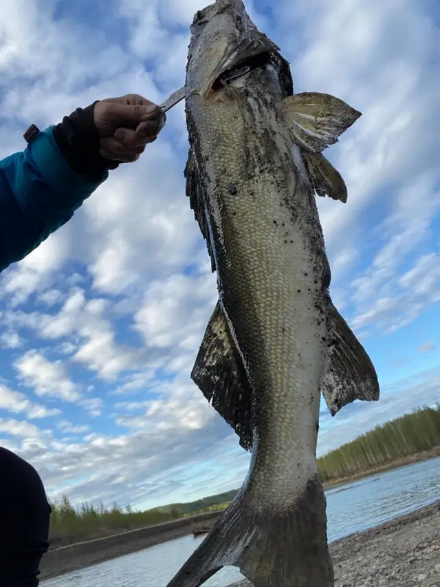
uploaded by: Rosemelzam

uploaded by: Eric Foster

uploaded by: cspooner
Best Fishing Spots in the greater Dauterive Landing area
Beaches and Bays are ideal places for land-based fishing. If the beach is shallow and the water is clear then twilight times are usually the best times, especially when they coincide with a major or minor fishing time. Often the points on either side of a beach are the best spots. Or if the beach is large then look for irregularities in the breaking waves, indicating sandbanks and holes. We found 21 beaches and bays in this area.
Bayou Coline - 2km , Bayou Grand Gueule - 3km , Bayou Fredrick - 3km , Bayou Benoit - 3km , Jackass Bay - 7km , Alligator Bay (historical) - 7km , Bay Baron - 8km , Haha Bay - 8km , Red Bayou - 8km , Bay Toni - 9km , Bay De Plomb - 13km , Bayou La Chute - 14km , Bayou Chene Cut - 15km , Bayou Nimrod - 15km , Deadman Bayou - 16km , Cow Bayou Cove - 16km , Tensas Bay - 17km , Bayou Mersier - 17km , Yanks Bayou - 18km , Pigeon Bay - 19km , Bayou Simpson - 20km
We found a total of 82 potential fishing spots nearby Dauterive Landing. Below you can find them organized on a map. Points, Headlands, Reefs, Islands, Channels, etc can all be productive fishing spots. As these are user submitted spots, there might be some errors in the exact location. You also need to cross check local fishing regulations. Some of the spots might be in or around marine reserves or other locations that cannot be fished. If you click on a location marker it will bring up some details and a quick link to google search, satellite maps and fishing times. Tip: Click/Tap on a new area to load more fishing spots.
Dauterive Lake - 1km , Gonsoulin Canal - 2km , Bayou Coline - 2km , Bayou Grand Gueule - 3km , Bayou Fredrick - 3km , Eagle Point - 3km , Bayou Benoit - 3km , Lake Rond - 5km , Marshfield Canal - 5km , Mestayer Point - 6km , Sampsons Cove - 6km , Petit Lac - 6km , Willow Lake - 7km , Jackass Bay - 7km , Alligator Bay (historical) - 7km , Fish Coulee - 7km , Bay Baron - 8km , Loreauville Canal - 8km , Haha Bay - 8km , Red Bayou - 8km , Lake Fausse Pointe Cut - 9km , Bay Toni - 9km , Butte Canal - 9km , Sandy Point - 10km , Bay De Plomb - 13km , South Eagle Pointe - 13km , Fish Island - 13km , Crook Chene Cove - 13km , Lake Fausse Pointe - 14km , Little Lake Long - 14km , Cow Island - 14km , Bayou La Chute - 14km , Daspit Bridge - 15km , Bayou Chene Cut - 15km , Jeanerette Canal - 15km , Catahoula Lake - 15km , Long Lake - 15km , Buffalo Cove - 15km , Bayou Nimrod - 15km , Jack Island - 16km , Atchafalaya Basin Main Channel - 16km , Round Island - 16km , Deadman Cove (historical) - 16km , Deadman Bayou - 16km , Chicot Pass - 16km , Cozine Island - 16km , Cow Bayou Cove - 16km , Lewis Street Bridge - 17km , Lake Mongoulois - 17km , Nelson Canal - 17km , Tensas Bay - 17km , Splice Island - 17km , Shaw Island - 17km , Pharr Canal - 17km , Sediment Pond Dam - 17km , Poison Lake - 17km , Sawyers Cove - 17km , Sandager Canal - 17km , Cotton Point - 17km , Logan Chute - 17km , Little Devil Cut - 17km , Bayou Mersier - 17km , Keystone Lock and Dam - 17km , Duperier Bridge - 18km , Blind Tensas Cut - 18km , Louisiana Noname 44 Dam - 18km , Slim Island - 18km , Yanks Bayou - 18km , Crossing Cove - 18km , Lake La Rose - 18km , Cotton Canal - 18km , Fishers Island - 18km , Eagle Island - 18km , Hog Island - 19km , Pigeon Bay - 19km , Morris Lake - 19km , Cypress Island Coulee Canal - 20km , Bayou Simpson - 20km , Delahoussaye Canal - 20km , Frog Lake - 20km , Grand Avoille Cove - 20km , Lake Martin - 20km
Comments