


Manchac 🇺🇸
-
Nautical Twilight begins:05:44 amSunrise:06:36 am
-
Sunset:07:29 pmNautical Twilight ends:08:21 pm
-
Moonrise:12:28 pm
-
Moonset:10:52 pm
-
Moon over:05:40 pm
-
Moon under:05:11 am
-
Visibility:36%
-
 First Quarter Moon
-
Distance to earth:405,487 kmProximity:0.5 %
Moon Phases for Manchac
-
poor Day
-
major Time:04:11 am - 06:11 am
-
minor Time:11:28 am - 01:28 pm
-
major Time:04:40 pm - 06:40 pm
-
minor Time:09:52 pm - 11:52 pm
Tide Clock
Tide Graph
Times
| Tide | Time | Height |
|---|---|---|
| high | 12:12 pm | 0.66 ft |
| Date | Major Bite Times | Minor Bite Times | Sun | Moon | Moonphase | Tide Times |
|---|---|---|---|---|---|---|
|
Fri, 29 Aug
|
04:11 am -
06:11 am
04:40 pm -
06:40 pm
|
11:28 am -
01:28 pm
09:52 pm -
11:52 pm
|
R: 06:36 am S: 07:29 pm |
R: 12:28 pm S: 10:52 pm |
First Quarter Moon |
high: 12:12 pm
, 0.66 ft
, Coeff: 142
|
|
Sat, 30 Aug
|
05:00 am -
07:00 am
05:29 pm -
07:29 pm
|
12:26 pm -
02:26 pm
10:32 pm -
12:32 am
|
R: 06:36 am S: 07:28 pm |
R: 01:26 pm S: 11:32 pm |
First Quarter Moon |
low: 12:53 am
, 0.16 ft
high: 12:52 pm
, 0.72 ft
, Coeff: 164
|
|
Sun, 31 Aug
|
05:52 am -
07:52 am
06:20 pm -
08:20 pm
|
01:23 pm -
03:23 pm
11:18 pm -
01:18 am
|
R: 06:37 am S: 07:27 pm |
R: 02:23 pm S: - |
First Quarter Moon |
low: 01:53 am
, 0.13 ft
high: 01:44 pm
, 0.75 ft
, Coeff: 176
|
|
Mon, 01 Sep
|
06:48 am -
08:48 am
07:14 pm -
09:14 pm
|
02:19 pm -
04:19 pm
11:18 pm -
01:18 am
|
R: 06:37 am S: 07:25 pm |
R: 03:19 pm S: 12:18 am |
First Quarter Moon |
low: 02:48 am
, 0.07 ft
high: 02:46 pm
, 0.79 ft
, Coeff: 187
|
|
Tue, 02 Sep
|
07:41 am -
09:41 am
08:05 pm -
10:05 pm
|
12:11 am -
02:11 am
03:11 pm -
05:11 pm
|
R: 06:38 am S: 07:24 pm |
R: 04:11 pm S: 01:11 am |
Waxing Gibbous |
low: 03:39 am
, 0.03 ft
high: 03:56 pm
, 0.82 ft
, Coeff: 198
|
|
Wed, 03 Sep
|
08:33 am -
10:33 am
08:54 pm -
10:54 pm
|
01:09 am -
03:09 am
03:58 pm -
05:58 pm
|
R: 06:39 am S: 07:23 pm |
R: 04:58 pm S: 02:09 am |
Waxing Gibbous |
low: 04:26 am
, 0.03 ft
high: 05:06 pm
, 0.82 ft
, Coeff: 198
|
|
Thu, 04 Sep
|
09:26 am -
11:26 am
09:45 pm -
11:45 pm
|
02:12 am -
04:12 am
04:40 pm -
06:40 pm
|
R: 06:39 am S: 07:22 pm |
R: 05:40 pm S: 03:12 am |
Waxing Gibbous |
low: 05:10 am
, 0.03 ft
high: 06:11 pm
, 0.85 ft
, Coeff: 209
|


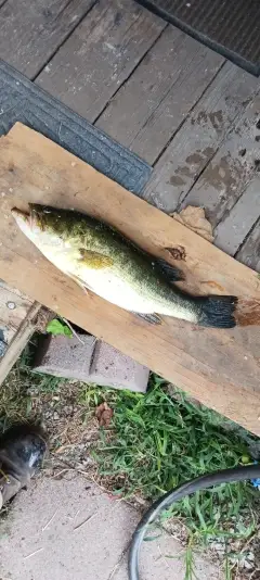
uploaded by: Charlie Pifer

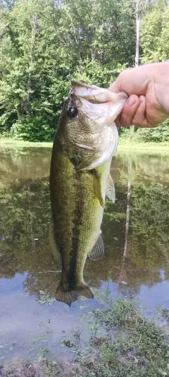
uploaded by: Charlie Pifer

uploaded by: Charlie Pifer

uploaded by: Charlie Pifer

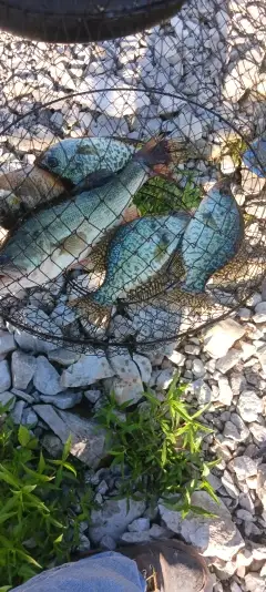
uploaded by: JhunB

uploaded by: JhunB

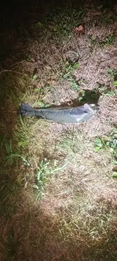
uploaded by: biggreg408

uploaded by: Blackmagic2

uploaded by: bandedwd

uploaded by: Rex_Ursus
Best Fishing Spots in the greater Manchac area
Beaches and Bays are ideal places for land-based fishing. If the beach is shallow and the water is clear then twilight times are usually the best times, especially when they coincide with a major or minor fishing time. Often the points on either side of a beach are the best spots. Or if the beach is large then look for irregularities in the breaking waves, indicating sandbanks and holes. We found 3 beaches and bays in this area.
Bayou Black - 8km , Bayou Desert - 11km , Shell Bank Bayou - 14km
Harbours and Marinas can often times be productive fishing spots for land based fishing as their sheltered environment attracts a wide variety of bait fish. Similar to river mouths, harbour entrances are also great places to fish as lots of fish will move in and out with the rising and falling tides. There are 3 main harbours in this area.
Tickfaw Marina - 17km, Vacajun Marina - 18km, Warsaw Marina - 18km
We found a total of 36 potential fishing spots nearby Manchac. Below you can find them organized on a map. Points, Headlands, Reefs, Islands, Channels, etc can all be productive fishing spots. As these are user submitted spots, there might be some errors in the exact location. You also need to cross check local fishing regulations. Some of the spots might be in or around marine reserves or other locations that cannot be fished. If you click on a location marker it will bring up some details and a quick link to google search, satellite maps and fishing times. Tip: Click/Tap on a new area to load more fishing spots.
Jones Island - 2km , Fernwood Canal - 2km , Cecils Canal - 3km , Galva Canal - 4km , Schleiders Ditch - 6km , Fuller Canal - 6km , First Canal - 6km , Second Canal - 7km , Mire Canal - 7km , Bayou Black - 8km , Ruddock Canal - 10km , Bayou Desert - 11km , Lake Maurepas - 11km , Lake Shore Canal - 11km , Cutoff Canal - 13km , Shell Bank Bayou - 14km , Anderson Canal - 14km , Sharp Islands - 15km , Long Island - 15km , Rome Ferry Bridge - 17km , Mitchells Lake - 17km , Hoovers Pond Dam - 17km , Lake Ju-Lu - 17km , Tickfaw Marina - 17km , Big Cypress Point - 18km , Vacajun Marina - 18km , Warsaw Marina - 18km , Pine Island - 18km , Jack Island - 18km , Ear Lake - 18km , Dead Lake - 18km , Big Liveoak Island - 18km , Little Liveoak Island - 19km , Little Cypress Point - 19km , Miltons Island - 20km , Blind Rigolets - 20km
Comments