Sanders Beach 🇺🇸
-
Nautical Twilight begins:04:49 amSunrise:05:49 am
-
Sunset:07:56 pmNautical Twilight ends:08:56 pm
-
Moonrise:10:06 am
-
Moonset:11:20 pm
-
Moon over:04:43 pm
-
Moon under:04:14 am
-
Visibility:21%
-
 Waxing Crescent
-
Distance to earth:391,161 kmProximity:34.1 %
Moon Phases for Sanders Beach
-
good Day
-
major Time:03:14 am - 05:14 am
-
minor Time:09:06 am - 11:06 am
-
major Time:03:43 pm - 05:43 pm
-
minor Time:10:20 pm - 12:20 am
Tide Clock
Tide Graph
Times
| Tide | Time | Height |
|---|---|---|
| low | 12:26 am | -0.07 ft |
| high | 12:51 pm | 1.15 ft |
| Date | Major Bite Times | Minor Bite Times | Sun | Moon | Moonphase | Tide Times |
|---|---|---|---|---|---|---|
|
Sun, 29 Jun
|
03:14 am -
05:14 am
03:43 pm -
05:43 pm
|
09:06 am -
11:06 am
10:20 pm -
12:20 am
|
R: 05:49 am S: 07:56 pm |
R: 10:06 am S: 11:20 pm |
Waxing Crescent |
low: 12:26 am
, -0.07 ft
high: 12:51 pm
, 1.15 ft
, Coeff: 153
|
|
Mon, 30 Jun
|
03:57 am -
05:57 am
04:25 pm -
06:25 pm
|
10:04 am -
12:04 pm
10:47 pm -
12:47 am
|
R: 05:49 am S: 07:57 pm |
R: 11:04 am S: 11:47 pm |
Waxing Crescent |
low: 12:40 am
, 0.1 ft
high: 01:20 pm
, 0.92 ft
, Coeff: 107
|
|
Tue, 01 Jul
|
04:39 am -
06:39 am
05:06 pm -
07:06 pm
|
11:00 am -
01:00 pm
11:13 pm -
01:13 am
|
R: 05:49 am S: 07:56 pm |
R: 12:00 pm S: - |
First Quarter Moon |
low: 12:17 am
, 0.3 ft
high: 01:20 pm
, 0.72 ft
, Coeff: 67
low: 11:05 pm
, 0.43 ft
|
|
Wed, 02 Jul
|
05:33 am -
07:33 am
06:00 pm -
08:00 pm
|
11:54 am -
01:54 pm
11:13 pm -
01:13 am
|
R: 05:50 am S: 07:56 pm |
R: 12:54 pm S: 12:13 am |
First Quarter Moon |
high: 06:37 am
, 0.66 ft
, Coeff: 53
low: 08:35 pm
, 0.43 ft
|
|
Thu, 03 Jul
|
06:13 am -
08:13 am
06:41 pm -
08:41 pm
|
12:48 pm -
02:48 pm
11:39 pm -
01:39 am
|
R: 05:50 am S: 07:56 pm |
R: 01:48 pm S: 12:39 am |
First Quarter Moon |
high: 05:47 am
, 0.82 ft
, Coeff: 87
low: 05:50 pm
, 0.3 ft
|
|
Fri, 04 Jul
|
06:54 am -
08:54 am
07:23 pm -
09:23 pm
|
12:06 am -
02:06 am
01:43 pm -
03:43 pm
|
R: 05:51 am S: 07:56 pm |
R: 02:43 pm S: 01:06 am |
First Quarter Moon |
high: 05:57 am
, 0.95 ft
, Coeff: 113
low: 05:53 pm
, 0.13 ft
|
|
Sat, 05 Jul
|
07:38 am -
09:38 am
08:07 pm -
10:07 pm
|
12:36 am -
02:36 am
02:40 pm -
04:40 pm
|
R: 05:51 am S: 07:56 pm |
R: 03:40 pm S: 01:36 am |
Waxing Gibbous |
high: 06:24 am
, 1.08 ft
, Coeff: 140
low: 06:21 pm
, 0 ft
|


")

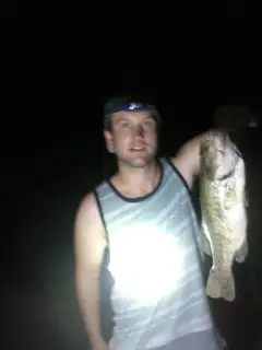
uploaded by: Christian Robinson

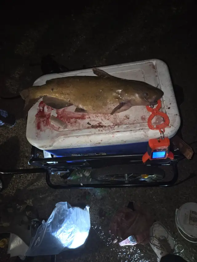
uploaded by: Dowdy Dana

uploaded by: Dowdy Dana

uploaded by: Dowdy Dana

uploaded by: Dowdy Dana

uploaded by: Александр Новиков

uploaded by: Александр Новиков

uploaded by: Ambassadeurcaster
uploaded by: biggreg408

uploaded by: Charlie Pifer
Best Fishing Spots in the greater Sanders Beach area
Wharf's or Jetties are good places to wet a line and meet other fishermen. They often produce a fresh feed of fish and are also great to catch bait fish. As they are often well lit, they also provide a good opportunity for night fishing. There are 1 wharf(s) in this area.
Muscogee Wharf - 4km
Beaches and Bays are ideal places for land-based fishing. If the beach is shallow and the water is clear then twilight times are usually the best times, especially when they coincide with a major or minor fishing time. Often the points on either side of a beach are the best spots. Or if the beach is large then look for irregularities in the breaking waves, indicating sandbanks and holes. We found 22 beaches and bays in this area.
Bayou Chico Bridge - 0km , Bayou Chico - 2km , Davenport Bayou - 4km , Pensacola Bay - 5km , Pensacola Bay Bridge - 5km , Bayou Texar - 5km , Bayou Grande - 6km , Redoubt Bayou - 7km , Bayou Texter - 7km , Mustin Beach - 8km , San Carlos Beach - 9km , Bayou Marcus - 10km , Little Sabine Bay - 11km , East Bay - 15km , Macky Bay - 16km , Alligator Bayou - 17km , Tarkiln Bayou - 17km , Caney Bayou - 18km , Escambia Bay - 18km , Tarkiln Bay - 18km , Bay Bridge Marina - 19km , Saultsman Bayou - 19km
Harbours and Marinas can often times be productive fishing spots for land based fishing as their sheltered environment attracts a wide variety of bait fish. Similar to river mouths, harbour entrances are also great places to fish as lots of fish will move in and out with the rising and falling tides. There are 2 main harbours in this area.
Davenport Bayou - 4km, Bay Bridge Marina - 19km
We found a total of 78 potential fishing spots nearby Sanders Beach. Below you can find them organized on a map. Points, Headlands, Reefs, Islands, Channels, etc can all be productive fishing spots. As these are user submitted spots, there might be some errors in the exact location. You also need to cross check local fishing regulations. Some of the spots might be in or around marine reserves or other locations that cannot be fished. If you click on a location marker it will bring up some details and a quick link to google search, satellite maps and fishing times. Tip: Click/Tap on a new area to load more fishing spots.
Bayou Chico Bridge - 0km , Bayou Chico - 2km , Muscogee Wharf - 4km , Magazine Point - 4km , Jones Point - 4km , Davenport Bayou - 4km , Pensacola Bay - 5km , Pensacola Bay Bridge - 5km , Fair Point - 5km , Bayou Texar - 5km , Town Point - 6km , Emanuel Point - 6km , Bayou Grande - 6km , Old Navy Cove - 6km , Redoubt Bayou - 7km , Bayou Texter - 7km , English Navy Cove - 8km , Mustin Beach - 8km , Deer Point - 8km , San Carlos Beach - 9km , Grassy Point - 9km , Butcherpen Cove - 9km , Sherman Inlet - 10km , Butcherpen Point - 10km , Bayou Marcus - 10km , Bob Silkes Bridge - 10km , Little Sabine Bay - 11km , Sabine Inlet - 11km , Robertson Island - 11km , Sherman Cove - 11km , Sabine Point - 11km , Fishing Bend - 12km , Spanish Point - 12km , Sharp Point - 13km , Lake Fan - 13km , Youngs Hammock - 13km , Devils Point - 13km , Big Lagoon - 14km , Hernandez Point - 14km , Rock Point - 14km , Trout Point - 14km , Redfish Point - 14km , Garcon Point - 15km , Chambers Point - 15km , Wicker Lakes - 15km , Lora Point - 15km , Double Point - 15km , Langley Point - 15km , East Bay - 15km , Range Point - 16km , Tee Lake - 16km , Murphys Cove - 16km , Macky Bay - 16km , Alligator Bayou - 17km , White Point - 17km , Tarkiln Bayou - 17km , Cummings Point - 18km , Nix Point - 18km , Caney Bayou - 18km , Liveoak Point - 18km , East River - 18km , Gum River - 18km , Escambia Bay - 18km , Tarkiln Bay - 18km , Sullivans Ditch - 18km , Big Sabine Point - 19km , Tarkiln Point - 19km , Bay Bridge Marina - 19km , Noriegas Island - 19km , Ferry Cutoff - 19km , Petermans Basin - 19km , Redfish Cove - 19km , Lillian Bridge - 19km , Fishermans Point - 19km , Saultsman Bayou - 19km , Saultsman Cove - 19km , Coulter Basin - 20km , The Wye - 20km
Comments