
Wachapreague 🇺🇸
-
Nautical Twilight begins:04:50 amSunrise:05:53 am
-
Sunset:08:05 pmNautical Twilight ends:09:09 pm
-
Moonrise:09:29 pm
-
Moonset:06:03 am
-
Moon over:01:16 am
-
Moon under:01:46 pm
-
Visibility:99%
-
 Full Moon
-
Distance to earth:402,830 kmProximity:6.7 %
Moon Phases for Wachapreague
-
average Day
-
major Time:12:16 am - 02:16 am
-
minor Time:
 05:03 am -
07:03 am
05:03 am -
07:03 am
-
major Time:12:46 pm - 02:46 pm
-
minor Time:08:29 pm - 10:29 pm
Tide Clock
Tide Graph
Times
| Tide | Time | Height |
|---|---|---|
| low | 03:32 am | 0.13 ft |
| high | 09:25 am | 3.71 ft |
| low | 03:27 pm | 0.46 ft |
| high | 09:35 pm | 4.56 ft |
| Date | Major Bite Times | Minor Bite Times | Sun | Moon | Moonphase | Tide Times |
|---|---|---|---|---|---|---|
|
Tue, 13 May
|
12:16 am -
02:16 am
12:46 pm -
02:46 pm
|
05:03 am -
07:03 am
08:29 pm -
10:29 pm
|
R: 05:53 am S: 08:05 pm |
R: 09:29 pm S: 06:03 am |
Full Moon |
low: 03:32 am
, 0.13 ft
high: 09:25 am
, 3.71 ft
, Coeff: 94
low: 03:27 pm
, 0.46 ft
high: 09:35 pm
, 4.56 ft
, Coeff: 134
|
|
Wed, 14 May
|
01:07 am -
03:07 am
01:35 pm -
03:35 pm
|
05:42 am -
07:42 am
09:28 pm -
11:28 pm
|
R: 05:52 am S: 08:06 pm |
R: 10:28 pm S: 06:42 am |
Full Moon |
low: 04:11 am
, 0.16 ft
high: 10:02 am
, 3.61 ft
, Coeff: 89
low: 04:03 pm
, 0.56 ft
high: 10:08 pm
, 4.46 ft
, Coeff: 129
|
|
Thu, 15 May
|
02:06 am -
04:06 am
02:26 pm -
04:26 pm
|
06:30 am -
08:30 am
10:23 pm -
12:23 am
|
R: 05:51 am S: 08:07 pm |
R: 11:23 pm S: 07:30 am |
Waning Gibbous |
low: 04:49 am
, 0.23 ft
high: 10:40 am
, 3.48 ft
, Coeff: 83
low: 04:38 pm
, 0.66 ft
high: 10:43 pm
, 4.33 ft
, Coeff: 123
|
|
Fri, 16 May
|
02:58 am -
04:58 am
03:18 pm -
05:18 pm
|
07:25 am -
09:25 am
11:11 pm -
01:11 am
|
R: 05:51 am S: 08:08 pm |
R: - S: 08:25 am |
Waning Gibbous |
low: 05:27 am
, 0.33 ft
high: 11:22 am
, 3.38 ft
, Coeff: 78
low: 05:13 pm
, 0.75 ft
high: 11:24 pm
, 4.23 ft
, Coeff: 118
|
|
Sat, 17 May
|
03:49 am -
05:49 am
04:09 pm -
06:09 pm
|
08:27 am -
10:27 am
11:11 pm -
01:11 am
|
R: 05:50 am S: 08:09 pm |
R: 12:11 am S: 09:27 am |
Waning Gibbous |
low: 06:05 am
, 0.43 ft
high: 12:08 pm
, 3.35 ft
, Coeff: 77
low: 05:51 pm
, 0.89 ft
|
|
Sun, 18 May
|
04:41 am -
06:41 am
04:59 pm -
06:59 pm
|
09:32 am -
11:32 am
11:51 pm -
01:51 am
|
R: 05:49 am S: 08:09 pm |
R: 12:51 am S: 10:32 am |
Third Quarter Moon |
high: 12:11 am
, 4.17 ft
, Coeff: 115
low: 06:48 am
, 0.49 ft
high: 01:00 pm
, 3.38 ft
, Coeff: 78
low: 06:37 pm
, 0.95 ft
|
|
Mon, 19 May
|
05:33 am -
07:33 am
05:48 pm -
07:48 pm
|
12:26 am -
02:26 am
10:41 am -
12:41 pm
|
R: 05:48 am S: 08:10 pm |
R: 01:26 am S: 11:41 am |
Third Quarter Moon |
high: 01:05 am
, 4.1 ft
, Coeff: 112
low: 07:40 am
, 0.52 ft
high: 01:53 pm
, 3.51 ft
, Coeff: 85
low: 07:42 pm
, 1.02 ft
|
 🎣🚐✨")

")

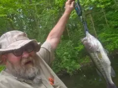
uploaded by: papafish

uploaded by: papafish

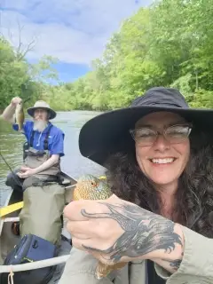
uploaded by: jennifer baldwin

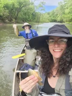
uploaded by: jennifer baldwin

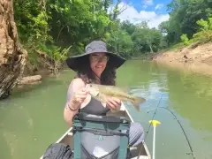
uploaded by: jennifer baldwin

uploaded by: tajiran

uploaded by: Joey Piercefield

uploaded by: Joey Piercefield

uploaded by: Joey Piercefield

uploaded by: Joey Piercefield
Best Fishing Spots in the greater Wachapreague area
Wharf's or Jetties are good places to wet a line and meet other fishermen. They often produce a fresh feed of fish and are also great to catch bait fish. As they are often well lit, they also provide a good opportunity for night fishing. There are 8 wharf(s) in this area.
Boggs Wharf - 12km , Evans Wharf - 13km , Finneys Wharf - 14km , Rue Wharf - 14km , Willis Wharf - 14km , Sheilds Wharf - 15km , Miles Wharf - 16km , Poplar Cove Wharf - 16km
Beaches and Bays are ideal places for land-based fishing. If the beach is shallow and the water is clear then twilight times are usually the best times, especially when they coincide with a major or minor fishing time. Often the points on either side of a beach are the best spots. Or if the beach is large then look for irregularities in the breaking waves, indicating sandbanks and holes. We found 19 beaches and bays in this area.
Bradford Bay - 2km , Curlew Bay - 3km , Gates Bay - 3km , Clark Bay - 4km , Burtons Bay - 5km , Swash Bay - 6km , Cedar Island Beach - 8km , Major Hole Bay - 8km , Cedar Island Bay - 9km , Little Beach - 9km , Parramore Beach - 9km , Little Beach Cove - 10km , Revel Island Bay - 10km , Snead Beach - 10km , Upshur Bay - 10km , Bordenstake Bay - 12km , Sandy Island Bay - 13km , Baylys Neck - 14km , Metompkin Bay - 16km
Harbours and Marinas can often times be productive fishing spots for land based fishing as their sheltered environment attracts a wide variety of bait fish. Similar to river mouths, harbour entrances are also great places to fish as lots of fish will move in and out with the rising and falling tides. There are 1 main harbours in this area.
Wachapreague Marina - 0km
We found a total of 98 potential fishing spots nearby Wachapreague. Below you can find them organized on a map. Points, Headlands, Reefs, Islands, Channels, etc can all be productive fishing spots. As these are user submitted spots, there might be some errors in the exact location. You also need to cross check local fishing regulations. Some of the spots might be in or around marine reserves or other locations that cannot be fished. If you click on a location marker it will bring up some details and a quick link to google search, satellite maps and fishing times. Tip: Click/Tap on a new area to load more fishing spots.
Wachapreague Marina - 0km , Fools Gut - 1km , Bradford Bay - 2km , Curlew Bay - 3km , Gates Bay - 3km , Hummock Cove - 3km , Bradford Neck - 4km , Chalk Pipe Gut - 4km , Clark Bay - 4km , Sandy Point - 4km , Burtons Bay - 5km , Fishpen Gut - 6km , Roach Hole Gut - 6km , Swash Bay - 6km , Cedar Island - 7km , Clubhouse Gut - 7km , Great Gut - 7km , Great Gut Cove - 7km , Jim Bell Gut - 7km , Shell Narrows - 7km , Cedar Island Beach - 8km , Cross Gut - 8km , Goose Lakes - 8km , Horseshoe Pond - 8km , Major Hole Bay - 8km , North Pond - 8km , Pealer Point - 8km , Teagles Ditch - 8km , Barge Point - 9km , Cedar Island Bay - 9km , Custis Neck - 9km , Level Pond - 9km , Little Beach - 9km , Parramore Beach - 9km , Parramore Island - 9km , Powdering Tub - 9km , Point of Rocks - 9km , Southwest Gut - 9km , White Perch Cove - 9km , Bucket Gut - 10km , Little Beach Cove - 10km , Revel Island Bay - 10km , Snead Beach - 10km , Tankard Dam - 10km , Upshur Bay - 10km , Big Thrasher Gut - 11km , Henrys Point - 11km , Knock Knees Gut - 11km , Little Thrasher Gut - 11km , The Swash - 11km , Upshur Neck - 11km , Walkers Tumps - 11km , Boggs Wharf - 12km , Bordenstake Bay - 12km , Cedar Point - 12km , Flounder Point - 12km , Revel Island - 12km , Virginia Truck and Experimental Station Dam - 12km , Yeo Neck - 12km , Bell Neck - 13km , Duer Dam - 13km , Evans Wharf - 13km , Joynes Neck - 13km , Metompkin Inlet - 13km , Revel Island Cove - 13km , Sandy Island - 13km , Sandy Island Bay - 13km , Walston Creek Dam - 13km , Battle Point - 14km , Baylys Neck - 14km , Black Duck Cove - 14km , Custis Dam - 14km , Finneys Wharf - 14km , Kusian Cove - 14km , Rue Wharf - 14km , Stingaree Point Cove - 14km , Willis Wharf - 14km , Bailey Neck - 15km , Boggs Gut - 15km , Buckland Gut - 15km , Fairview Neck - 15km , Hacks Neck - 15km , McLean Gut - 15km , Onley Point - 15km , Quinby Inlet - 15km , Sheilds Wharf - 15km , Stingaree Point - 15km , Wescott Cove - 15km , Bailey Point - 16km , Broadway Neck - 16km , Finneys Neck - 16km , Hancock Gut - 16km , Klondike Point - 16km , Metompkin Bay - 16km , Miles Wharf - 16km , Poplar Cove - 16km , Poplar Cove Wharf - 16km , Shields Cove - 16km
Comments