
Dawesville 🇦🇺
-
Nautical Twilight begins:05:03 amSunrise:05:55 am
-
Sunset:06:20 pmNautical Twilight ends:07:12 pm
-
Moonrise:11:01 am
-
Moonset:01:20 am
-
Moon over:06:40 pm
-
Moon under:06:10 am
-
Visibility:52%
-
 First Quarter Moon
-
Distance to earth:397,712 kmProximity:18.7 %
Moon Phases for Dawesville
-
poor Day
-
minor Time:12:20 am - 02:20 am
-
major Time:
 05:10 am -
07:10 am
05:10 am -
07:10 am
-
minor Time:10:01 am - 12:01 pm
-
major Time:
05:40 pm -
07:40 pm
Tide Clock
Tide Graph
Times
| Tide | Time | Height |
|---|---|---|
| high | 12:54 am | 2.62 ft |
| low | 01:41 pm | 1.02 ft |
| Date | Major Bite Times | Minor Bite Times | Sun | Moon | Moonphase | Tide Times |
|---|---|---|---|---|---|---|
|
Tue, 30 Sep
|
05:10 am -
07:10 am
05:40 pm -
07:40 pm
|
12:20 am -
02:20 am
10:01 am -
12:01 pm
|
R: 05:55 am S: 06:20 pm |
R: 11:01 am S: 01:20 am |
First Quarter Moon |
high: 12:54 am
, 2.62 ft
, Coeff: 51
low: 01:41 pm
, 1.02 ft
|
|
Wed, 01 Oct
|
06:04 am -
08:04 am
06:36 pm -
08:36 pm
|
01:08 am -
03:08 am
11:01 am -
01:01 pm
|
R: 05:54 am S: 06:21 pm |
R: 12:01 pm S: 02:08 am |
First Quarter Moon |
high: 02:21 am
, 2.59 ft
, Coeff: 50
low: 01:57 pm
, 1.05 ft
|
|
Thu, 02 Oct
|
06:57 am -
08:57 am
07:30 pm -
09:30 pm
|
01:50 am -
03:50 am
12:05 pm -
02:05 pm
|
R: 05:52 am S: 06:21 pm |
R: 01:05 pm S: 02:50 am |
Waxing Gibbous |
high: 04:28 am
, 2.56 ft
, Coeff: 48
low: 02:13 pm
, 1.08 ft
|
|
Fri, 03 Oct
|
07:49 am -
09:49 am
08:22 pm -
10:22 pm
|
02:28 am -
04:28 am
01:10 pm -
03:10 pm
|
R: 05:51 am S: 06:22 pm |
R: 02:10 pm S: 03:28 am |
Waxing Gibbous |
high: 06:12 am
, 2.56 ft
, Coeff: 48
low: 02:31 pm
, 1.18 ft
high: 09:48 pm
, 2 ft
, Coeff: 20
|
|
Sat, 04 Oct
|
08:38 am -
10:38 am
09:12 pm -
11:12 pm
|
03:01 am -
05:01 am
02:16 pm -
04:16 pm
|
R: 05:50 am S: 06:23 pm |
R: 03:16 pm S: 04:01 am |
Waxing Gibbous |
low: 01:09 am
, 1.87 ft
high: 07:29 am
, 2.56 ft
, Coeff: 48
low: 02:47 pm
, 1.31 ft
high: 09:09 pm
, 2.07 ft
, Coeff: 23
|
|
Sun, 05 Oct
|
09:27 am -
11:27 am
10:02 pm -
12:02 am
|
03:32 am -
05:32 am
03:23 pm -
05:23 pm
|
R: 05:48 am S: 06:24 pm |
R: 04:23 pm S: 04:32 am |
Waxing Gibbous |
low: 02:07 am
, 1.61 ft
high: 08:32 am
, 2.46 ft
, Coeff: 43
low: 03:01 pm
, 1.41 ft
high: 09:00 pm
, 2.2 ft
, Coeff: 30
|
|
Mon, 06 Oct
|
10:17 am -
12:17 pm
10:52 pm -
12:52 am
|
04:03 am -
06:03 am
04:32 pm -
06:32 pm
|
R: 05:47 am S: 06:24 pm |
R: 05:32 pm S: 05:03 am |
Full Moon |
low: 03:00 am
, 1.31 ft
high: 09:30 am
, 2.26 ft
, Coeff: 33
low: 03:09 pm
, 1.54 ft
high: 09:08 pm
, 2.33 ft
, Coeff: 36
|


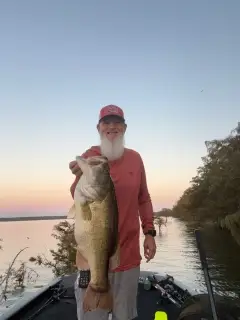
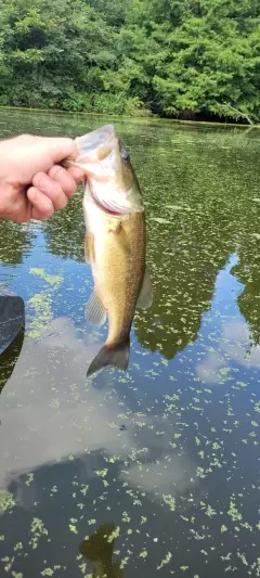
uploaded by: v l

uploaded by: Shin_Benfield

uploaded by: Charles Clute

uploaded by: tajiran

uploaded by: MN fisher

uploaded by: Trey Cowan

uploaded by: primerone

uploaded by: Jeff Bollenbacher

uploaded by: Salim Jamia

uploaded by: rich77
Best Fishing Spots in the greater Dawesville area
Beaches and Bays are ideal places for land-based fishing. If the beach is shallow and the water is clear then twilight times are usually the best times, especially when they coincide with a major or minor fishing time. Often the points on either side of a beach are the best spots. Or if the beach is large then look for irregularities in the breaking waves, indicating sandbanks and holes. We found 10 beaches and bays in this area.
Falcon Bay - 5.91819108249km , Cox Bay - 6.38553329301km , Robert Bay - 7.15812178837km , Boggy Bay - 11.35266461349km , Austin Bay - 12.13968803423km , Blue Bay - 13.23565726874km , Mandjar Bay - 13.88564658656km , Halls Head Beach - 14.03547500841km , Administration Bay - 14.20343747282km , Comet Bay - 15.88898600608km
We found a total of 40 potential fishing spots nearby Dawesville. Below you can find them organized on a map. Points, Headlands, Reefs, Islands, Channels, etc can all be productive fishing spots. As these are user submitted spots, there might be some errors in the exact location. You also need to cross check local fishing regulations. Some of the spots might be in or around marine reserves or other locations that cannot be fished. If you click on a location marker it will bring up some details and a quick link to google search, satellite maps and fishing times. Tip: Click/Tap on a new area to load more fishing spots.
Avocet Island - 3.0941333435km , Endeavour Island - 3.83260866856km , Falcon Bay - 5.91819108249km , Cox Bay - 6.38553329301km , Robert Bay - 7.15812178837km , Lake Mealup - 8.83756887403km , Nirimba Cay - 9.63088637969km , Big Lake - 10.16756064731km , Boundary Island - 10.18898121234km , Peel Inlet - 10.99363363009km , Channel Island - 11.19979443219km , Boggy Bay - 11.35266461349km , Creery Island - 11.55916867972km , Lake Mclarty - 11.58163867769km , Harvey Estuary - 11.64007422572km , Boodalan Island - 11.98199045223km , Austin Bay - 12.13968803423km , Blue Bay - 13.23565726874km , Little Yunderup Island - 13.30364600385km , Goongoolup Island - 13.5620084972km , Murray River - 13.83329927708km , Worallgarook Island - 13.88392761414km , Mandjar Bay - 13.88564658656km , Meeyip Island - 13.90815352663km , Halls Head Beach - 14.03547500841km , Jennala Island - 14.15864756796km , Robert Point - 14.18301510575km , Administration Bay - 14.20343747282km , Ballee Island - 14.23440104596km , Yunderup Island - 14.34788680699km , Jeegarnyeejip Island - 14.59069157893km , Cooleenup Island - 14.68953288478km , Brunswick Island - 15.0061395249km , Boundary Lake - 15.18934303574km , Serpentine River - 15.59944795014km , Comet Bay - 15.88898600608km , Harvey River - 17.1979838155km , Lake Clifton - 18.12097373868km , Nine Mile Lake - 18.6615417975km , Black Lake - 18.71324412113km
Comments