-
Nautical Twilight begins:Sunrise:
-
Sunset:Nautical Twilight ends:
-
Moonrise:
-
Moonset:
-
Moon over:
-
Moon under:
-
Visibility:11%
-
 Waning Crescent
-
Distance to earth:392,249 kmProximity:31.6 %
Moon Phases for Mackay
-
average Day
-
minor Time:02:25 am - 04:25 am
-
major Time:08:25 am - 10:25 am
-
minor Time:02:25 pm - 04:25 pm
-
major Time:08:41 pm - 10:41 pm
Tide Clock
Tide Graph
Times
| Tide | Time | Height |
|---|---|---|
| low | 02:53 am | 1.54 ft |
| high | 08:59 am | 16.57 ft |
| low | 03:02 pm | 2.49 ft |
| high | 09:08 pm | 17.81 ft |
Wind Speed and Direction
Wind Direction:
Wind Speed:
Wind Direction and Speed are one of the most important aspects for choosing a fishing spot. An offshore wind can help land-based anglers with longer casting distances, while an onshore wind will make kayak fishing safer. Often fish will also move to certain feeding areas depending on the wind direction. Check out the long term wind forecast at the charts below.
Fishing Barometer
Atmospheric Pressure:
Change since midnight:
Trend for next 6 hours:
Atmospheric or Barometric Pressure affects fish activity. The best fishing can be had on a rising barometer and also the time just before it is falling. A steady barometer in the higher ranges can also mean good fishing. A falling or low barometer reading without much change is usually not a very good time for fishing.
UV Effect on Fishing
As a rule of thumb, the higher the UV index, the deeper fish will move. Shallow water fishing is best done at times with a low UV index. When the UV is high, stick to early mornings, late evenings and shaded areas. The effect is less noticable in deeper water, but often a higher UV index can produce good results in the deep.
| Date | Major Bite Times | Minor Bite Times | Sun | Moon | Moonphase | Tide Times |
|---|---|---|---|---|---|---|
|
|
-
-
|
-
-
|
R: S: |
R: S: |
Waning Crescent |
low:
, 1.54 ft
high:
, 16.57 ft
, Coeff: 89
low:
, 2.49 ft
high:
, 17.81 ft
, Coeff: 102
|
|
|
-
-
|
-
-
|
R: S: |
R: S: |
Waning Crescent |
low:
, 1.31 ft
high:
, 17.22 ft
, Coeff: 96
low:
, 2.4 ft
high:
, 17.42 ft
, Coeff: 98
|
|
|
-
-
|
-
-
|
R: S: |
R: S: |
New Moon |
low:
, 1.41 ft
high:
, 17.52 ft
, Coeff: 99
low:
, 2.66 ft
high:
, 16.73 ft
, Coeff: 91
|
|
|
-
-
|
-
-
|
R: S: |
R: S: |
New Moon |
low:
, 1.74 ft
high:
, 17.45 ft
, Coeff: 99
low:
, 3.18 ft
high:
, 15.81 ft
, Coeff: 82
|
|
|
-
-
|
-
-
|
R: S: |
R: S: |
New Moon |
low:
, 2.23 ft
high:
, 17.09 ft
, Coeff: 95
low:
, 3.87 ft
high:
, 14.76 ft
, Coeff: 71
|
|
|
-
-
|
-
-
|
R: S: |
R: S: |
New Moon |
low:
, 2.85 ft
high:
, 16.6 ft
, Coeff: 90
low:
, 4.63 ft
high:
, 13.68 ft
, Coeff: 60
|
|
|
-
-
|
-
-
|
R: S: |
R: S: |
Waxing Crescent |
low:
, 3.51 ft
high:
, 15.98 ft
, Coeff: 83
low:
, 5.38 ft
high:
, 12.63 ft
, Coeff: 49
|
October Fishing Report
Spring warmth has Mackay firing. In the impoundments, barramundi at Kinchant and Teemburra are active along weed edges during the early morning and last light. Work suspending hardbodies or 5–6" paddle-tail plastics slow-rolled through the pockets; brief pauses are drawing eats.
Pioneer River and mangrove-lined creeks are producing mangrove jack and threadfin around snags on the run-in tide. Skip-cast prawn imitations and compact vibes; live herring are excellent if the water is a touch dirty.
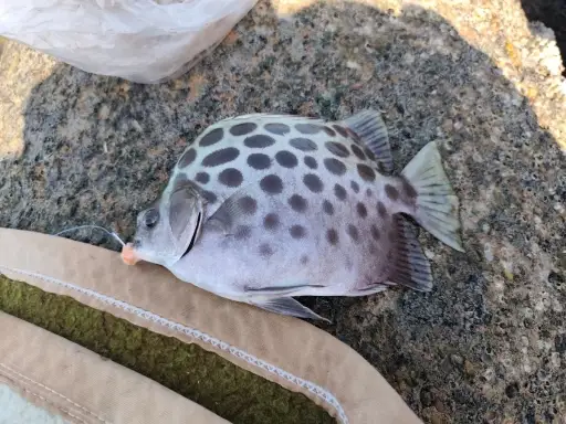
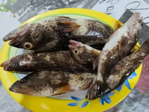
Inshore reefs off Mackay Harbour, Seaforth, and Cape Hillsborough are holding coral trout, fingermark, and roaming queenfish. Look for bait on pressure edges when the current is pushing. Hop 20–40 g soft vibes for fingermark and float pilchards or flick stickbaits for queenies when they bust up. On the beaches, whiting and flathead are steady over the top of the tide with yabbies and small surface walkers.
Conditions: Water is warming, morning winds are lighter before the afternoon sea breeze. Clearer water favors natural colors; carry a brighter option if rain stains the creeks.
Top tip: Note bait size—if jelly prawns are thick, downsize to 2–3" profiles and match the hatch for far more bites.
Best Fishing Spots in the greater Mackay area
Beaches and Bays are ideal places for land-based fishing. If the beach is shallow and the water is clear then twilight times are usually the best times, especially when they coincide with a major or minor fishing time. Often the points on either side of a beach are the best spots. Or if the beach is large then look for irregularities in the breaking waves, indicating sandbanks and holes. We found 8 beaches and bays in this area.
Town Beach - 3.11598512289km , Far Beach - 4.82962622661km , Lamberts Beach - 10.36065048981km , Slade Bay - 10.40789951824km , Sandringham Bay - 12.29627178549km , Sunset Bay - 12.96731786972km , Dalrymple Bay - 16.97209441794km , Neils Beach - 17.60218791282km
Harbours and Marinas can often times be productive fishing spots for land based fishing as their sheltered environment attracts a wide variety of bait fish. Similar to river mouths, harbour entrances are also great places to fish as lots of fish will move in and out with the rising and falling tides. There are 2 main harbours in this area.
Port of Mackay - 7.35776046519km, Mackay Outer Harbour - 7.54292432631km
We found a total of 40 potential fishing spots nearby Mackay. Below you can find them organized on a map. Points, Headlands, Reefs, Islands, Channels, etc can all be productive fishing spots. As these are user submitted spots, there might be some errors in the exact location. You also need to cross check local fishing regulations. Some of the spots might be in or around marine reserves or other locations that cannot be fished. If you click on a location marker it will bring up some details and a quick link to google search, satellite maps and fishing times. Tip: Click/Tap on a new area to load more fishing spots.
Fursden Creek - 1.87781534642km , Goosepond Creek - 2.30731501509km , Town Beach - 3.11598512289km , South Head - 3.11598512289km , Pioneer River - 3.11598512289km , Barnes Creek - 3.62173957413km , Bassett Creek - 3.62173957413km , Bassett Basin - 4.03328204043km , Far Beach - 4.82962622661km , Fishermans Point - 5.18717600758km , Janes Creek - 5.30358221989km , Port of Mackay - 7.35776046519km , Mackay Outer Harbour - 7.54292432631km , Flat Top Island - 7.95160632677km , Bakers Creek - 8.01211404524km , McCreadys Creek - 8.01260285299km , Bagley Point - 8.16215203599km , Forgan Smith Point - 8.21465729881km , MacLennan Creek - 9.22809618402km , Slade Point - 9.45726438074km , Slade Island - 9.63465191441km , Round Top Island - 10.24572705169km , Lamberts Beach - 10.36065048981km , Slade Bay - 10.40789951824km , Orphanage Swamp - 11.70905446468km , Eimeo Creek - 11.95150624148km , Sandringham Bay - 12.29627178549km , Denmans Creek - 12.38097724914km , Sunset Bay - 12.96731786972km , Dudgeon Point - 13.8414710672km , Leila Creek - 14.05589583605km , Amhurst Creek - 14.27155433103km , Tin-pot Creek - 14.66874663937km , Kanakas Release Creek - 15.50995686474km , Shoal Point - 16.45800988018km , Sandringham Creek - 16.66554808507km , Dalrymple Bay - 16.97209441794km , Reliance Creek - 17.03927935267km , Neils Beach - 17.60218791282km , Green Reef - 18.35097239994km


Comments