Mahurangi 🇳🇿
-
Nautical Twilight begins:06:13 amSunrise:07:11 am
-
Sunset:05:24 pmNautical Twilight ends:06:21 pm
-
Moonrise:07:38 pm
-
Moonset:10:25 am
-
Moon over:02:31 am
-
Moon under:03:01 pm
-
Visibility:90%
-
 Waning Gibbous
-
Distance to earth:395,599 kmProximity:23.7 %
Moon Phases for Mahurangi
-
good Day
-
major Time:01:31 am - 03:31 am
-
minor Time:09:25 am - 11:25 am
-
major Time:02:01 pm - 04:01 pm
-
minor Time:06:38 pm - 08:38 pm
Tide Clock
Tide Graph
Times
| Tide | Time | Height |
|---|---|---|
| low | 03:24 am | 2.36 ft |
| high | 09:18 am | 7.61 ft |
| low | 03:38 pm | 2.1 ft |
| high | 09:47 pm | 7.91 ft |
| Date | Major Bite Times | Minor Bite Times | Sun | Moon | Moonphase | Tide Times |
|---|---|---|---|---|---|---|
|
Fri, 16 May
|
01:31 am -
03:31 am
02:01 pm -
04:01 pm
|
09:25 am -
11:25 am
06:38 pm -
08:38 pm
|
R: 07:11 am S: 05:24 pm |
R: 07:38 pm S: 10:25 am |
Waning Gibbous |
low: 03:24 am
, 2.36 ft
high: 09:18 am
, 7.61 ft
, Coeff: 70
low: 03:38 pm
, 2.1 ft
high: 09:47 pm
, 7.91 ft
, Coeff: 75
|
|
Sat, 17 May
|
02:23 am -
04:23 am
02:56 pm -
04:56 pm
|
10:15 am -
12:15 pm
07:38 pm -
09:38 pm
|
R: 07:12 am S: 05:23 pm |
R: 08:38 pm S: 11:15 am |
Waning Gibbous |
low: 04:08 am
, 2.43 ft
high: 10:00 am
, 7.55 ft
, Coeff: 68
low: 04:19 pm
, 2.17 ft
high: 10:29 pm
, 7.81 ft
, Coeff: 74
|
|
Sun, 18 May
|
03:16 am -
05:16 am
03:50 pm -
05:50 pm
|
10:57 am -
12:57 pm
08:43 pm -
10:43 pm
|
R: 07:12 am S: 05:23 pm |
R: 09:43 pm S: 11:57 am |
Waning Gibbous |
low: 04:55 am
, 2.53 ft
high: 10:45 am
, 7.45 ft
, Coeff: 66
low: 05:02 pm
, 2.26 ft
high: 11:13 pm
, 7.74 ft
, Coeff: 72
|
|
Mon, 19 May
|
04:08 am -
06:08 am
04:42 pm -
06:42 pm
|
11:34 am -
01:34 pm
09:50 pm -
11:50 pm
|
R: 07:13 am S: 05:22 pm |
R: 10:50 pm S: 12:34 pm |
Third Quarter Moon |
low: 05:44 am
, 2.59 ft
high: 11:31 am
, 7.35 ft
, Coeff: 65
low: 05:49 pm
, 2.43 ft
|
|
Tue, 20 May
|
05:11 am -
07:11 am
05:31 pm -
07:31 pm
|
12:05 pm -
02:05 pm
10:57 pm -
12:57 am
|
R: 07:14 am S: 05:21 pm |
R: 11:57 pm S: 01:05 pm |
Third Quarter Moon |
high: 12:00 am
, 7.68 ft
, Coeff: 71
low: 06:35 am
, 2.62 ft
high: 12:20 pm
, 7.32 ft
, Coeff: 64
low: 06:42 pm
, 2.56 ft
|
|
Wed, 21 May
|
05:59 am -
07:59 am
06:19 pm -
08:19 pm
|
12:05 am -
02:05 am
12:34 pm -
02:34 pm
|
R: 07:15 am S: 05:21 pm |
R: - S: 01:34 pm |
Third Quarter Moon |
high: 12:50 am
, 7.68 ft
, Coeff: 71
low: 07:29 am
, 2.56 ft
high: 01:11 pm
, 7.35 ft
, Coeff: 65
low: 07:42 pm
, 2.62 ft
|
|
Thu, 22 May
|
06:33 am -
08:33 am
07:08 pm -
09:08 pm
|
12:05 am -
02:05 am
01:01 pm -
03:01 pm
|
R: 07:16 am S: 05:20 pm |
R: 01:05 am S: 02:01 pm |
Third Quarter Moon |
high: 01:45 am
, 7.74 ft
, Coeff: 72
low: 08:25 am
, 2.4 ft
high: 02:10 pm
, 7.41 ft
, Coeff: 66
low: 08:45 pm
, 2.56 ft
|
 🎣🚐✨")

")

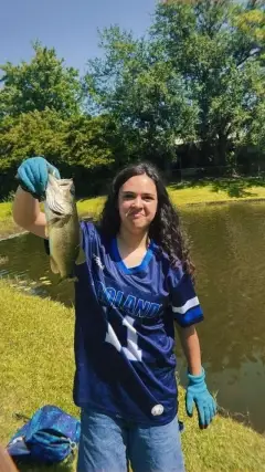
uploaded by: Kayla Smith

uploaded by: papafish

uploaded by: papafish

uploaded by: jennifer baldwin

uploaded by: jennifer baldwin

uploaded by: jennifer baldwin

uploaded by: tajiran

uploaded by: Joey Piercefield

uploaded by: Joey Piercefield

uploaded by: Joey Piercefield
Best Fishing Spots in the greater Mahurangi area
Beaches and Bays are ideal places for land-based fishing. If the beach is shallow and the water is clear then twilight times are usually the best times, especially when they coincide with a major or minor fishing time. Often the points on either side of a beach are the best spots. Or if the beach is large then look for irregularities in the breaking waves, indicating sandbanks and holes. We found 39 beaches and bays in this area.
Big Bay - 1km , Lagoon Bay - 1km , Ngaio Bay - 1km , Otuawaea Bay - 2km , Dairy Bay - 2km , Jamieson Bay - 2km , Otarawao Bay - 3km , Opahi Bay - 3km , Huawai Bay - 3km , Brownes Bay - 3km , Martins Bay - 5km , Cowan Bay - 5km , Scandretts Bay - 6km , Goldsworthy Bay - 7km , Kawau Bay - 8km , Hatfields Beach - 9km , Mansion House Bay - 9km , Farmer Bay - 9km , Ladys Bay - 9km , Whangaparaoa Bay - 11km , Stockyard Bay - 11km , Shark Bay - 11km , Two House Bay - 11km , School House Bay - 11km , Wanns Bay - 11km , Orewa Beach - 12km , Bostaquet Bay - 12km , Swansea Bay - 12km , Prospect Bay - 12km , Campbells Beach - 12km , Baddeleys Beach - 12km , Millon Bay - 12km , Coal Mine Bay - 13km , Red Beach - 13km , Burgess Bay - 13km , Moores Bay - 13km , Christian Bay - 13km , Puawai Bay - 14km , Stanmore Bay - 14km
Harbours and Marinas can often times be productive fishing spots for land based fishing as their sheltered environment attracts a wide variety of bait fish. Similar to river mouths, harbour entrances are also great places to fish as lots of fish will move in and out with the rising and falling tides. There are 2 main harbours in this area.
Mahurangi Harbour - 4km, Bon Accord Harbour - 11km
We found a total of 97 potential fishing spots nearby Mahurangi. Below you can find them organized on a map. Points, Headlands, Reefs, Islands, Channels, etc can all be productive fishing spots. As these are user submitted spots, there might be some errors in the exact location. You also need to cross check local fishing regulations. Some of the spots might be in or around marine reserves or other locations that cannot be fished. If you click on a location marker it will bring up some details and a quick link to google search, satellite maps and fishing times. Tip: Click/Tap on a new area to load more fishing spots.
Big Bay - 1km , Lagoon Bay - 1km , Casnell Island - 1km , Pukapuka Inlet - 1km , Ngaio Bay - 1km , North Head - 2km , Otuawaea Bay - 2km , Tungutu Point - 2km , Dairy Bay - 2km , Mahurangi Heads - 2km , Sadler Point - 2km , Jamieson Bay - 2km , Opaheke Point - 2km , Oaua Point - 2km , Pudding Island - 3km , Otarawao Bay - 3km , Te Haupa Island (Saddle Island) - 3km , Opahi Bay - 3km , Opahi Point - 3km , Huawai Bay - 3km , Inner Channel - 3km , Brownes Bay - 3km , Grants Island - 3km , Cudlip Point - 4km , Mahurangi Harbour - 4km , Bradley Point - 4km , Brazier Rock - 5km , Rocky Islets - 5km , Moturekareka Island - 5km , Motutara Island - 5km , Martins Bay - 5km , Cowan Bay - 5km , Mahurangi Island - 6km , Motuora Island - 6km , Blanche Channel - 6km , Motuketekete Island - 6km , Scandretts Bay - 6km , Motuketekete - 7km , Mullet Point - 7km , Goldsworthy Bay - 7km , South Channel - 8km , Pohuehue Viaduct - 8km , Martello Rock (Ruakoura) - 8km , Kawau Bay - 8km , Hatfields Beach - 9km , Rosario Channel - 9km , Beehive Island (Taungamaro Island) - 9km , Mansion House Bay - 9km , Farmer Bay - 9km , Ladys Bay - 9km , Momona Point - 9km , Takangaroa Island - 9km , Archway Island - 10km , Elizabeth Point - 10km , South Cove - 10km , Percy Point - 10km , Dispute Cove - 10km , Accord Point - 10km , Rabbit Island - 10km , Whangaparaoa Bay - 11km , Twins - 11km , Stockyard Bay - 11km , Shark Bay - 11km , Two House Bay - 11km , Bon Accord Harbour - 11km , School House Bay - 11km , North Cove - 11km , Edwards Point - 11km , Wanns Bay - 11km , Crocodile Island - 12km , Orewa Beach - 12km , Bostaquet Bay - 12km , Brownrigg Point - 12km , Swansea Bay - 12km , Beaumont Point - 12km , Pembles Island (Tangaroa) - 12km , Sharp Point - 12km , Karangatuoro Point - 12km , Prospect Bay - 12km , Campbells Beach - 12km , Tongue Point - 12km , Baddeleys Beach - 12km , Millon Bay - 12km , Coal Mine Bay - 13km , Red Beach - 13km , Wellington Rock - 13km , Challenger Island - 13km , Little Markham Island - 13km , Challenger Island (Little Kawau Island) - 13km , Burgess Bay - 13km , Moores Bay - 13km , Kawau Island - 13km , Kawati Point - 13km , Christian Bay - 13km , Motutara Point - 13km , Puawai Bay - 14km , Stanmore Bay - 14km
Comments