


Beech Camper and Mobile Home Park 🇺🇸
-
Nautical Twilight begins:05:00 amSunrise:05:58 am
-
Sunset:07:55 pmNautical Twilight ends:08:53 pm
-
Moonrise:11:41 pm
-
Moonset:11:44 am
-
Moon over:05:22 am
-
Moon under:05:42 pm
-
Visibility:65%
-
 Third Quarter Moon
-
Distance to earth:366,823 kmProximity:91.3 %
Moon Phases for Beech Camper and Mobile Home Park
-
poor Day
-
major Time:04:22 am - 06:22 am
-
minor Time:10:44 am - 12:44 pm
-
major Time:04:42 pm - 06:42 pm
-
minor Time:10:41 pm - 12:41 am
Tide Clock
Tide Graph
Times
| Tide | Time | Height |
|---|---|---|
| high | 05:54 am | 0.95 ft |
| low | 10:29 am | 0.72 ft |
| high | 05:07 pm | 1.12 ft |
| low | 11:12 pm | 0.82 ft |
| Date | Major Bite Times | Minor Bite Times | Sun | Moon | Moonphase | Tide Times |
|---|---|---|---|---|---|---|
|
Wed, 16 Jul
|
04:22 am -
06:22 am
04:42 pm -
06:42 pm
|
10:44 am -
12:44 pm
10:41 pm -
12:41 am
|
R: 05:58 am S: 07:55 pm |
R: 11:41 pm S: 11:44 am |
Third Quarter Moon |
high: 05:54 am
, 0.95 ft
, Coeff: 27
low: 10:29 am
, 0.72 ft
high: 05:07 pm
, 1.12 ft
, Coeff: 46
low: 11:12 pm
, 0.82 ft
|
|
Thu, 17 Jul
|
05:10 am -
07:10 am
05:30 pm -
07:30 pm
|
11:48 am -
01:48 pm
11:13 pm -
01:13 am
|
R: 05:59 am S: 07:54 pm |
R: - S: 12:48 pm |
Third Quarter Moon |
high: 05:12 am
, 1.21 ft
, Coeff: 57
low: 12:48 pm
, 0.49 ft
|
|
Fri, 18 Jul
|
06:04 am -
08:04 am
06:23 pm -
08:23 pm
|
12:55 pm -
02:55 pm
11:13 pm -
01:13 am
|
R: 06:00 am S: 07:54 pm |
R: 12:13 am S: 01:55 pm |
Third Quarter Moon |
high: 05:14 am
, 1.54 ft
, Coeff: 94
low: 03:43 pm
, 0.26 ft
|
|
Sat, 19 Jul
|
06:57 am -
08:57 am
07:19 pm -
09:19 pm
|
02:05 pm -
04:05 pm
11:50 pm -
01:50 am
|
R: 06:00 am S: 07:53 pm |
R: 12:50 am S: 03:05 pm |
Third Quarter Moon |
high: 05:44 am
, 1.84 ft
, Coeff: 127
low: 06:21 pm
, -0.03 ft
|
|
Sun, 20 Jul
|
07:55 am -
09:55 am
08:21 pm -
10:21 pm
|
12:34 am -
02:34 am
03:16 pm -
05:16 pm
|
R: 06:01 am S: 07:53 pm |
R: 01:34 am S: 04:16 pm |
Waning Crescent |
high: 06:33 am
, 2 ft
, Coeff: 146
low: 07:35 pm
, -0.26 ft
|
|
Mon, 21 Jul
|
08:55 am -
10:55 am
09:25 pm -
11:25 pm
|
01:25 am -
03:25 am
04:25 pm -
06:25 pm
|
R: 06:01 am S: 07:52 pm |
R: 02:25 am S: 05:25 pm |
Waning Crescent |
high: 07:43 am
, 2.1 ft
, Coeff: 157
low: 08:33 pm
, -0.43 ft
|
|
Tue, 22 Jul
|
09:56 am -
11:56 am
10:29 pm -
12:29 am
|
02:25 am -
04:25 am
05:28 pm -
07:28 pm
|
R: 06:02 am S: 07:52 pm |
R: 03:25 am S: 06:28 pm |
Waning Crescent |
high: 09:21 am
, 2.13 ft
, Coeff: 161
low: 09:28 pm
, -0.46 ft
|


uploaded by: primerone

uploaded by: primerone

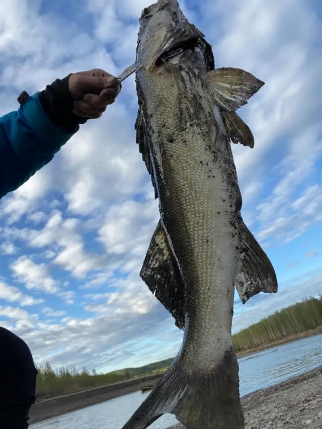
uploaded by: Michael Mitchell 1

uploaded by: Joey Piercefield

uploaded by: Joey Piercefield

uploaded by: Joey Piercefield

uploaded by: SzatanEK666
uploaded by: Rosemelzam

uploaded by: Eric Foster

uploaded by: cspooner
Best Fishing Spots in the greater Beech Camper and Mobile Home Park area
Wharf's or Jetties are good places to wet a line and meet other fishermen. They often produce a fresh feed of fish and are also great to catch bait fish. As they are often well lit, they also provide a good opportunity for night fishing. There are 1 wharf(s) in this area.
The Golf Club of the Wharf - 12km
Beaches and Bays are ideal places for land-based fishing. If the beach is shallow and the water is clear then twilight times are usually the best times, especially when they coincide with a major or minor fishing time. Often the points on either side of a beach are the best spots. Or if the beach is large then look for irregularities in the breaking waves, indicating sandbanks and holes. We found 23 beaches and bays in this area.
Cotton Bayou - 1km , Cotton Bayou Marina - 2km , Orange Beach Marina - 2km , Bayou La Launch - 3km , Stone Quarry Bayou - 5km , Bayou Saint John - 5km , Hammock Bay - 5km , Wolf Bay - 5km , Arnica Bay - 6km , Goat Bayou - 8km , Moccasin Bayou - 8km , Bellville Bay - 9km , Russell Bayou - 9km , Kees Bayou - 11km , Perdido Bay - 14km , Oyster Bay - 15km , Bayou Garcon - 15km , Kinsey Bayou - 16km , Tarkiln Bay - 17km , Tarkiln Bayou - 18km , Long Bayou - 18km , Sand Bayou - 18km , Bay Bridge Marina - 19km
Harbours and Marinas can often times be productive fishing spots for land based fishing as their sheltered environment attracts a wide variety of bait fish. Similar to river mouths, harbour entrances are also great places to fish as lots of fish will move in and out with the rising and falling tides. There are 17 main harbours in this area.
Griffith's Marina - 1km, Romar Harbor Marina - 1km, Cotton Bayou Marina - 2km, Perdido Pass Marina - 2km, Orange Beach Marina - 2km, Safe Harbor Marina - 2km, Trents Marina - 2km, Bobby Walker Marina - 2km, Zeke's Landing Marina - 2km, Sportsman Marina - 3km, Portage Creek - 4km, Bear Point Marina - 6km, Pirates Cove Marina and Boat Yard - 6km, Homeport Marina - 10km, Holiday Harbor Marina - 14km, Bay Bridge Marina - 19km, Kits Marina - 19km
We found a total of 83 potential fishing spots nearby Beech Camper and Mobile Home Park. Below you can find them organized on a map. Points, Headlands, Reefs, Islands, Channels, etc can all be productive fishing spots. As these are user submitted spots, there might be some errors in the exact location. You also need to cross check local fishing regulations. Some of the spots might be in or around marine reserves or other locations that cannot be fished. If you click on a location marker it will bring up some details and a quick link to google search, satellite maps and fishing times. Tip: Click/Tap on a new area to load more fishing spots.
Griffith's Marina - 1km , Romar Harbor Marina - 1km , Cotton Bayou - 1km , Cotton Bayou Marina - 2km , Perdido Pass Marina - 2km , Orange Beach Marina - 2km , Safe Harbor Marina - 2km , Sapling Point - 2km , Terry Cove - 2km , Trents Marina - 2km , Bobby Walker Marina - 2km , Gilchrist Island - 2km , Zeke's Landing Marina - 2km , Florida Point - 3km , Sportsman Marina - 3km , Alabama Point - 3km , Robinson Island - 3km , Johnson Cove - 3km , Bayou La Launch - 3km , Mulberry Point - 4km , Middle River - 4km , Little Lake - 4km , Portage Creek - 4km , Hatcher Point - 4km , Walker Island - 4km , Perdido Key - 5km , Stone Quarry Bayou - 5km , Bayou Saint John - 5km , Hammock Bay - 5km , Wolf Bay - 5km , Mill Point - 6km , Bear Point Marina - 6km , Bear Point - 6km , Pirates Cove Marina and Boat Yard - 6km , Arnica Bay - 6km , Goat Point - 7km , Ross Point - 7km , Goat Bayou - 8km , South Island - 8km , Inerarity Point - 8km , Peterson Point - 8km , Alligator Island - 8km , Ono Island - 8km , Old River - 8km , Moccasin Bayou - 8km , Bellville Bay - 9km , Russell Bayou - 9km , Grass Island - 9km , Shelby Lakes - 9km , Homeport Marina - 10km , Doctor W C Holmes Bridge - 10km , Muiel Dam - 10km , Kees Bayou - 11km , The Golf Club of the Wharf - 12km , Point Ono - 12km , Rabbit Island - 12km , Bear Creek - 13km , Baroco Lake Dam Number 2 - 13km , Baroco Lake Dam Number 1 - 13km , Manuel Point - 14km , Perdido Bay - 14km , Holiday Harbor Marina - 14km , Oyster Bay - 15km , Bayou Garcon - 15km , Canal Bridge - 15km , Flash Point - 16km , Lee Callaway Bridge - 16km , Kinsey Bayou - 16km , Tarkiln Point - 16km , Du Pont Point - 16km , Suarez Point - 16km , Tarkiln Bay - 17km , Tarkiln Bayou - 18km , Long Bayou - 18km , Sand Bayou - 18km , Little Lagoon - 18km , Willet Point - 18km , Nix Point - 19km , Chagrin Point - 19km , Bay Bridge Marina - 19km , Cummings Point - 19km , Lillian Bridge - 19km , Kits Marina - 19km
Comments