
Boothbay Harbor 🇺🇸
-
Nautical Twilight begins:04:35 amSunrise:05:43 am
-
Sunset:07:42 pmNautical Twilight ends:08:50 pm
-
Moonrise:11:18 pm
-
Moonset:02:37 pm
-
Moon over:06:37 am
-
Moon under:06:57 pm
-
Visibility:45%
-
 Third Quarter Moon
-
Distance to earth:363,881 kmProximity:98.2 %
Moon Phases for Boothbay Harbor
-
average Day
-
major Time:
 05:37 am -
07:37 am
05:37 am -
07:37 am
-
minor Time:01:37 pm - 03:37 pm
-
major Time:
05:57 pm -
07:57 pm
-
minor Time:10:18 pm - 12:18 am
Tide Clock
Tide Graph
Times
| Tide | Time | Height |
|---|---|---|
| high | 04:54 am | 8.79 ft |
| low | 10:53 am | 0.46 ft |
| high | 05:16 pm | 9.91 ft |
| low | 11:43 pm | 0.13 ft |
| Date | Major Bite Times | Minor Bite Times | Sun | Moon | Moonphase | Tide Times |
|---|---|---|---|---|---|---|
|
Sat, 16 Aug
|
05:37 am -
07:37 am
05:57 pm -
07:57 pm
|
01:37 pm -
03:37 pm
10:18 pm -
12:18 am
|
R: 05:43 am S: 07:42 pm |
R: 11:18 pm S: 02:37 pm |
Third Quarter Moon |
high: 04:54 am
, 8.79 ft
, Coeff: 104
low: 10:53 am
, 0.46 ft
high: 05:16 pm
, 9.91 ft
, Coeff: 127
low: 11:43 pm
, 0.13 ft
|
|
Sun, 17 Aug
|
06:40 am -
08:40 am
07:00 pm -
09:00 pm
|
02:53 pm -
04:53 pm
11:07 pm -
01:07 am
|
R: 05:44 am S: 07:41 pm |
R: - S: 03:53 pm |
Third Quarter Moon |
high: 05:59 am
, 8.37 ft
, Coeff: 95
low: 11:54 am
, 0.82 ft
high: 06:19 pm
, 9.78 ft
, Coeff: 124
|
|
Mon, 18 Aug
|
07:32 am -
09:32 am
08:04 pm -
10:04 pm
|
03:58 pm -
05:58 pm
11:07 pm -
01:07 am
|
R: 05:45 am S: 07:39 pm |
R: 12:07 am S: 04:58 pm |
Waning Crescent |
low: 12:52 am
, 0.23 ft
high: 07:08 am
, 8.14 ft
, Coeff: 90
low: 01:01 pm
, 1.05 ft
high: 07:26 pm
, 9.71 ft
, Coeff: 123
|
|
Tue, 19 Aug
|
08:30 am -
10:30 am
09:06 pm -
11:06 pm
|
12:10 am -
02:10 am
04:51 pm -
06:51 pm
|
R: 05:46 am S: 07:38 pm |
R: 01:10 am S: 05:51 pm |
Waning Crescent |
low: 02:01 am
, 0.2 ft
high: 08:18 am
, 8.14 ft
, Coeff: 90
low: 02:09 pm
, 1.05 ft
high: 08:33 pm
, 9.78 ft
, Coeff: 124
|
|
Wed, 20 Aug
|
09:26 am -
11:26 am
10:05 pm -
12:05 am
|
01:21 am -
03:21 am
05:32 pm -
07:32 pm
|
R: 05:47 am S: 07:36 pm |
R: 02:21 am S: 06:32 pm |
Waning Crescent |
low: 03:06 am
, 0.03 ft
high: 09:23 am
, 8.33 ft
, Coeff: 94
low: 03:13 pm
, 0.89 ft
high: 09:35 pm
, 9.94 ft
, Coeff: 128
|
|
Thu, 21 Aug
|
10:20 am -
12:20 pm
10:58 pm -
12:58 am
|
02:38 am -
04:38 am
06:03 pm -
08:03 pm
|
R: 05:49 am S: 07:34 pm |
R: 03:38 am S: 07:03 pm |
New Moon |
low: 04:03 am
, -0.16 ft
high: 10:20 am
, 8.63 ft
, Coeff: 100
low: 04:11 pm
, 0.62 ft
high: 10:31 pm
, 10.07 ft
, Coeff: 130
|
|
Fri, 22 Aug
|
11:10 am -
01:10 pm
10:34 pm -
12:34 am
|
03:53 am -
05:53 am
06:28 pm -
08:28 pm
|
R: 05:50 am S: 07:33 pm |
R: 04:53 am S: 07:28 pm |
New Moon |
low: 04:55 am
, -0.3 ft
high: 11:10 am
, 8.89 ft
, Coeff: 106
low: 05:03 pm
, 0.39 ft
high: 11:22 pm
, 10.1 ft
, Coeff: 131
|


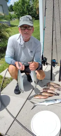
uploaded by: Munta

uploaded by: todd douglas

uploaded by: primerone
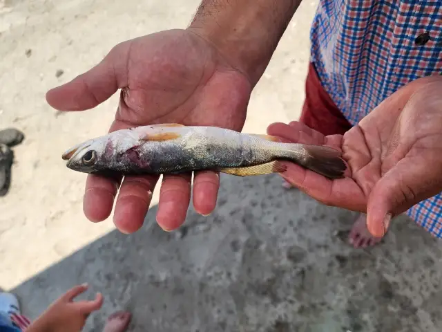
uploaded by: Ryan Frazier

uploaded by: Hoza

uploaded by: Alan Baker

uploaded by: Granpa C

uploaded by: Asaad S Shalbi

uploaded by: Hoza

uploaded by: Hoza
Best Fishing Spots in the greater Boothbay Harbor area
Wharf's or Jetties are good places to wet a line and meet other fishermen. They often produce a fresh feed of fish and are also great to catch bait fish. As they are often well lit, they also provide a good opportunity for night fishing. There are 3 wharf(s) in this area.
Fishermans Wharf - 0km , Wattons Wharf - 1km , Robinson Wharf - 2km
Beaches and Bays are ideal places for land-based fishing. If the beach is shallow and the water is clear then twilight times are usually the best times, especially when they coincide with a major or minor fishing time. Often the points on either side of a beach are the best spots. Or if the beach is large then look for irregularities in the breaking waves, indicating sandbanks and holes. We found 2 beaches and bays in this area.
Boothbay Harbor - 1km , Linekin Bay - 3km
Harbours and Marinas can often times be productive fishing spots for land based fishing as their sheltered environment attracts a wide variety of bait fish. Similar to river mouths, harbour entrances are also great places to fish as lots of fish will move in and out with the rising and falling tides. There are 3 main harbours in this area.
Southport Bridge - 2km, Southport Water Supply Pond Dam - 3km, Southport Island - 5km
We found a total of 100 potential fishing spots nearby Boothbay Harbor. Below you can find them organized on a map. Points, Headlands, Reefs, Islands, Channels, etc can all be productive fishing spots. As these are user submitted spots, there might be some errors in the exact location. You also need to cross check local fishing regulations. Some of the spots might be in or around marine reserves or other locations that cannot be fished. If you click on a location marker it will bring up some details and a quick link to google search, satellite maps and fishing times. Tip: Click/Tap on a new area to load more fishing spots.
Fishermans Wharf - 0km , Appalachie Pond Dam - 1km , Wattons Wharf - 1km , Wall Point - 1km , Railway Point - 1km , Boothbay Harbor - 1km , Clam Rock - 1km , Mill Point - 1km , Mill Cove - 1km , Lewis Cove - 1km , McKown Point - 1km , McFarland Point - 1km , McFarland Island - 1km , Appalachie Pond - 2km , Factory Cove - 2km , West Harbor Pond Dam - 2km , West Harbor Pond - 2km , Fish Hawk Island - 2km , Tumbler Island - 2km , Southport Bridge - 2km , Hogdon Cove - 2km , Robinson Wharf - 2km , Juniper Point - 2km , Cabbage Island - 2km , Townsend Gut - 3km , Spruce Point - 3km , Southport Water Supply Pond Dam - 3km , Indiantown Island - 3km , Perch Island - 3km , Paradise Point - 3km , Oak Point - 3km , Mouse Island - 3km , Moffat Cove - 3km , Burnt Island - 3km , Cameron Point - 3km , Linekin Bay - 3km , Deckers Cove - 3km , Ebenecook Harbor - 4km , Farnham Point - 4km , Isle of Springs - 4km , Spectacle Islands - 4km , Hodgdon Island - 4km , Sawyer Island - 4km , Point Pleasant - 4km , Pig Cove - 4km , Boston Island - 4km , Pierce Cove - 4km , Negro Island - 4km , Montgomery Point - 4km , Knickerbocker Lakes - 4km , Cameron Cove - 4km , Meadow Cove - 4km , Capitol Island - 4km , Card Cove - 4km , Linekin Neck - 4km , Love Cove - 4km , Deep Cove - 5km , Dogfish Head - 5km , Dry Point - 5km , Fort Point - 5km , Foster Point - 5km , Green Island - 5km , Green Islands - 5km , Clifford Point - 5km , Jones Cove - 5km , Jones Point - 5km , Clam Cove - 5km , Cavis Point - 5km , Cavis Cove - 5km , Long Cove - 5km , Maddock Cove - 5km , Little Green Island - 5km , Merrow Island - 5km , Mill Pond - 5km , Adams Pond Dam - 5km , Ocean Harbor - 5km , Powderhorn Island - 5km , Wiley Pond - 5km , Ram Islands - 5km , Reeds Island - 5km , Trevett Swing Bridge - 5km , Squirrel Island - 5km , Squirrel Cove - 5km , Southport Island - 5km , Lobster Rock - 6km , Shipley Point - 6km , Witch Island - 6km , Whittum Island - 6km , Upper Mark Island - 6km , Turnip Island - 6km , Fort Island - 6km , Fox Island - 6km , Gem Island - 6km , Kehali Point - 6km , Ram Island - 6km , Pratts Island - 6km , Northeast Point - 6km , Inner Heron Island - 6km , Middle Mark Island - 6km , McFarlands Cove - 6km
Comments