

Broad Channel 🇺🇸
-
Nautical Twilight begins:04:14 amSunrise:05:26 am
-
Sunset:08:20 pmNautical Twilight ends:09:32 pm
-
Moonrise:08:41 am
-
Moonset:-
-
Moon over:04:28 pm
-
Moon under:03:51 am
-
Visibility:17%
-
 Waxing Crescent
-
Distance to earth:379,355 kmProximity:61.8 %
Moon Phases for Broad Channel
-
good Day
-
major Time:02:51 am - 04:51 am
-
minor Time:07:41 am - 09:41 am
-
major Time:03:28 pm - 05:28 pm
-
minor Time:11:15 pm - 01:15 am
Tide Clock
Tide Graph
Times
| Tide | Time | Height |
|---|---|---|
| low | 05:46 am | -0.36 ft |
| high | 12:04 pm | 5.18 ft |
| low | 05:44 pm | 0.33 ft |
| Date | Major Bite Times | Minor Bite Times | Sun | Moon | Moonphase | Tide Times |
|---|---|---|---|---|---|---|
|
Fri, 30 May
|
02:51 am -
04:51 am
03:28 pm -
05:28 pm
|
07:41 am -
09:41 am
11:15 pm -
01:15 am
|
R: 05:26 am S: 08:20 pm |
R: 08:41 am S: - |
Waxing Crescent |
low: 05:46 am
, -0.36 ft
high: 12:04 pm
, 5.18 ft
, Coeff: 106
low: 05:44 pm
, 0.33 ft
|
|
Sat, 31 May
|
04:05 am -
06:05 am
04:40 pm -
06:40 pm
|
08:55 am -
10:55 am
11:15 pm -
01:15 am
|
R: 05:25 am S: 08:21 pm |
R: 09:55 am S: 12:15 am |
Waxing Crescent |
high: 12:14 am
, 6.1 ft
, Coeff: 139
low: 06:37 am
, -0.07 ft
high: 01:02 pm
, 5.09 ft
, Coeff: 102
low: 06:37 pm
, 0.69 ft
|
|
Sun, 01 Jun
|
04:55 am -
06:55 am
05:28 pm -
07:28 pm
|
10:05 am -
12:05 pm
11:46 pm -
01:46 am
|
R: 05:25 am S: 08:22 pm |
R: 11:05 am S: 12:46 am |
First Quarter Moon |
high: 01:10 am
, 5.71 ft
, Coeff: 125
low: 07:30 am
, 0.23 ft
high: 01:58 pm
, 4.99 ft
, Coeff: 99
low: 07:34 pm
, 1.02 ft
|
|
Mon, 02 Jun
|
05:41 am -
07:41 am
06:13 pm -
08:13 pm
|
12:12 am -
02:12 am
11:11 am -
01:11 pm
|
R: 05:24 am S: 08:22 pm |
R: 12:11 pm S: 01:12 am |
First Quarter Moon |
high: 02:04 am
, 5.35 ft
, Coeff: 112
low: 08:25 am
, 0.49 ft
high: 02:51 pm
, 4.99 ft
, Coeff: 99
low: 08:38 pm
, 1.25 ft
|
|
Tue, 03 Jun
|
06:24 am -
08:24 am
06:55 pm -
08:55 pm
|
12:34 am -
02:34 am
12:14 pm -
02:14 pm
|
R: 05:24 am S: 08:23 pm |
R: 01:14 pm S: 01:34 am |
First Quarter Moon |
high: 02:56 am
, 5.05 ft
, Coeff: 101
low: 09:20 am
, 0.66 ft
high: 03:42 pm
, 5.02 ft
, Coeff: 100
low: 09:43 pm
, 1.31 ft
|
|
Wed, 04 Jun
|
07:04 am -
09:04 am
07:34 pm -
09:34 pm
|
12:53 am -
02:53 am
01:15 pm -
03:15 pm
|
R: 05:24 am S: 08:24 pm |
R: 02:15 pm S: 01:53 am |
First Quarter Moon |
high: 03:46 am
, 4.79 ft
, Coeff: 92
low: 10:12 am
, 0.72 ft
high: 04:32 pm
, 5.09 ft
, Coeff: 102
low: 10:41 pm
, 1.25 ft
|
|
Thu, 05 Jun
|
07:43 am -
09:43 am
08:13 pm -
10:13 pm
|
01:12 am -
03:12 am
02:15 pm -
04:15 pm
|
R: 05:23 am S: 08:24 pm |
R: 03:15 pm S: 02:12 am |
Waxing Gibbous |
high: 04:38 am
, 4.59 ft
, Coeff: 85
low: 10:58 am
, 0.75 ft
high: 05:22 pm
, 5.25 ft
, Coeff: 108
low: 11:33 pm
, 1.08 ft
|

 🎣🚐✨")

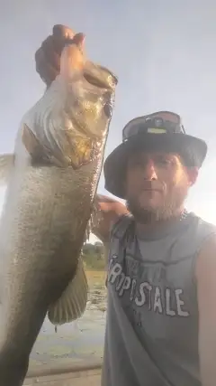
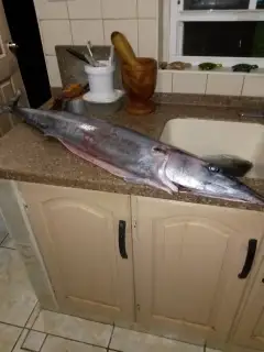
uploaded by: Joel Morris

uploaded by: Allan Bryan

uploaded by: Joel Morris

uploaded by: Craig Hyman

uploaded by: Michael Mitchell 1

uploaded by: Michael Hardwick

uploaded by: Joey Piercefield

uploaded by: Joey Piercefield

uploaded by: Anderson2020##

uploaded by: scott_1
Best Fishing Spots in the greater Broad Channel area
Beaches and Bays are ideal places for land-based fishing. If the beach is shallow and the water is clear then twilight times are usually the best times, especially when they coincide with a major or minor fishing time. Often the points on either side of a beach are the best spots. Or if the beach is large then look for irregularities in the breaking waves, indicating sandbanks and holes. We found 19 beaches and bays in this area.
Cross Bay Veterans Memorial Bridge - 1km , Jamaica Bay - 1km , Little Bay - 3km , Rockaway Beach - 4km , Grassy Bay - 4km , Canarsie Beach - 6km , Head of Bay - 6km , Atlantic Beach Bridge - 7km , Dead Horse Bay - 7km , Atlantic Beach - 8km , Bannister Bay - 8km , Sheepshead Bay - 10km , Brosewere Bay - 10km , East Atlantic Beach - 10km , Hicks Beach - 10km , Long Beach - 13km , Ridgewppd Masonic Temple - 13km , Hewlett Bay - 13km , Long Beach Road Bridge - 14km
Harbours and Marinas can often times be productive fishing spots for land based fishing as their sheltered environment attracts a wide variety of bait fish. Similar to river mouths, harbour entrances are also great places to fish as lots of fish will move in and out with the rising and falling tides. There are 2 main harbours in this area.
Prospect Hospice - 9km, Sheepshead Bay - 10km
We found a total of 99 potential fishing spots nearby Broad Channel. Below you can find them organized on a map. Points, Headlands, Reefs, Islands, Channels, etc can all be productive fishing spots. As these are user submitted spots, there might be some errors in the exact location. You also need to cross check local fishing regulations. Some of the spots might be in or around marine reserves or other locations that cannot be fished. If you click on a location marker it will bring up some details and a quick link to google search, satellite maps and fishing times. Tip: Click/Tap on a new area to load more fishing spots.
Cross Bay Veterans Memorial Bridge - 1km , Winhole Hassock - 1km , Jamaica Bay - 1km , Rulers Bar Hassock - 2km , Barbadoes Basin - 2km , Big Mucks Creek - 2km , Brant Point - 2km , Yellow Bar Hassock - 2km , Winhole Point - 2km , Green Point - 2km , The Raut (historical) - 2km , West Pond - 2km , Vernam Basin - 2km , Ruffle Bar - 3km , Conchs Hole Point - 3km , Sommerville Basin - 3km , East Pond - 3km , Stony Point - 3km , Little Bay - 3km , Jo Co Creek - 3km , Rockaway Beach - 4km , Sails Point Hassock - 4km , Black Point - 4km , Bass Channel Island (historical) - 4km , Norton Basin - 4km , Duck Point - 4km , Motts Point - 4km , Fishkill Hassocks - 4km , Grassy Bay - 4km , Joseph P. Addabbo Memorial Bridge - 4km , Northwest Point - 5km , Canarsie Pol - 5km , Channel Bridge - 5km , Motts Basin - 5km , Hawtree Basin - 5km , Grass Hassock - 5km , Barren Island - 6km , Bergen Basin - 6km , Shellbank Basin - 6km , Canarsie Beach - 6km , Silver Point - 6km , Marine Parkway-Gil Hodges Memorial Bridge - 6km , Head of Bay - 6km , Atlantic Beach Bridge - 7km , Norton Point - 7km , Dead Horse Bay - 7km , Deep Creek - 7km , East Mill Basin - 7km , Mill Basin - 7km , Mill Basin Bridge - 7km , Uncle Daniels Point - 7km , Hendrix Creek - 7km , Mau Mau Island - 8km , Sage Pond - 8km , Atlantic Beach - 8km , Bannister Bay - 8km , Paerdegat Basin - 8km , Point Breeze - 8km , Willets Hassock - 8km , Plumb Island - 8km , Thurston Basin - 8km , Prospect Hospice - 9km , Baisley Pond - 9km , Breezy Point - 9km , Conselyeas Pond - 9km , Crooked Creek - 9km , Post Marsh - 10km , Sheepshead Bay - 10km , Big Hassock - 10km , Brosewere Bay - 10km , East Atlantic Beach - 10km , Hicks Beach - 10km , Sand Bar Point - 11km , Charles Point - 11km , Three Cornered Hassock - 11km , Rockaway Point - 12km , Hewlett Point - 12km , Goose Pond - 12km , North Black Banks Hassock - 12km , South Black Banks Hassock - 12km , Cedar Island Marsh - 12km , Cedar Island - 12km , Cauerbach Canal - 12km , Willow Pond - 12km , Grant Pond - 12km , Green Sedge Point - 12km , Long Beach - 13km , Island Park Channel - 13km , Simmons Hassock - 13km , Pearsalls Hassock - 13km , Grand Canal - 13km , Willow Lake - 13km , Island Park Harbor - 13km , Ridgewppd Masonic Temple - 13km , Hewlett Bay - 13km , Hawlett Hassock - 13km , Prospect Park Lake - 14km , Jeckyl Island - 14km , Long Beach Road Bridge - 14km
Comments