

Dividing Creek 🇺🇸
-
Nautical Twilight begins:04:40 amSunrise:05:46 am
-
Sunset:08:08 pmNautical Twilight ends:09:14 pm
-
Moonrise:10:32 pm
-
Moonset:06:34 am
-
Moon over:02:05 am
-
Moon under:02:33 pm
-
Visibility:96%
-
 Full Moon
-
Distance to earth:400,230 kmProximity:12.8 %
Moon Phases for Dividing Creek
-
good Day
-
major Time:01:05 am - 03:05 am
-
minor Time:
 05:34 am -
07:34 am
05:34 am -
07:34 am
-
major Time:01:33 pm - 03:33 pm
-
minor Time:09:32 pm - 11:32 pm
Tide Clock
Tide Graph
Times
| Tide | Time | Height |
|---|---|---|
| high | 02:39 am | 1.31 ft |
| low | 09:11 am | 0.1 ft |
| high | 03:12 pm | 1.08 ft |
| low | 08:56 pm | 0.2 ft |
| Date | Major Bite Times | Minor Bite Times | Sun | Moon | Moonphase | Tide Times |
|---|---|---|---|---|---|---|
|
Wed, 14 May
|
01:05 am -
03:05 am
01:33 pm -
03:33 pm
|
05:34 am -
07:34 am
09:32 pm -
11:32 pm
|
R: 05:46 am S: 08:08 pm |
R: 10:32 pm S: 06:34 am |
Full Moon |
high: 02:39 am
, 1.31 ft
, Coeff: 131
low: 09:11 am
, 0.1 ft
high: 03:12 pm
, 1.08 ft
, Coeff: 94
low: 08:56 pm
, 0.2 ft
|
|
Thu, 15 May
|
02:04 am -
04:04 am
02:24 pm -
04:24 pm
|
06:21 am -
08:21 am
10:27 pm -
12:27 am
|
R: 05:45 am S: 08:09 pm |
R: 11:27 pm S: 07:21 am |
Waning Gibbous |
high: 03:10 am
, 1.28 ft
, Coeff: 125
low: 09:50 am
, 0.13 ft
high: 03:48 pm
, 1.05 ft
, Coeff: 88
low: 09:31 pm
, 0.2 ft
|
|
Fri, 16 May
|
02:55 am -
04:55 am
03:15 pm -
05:15 pm
|
07:16 am -
09:16 am
11:14 pm -
01:14 am
|
R: 05:44 am S: 08:10 pm |
R: - S: 08:16 am |
Waning Gibbous |
high: 03:42 am
, 1.28 ft
, Coeff: 125
low: 10:30 am
, 0.16 ft
high: 04:24 pm
, 1.05 ft
, Coeff: 88
low: 10:08 pm
, 0.2 ft
|
|
Sat, 17 May
|
03:46 am -
05:46 am
04:06 pm -
06:06 pm
|
08:19 am -
10:19 am
11:14 pm -
01:14 am
|
R: 05:43 am S: 08:10 pm |
R: 12:14 am S: 09:19 am |
Waning Gibbous |
high: 04:17 am
, 1.28 ft
, Coeff: 125
low: 11:11 am
, 0.16 ft
high: 05:03 pm
, 1.05 ft
, Coeff: 88
low: 10:50 pm
, 0.2 ft
|
|
Sun, 18 May
|
04:39 am -
06:39 am
04:56 pm -
06:56 pm
|
09:25 am -
11:25 am
11:54 pm -
01:54 am
|
R: 05:42 am S: 08:11 pm |
R: 12:54 am S: 10:25 am |
Third Quarter Moon |
high: 05:01 am
, 1.28 ft
, Coeff: 125
low: 11:55 am
, 0.16 ft
high: 05:50 pm
, 1.08 ft
, Coeff: 94
low: 11:41 pm
, 0.2 ft
|
|
Mon, 19 May
|
05:31 am -
07:31 am
05:46 pm -
07:46 pm
|
12:28 am -
02:28 am
10:34 am -
12:34 pm
|
R: 05:42 am S: 08:12 pm |
R: 01:28 am S: 11:34 am |
Third Quarter Moon |
high: 05:52 am
, 1.28 ft
, Coeff: 125
low: 12:43 pm
, 0.16 ft
high: 06:45 pm
, 1.08 ft
, Coeff: 94
|
|
Tue, 20 May
|
06:20 am -
08:20 am
06:33 pm -
08:33 pm
|
12:57 am -
02:57 am
11:44 am -
01:44 pm
|
R: 05:41 am S: 08:13 pm |
R: 01:57 am S: 12:44 pm |
Third Quarter Moon |
low: 12:41 am
, 0.2 ft
high: 06:52 am
, 1.25 ft
, Coeff: 120
low: 01:35 pm
, 0.13 ft
high: 07:46 pm
, 1.15 ft
, Coeff: 104
|
 🎣🚐✨")

")

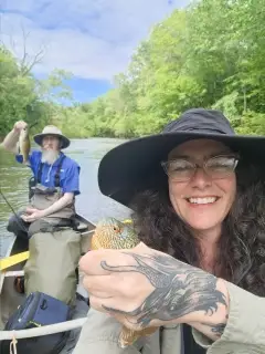
uploaded by: papafish

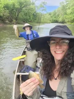
uploaded by: papafish

uploaded by: jennifer baldwin

uploaded by: jennifer baldwin

uploaded by: jennifer baldwin

uploaded by: tajiran

uploaded by: Joey Piercefield

uploaded by: Joey Piercefield

uploaded by: Joey Piercefield

uploaded by: Joey Piercefield
Best Fishing Spots in the greater Dividing Creek area
Beaches and Bays are ideal places for land-based fishing. If the beach is shallow and the water is clear then twilight times are usually the best times, especially when they coincide with a major or minor fishing time. Often the points on either side of a beach are the best spots. Or if the beach is large then look for irregularities in the breaking waves, indicating sandbanks and holes. We found 5 beaches and bays in this area.
Fortescue Beach - 7km , Bay Ponds - 9km , Thompsons Beach - 13km , Bay Point - 13km , Moores Beach - 16km
Harbours and Marinas can often times be productive fishing spots for land based fishing as their sheltered environment attracts a wide variety of bait fish. Similar to river mouths, harbour entrances are also great places to fish as lots of fish will move in and out with the rising and falling tides. There are 1 main harbours in this area.
Newport Neck - 8km
We found a total of 87 potential fishing spots nearby Dividing Creek. Below you can find them organized on a map. Points, Headlands, Reefs, Islands, Channels, etc can all be productive fishing spots. As these are user submitted spots, there might be some errors in the exact location. You also need to cross check local fishing regulations. Some of the spots might be in or around marine reserves or other locations that cannot be fished. If you click on a location marker it will bring up some details and a quick link to google search, satellite maps and fishing times. Tip: Click/Tap on a new area to load more fishing spots.
Turkey Point - 3km , Toms Bridge - 3km , Island Ditch - 4km , Johnsons Ditch - 4km , Wave Creek - 5km , Indian Creek - 5km , Iron Point - 5km , Lone Tree Creek - 5km , Sheepkill Pond - 5km , Wallens Pond - 5km , Round Pond - 6km , McCormick Pond - 6km , Courtney Ponds - 6km , Fortescue Neck - 6km , Fortescue Island (historical) - 6km , Shaws Mill Pond Dam - 7km , Kenny Point - 7km , The Three Mouths - 7km , Indian Ditch - 7km , Wilmas Pond - 7km , Fortescue Creek - 7km , Fortescue Beach - 7km , Elder Gut - 7km , East Branch Pond - 7km , Bradford Point - 7km , Cranberry Gut - 7km , Widgeon Ponds - 8km , Boiler Creek - 8km , Beadon Cove - 8km , Beadon Point - 8km , King Pond - 8km , Elder Point - 8km , Newport Neck - 8km , Fowler Island - 8km , Maurice River Cove - 9km , Hay Gut - 9km , Laurel Lake - 9km , Blackbird Gut - 9km , Lores Island - 9km , Beaver Dam - 9km , Dyer Cove - 9km , Bay Ponds - 9km , Maurice River Neck - 10km , Laurel Lake Dam - 10km , Nancy Gut - 10km , Andrews Ditch - 10km , East Point - 10km , False Egg Island Point - 10km , Cedar Lake Dam - 11km , Jones Island - 11km , Blizzard Neck Gut - 11km , Egg Island Point - 11km , Egg Island (historical) - 11km , Grandad Gut - 11km , Lopers Gut - 11km , Lummis Lake Lower Dam - 11km , Eagle Island Gut - 12km , Nantuxent Point - 12km , Money Island - 12km , Thompsons Beach - 13km , Bay Point - 13km , Nantuxent Cove - 14km , Sayres Neck - 14km , Riggin Ditch - 14km , Rattlesnake Gut - 14km , Tarpon Gut - 15km , Tarpon Cove - 15km , Silver Lake - 15km , Union Lake Dam - 15km , Sayres Point - 15km , Pier Point Neck - 16km , Back Creek Point - 16km , Ben Davis Island (historical) - 16km , Clarks Pond Dam - 16km , Hoffmans Mill Dam - 16km , Moores Beach - 16km , Hankins Pond Dam - 16km , Ben Davis Point - 16km , Drum Bed - 17km , Hands Mill Pond Dam - 17km , Cabin Island - 18km , Back Neck - 18km , Cumberland Pond Dam - 18km , Stipson Island - 18km , Dutch Neck - 18km , Victory Lakes Dam Number One - 20km , East Lake Dam - 20km
Comments