Holyoke 🇺🇸
-
Nautical Twilight begins:04:56 amSunrise:06:00 am
-
Sunset:07:48 pmNautical Twilight ends:08:53 pm
-
Moonrise:12:28 am
-
Moonset:05:03 pm
-
Moon over:08:45 am
-
Moon under:09:17 pm
-
Visibility:23%
-
 Waning Crescent
-
Distance to earth:368,316 kmProximity:87.8 %
Moon Phases for Holyoke
-
good Day
-
major Time:07:45 am - 09:45 am
-
minor Time:04:03 pm - 06:03 pm
-
major Time:08:17 pm - 10:17 pm
-
minor Time:11:28 pm - 01:28 am
Tide Clock
Tide Graph
Times
| Tide | Time | Height |
|---|---|---|
| low | 06:50 am | 0.23 ft |
| high | 11:16 am | 1.67 ft |
| low | 06:45 pm | 0.43 ft |
| high | 11:39 pm | 2.43 ft |
| Date | Major Bite Times | Minor Bite Times | Sun | Moon | Moonphase | Tide Times |
|---|---|---|---|---|---|---|
|
Mon, 18 Aug
|
07:45 am -
09:45 am
08:17 pm -
10:17 pm
|
04:03 pm -
06:03 pm
11:28 pm -
01:28 am
|
R: 06:00 am S: 07:48 pm |
R: 12:28 am S: 05:03 pm |
Waning Crescent |
low: 06:50 am
, 0.23 ft
high: 11:16 am
, 1.67 ft
, Coeff: 66
low: 06:45 pm
, 0.43 ft
high: 11:39 pm
, 2.43 ft
, Coeff: 131
|
|
Tue, 19 Aug
|
08:43 am -
10:43 am
09:18 pm -
11:18 pm
|
12:31 am -
02:31 am
04:56 pm -
06:56 pm
|
R: 06:01 am S: 07:47 pm |
R: 01:31 am S: 05:56 pm |
Waning Crescent |
low: 07:49 am
, 0.2 ft
high: 12:21 pm
, 1.71 ft
, Coeff: 69
low: 07:46 pm
, 0.36 ft
|
|
Wed, 20 Aug
|
09:39 am -
11:39 am
10:17 pm -
12:17 am
|
01:41 am -
03:41 am
05:38 pm -
07:38 pm
|
R: 06:02 am S: 07:45 pm |
R: 02:41 am S: 06:38 pm |
Waning Crescent |
high: 12:41 am
, 2.43 ft
, Coeff: 131
low: 08:44 am
, 0.16 ft
high: 01:20 pm
, 1.8 ft
, Coeff: 77
low: 08:44 pm
, 0.3 ft
|
|
Thu, 21 Aug
|
10:33 am -
12:33 pm
11:10 pm -
01:10 am
|
02:56 am -
04:56 am
06:11 pm -
08:11 pm
|
R: 06:03 am S: 07:44 pm |
R: 03:56 am S: 07:11 pm |
New Moon |
high: 01:37 am
, 2.43 ft
, Coeff: 131
low: 09:34 am
, 0.13 ft
high: 02:11 pm
, 1.94 ft
, Coeff: 89
low: 09:38 pm
, 0.23 ft
|
|
Fri, 22 Aug
|
11:23 am -
01:23 pm
10:48 pm -
12:48 am
|
04:10 am -
06:10 am
06:37 pm -
08:37 pm
|
R: 06:04 am S: 07:42 pm |
R: 05:10 am S: 07:37 pm |
New Moon |
high: 02:28 am
, 2.43 ft
, Coeff: 131
low: 10:19 am
, 0.13 ft
high: 02:57 pm
, 2.03 ft
, Coeff: 97
low: 10:29 pm
, 0.16 ft
|
|
Sat, 23 Aug
|
12:09 pm -
02:09 pm
11:35 pm -
01:35 am
|
05:20 am -
07:20 am
06:58 pm -
08:58 pm
|
R: 06:06 am S: 07:40 pm |
R: 06:20 am S: 07:58 pm |
New Moon |
high: 03:15 am
, 2.36 ft
, Coeff: 126
low: 11:02 am
, 0.13 ft
high: 03:39 pm
, 2.13 ft
, Coeff: 106
low: 11:17 pm
, 0.16 ft
|
|
Sun, 24 Aug
|
12:20 am -
02:20 am
12:52 pm -
02:52 pm
|
06:28 am -
08:28 am
07:17 pm -
09:17 pm
|
R: 06:07 am S: 07:39 pm |
R: 07:28 am S: 08:17 pm |
New Moon |
high: 03:58 am
, 2.3 ft
, Coeff: 120
low: 11:44 am
, 0.16 ft
high: 04:21 pm
, 2.2 ft
, Coeff: 111
|


uploaded by: todd douglas

uploaded by: primerone
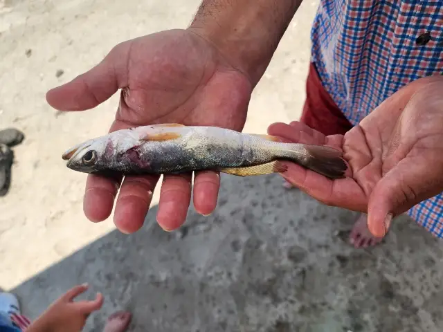
uploaded by: Ryan Frazier

uploaded by: Hoza

uploaded by: Alan Baker

uploaded by: Granpa C

uploaded by: Asaad S Shalbi

uploaded by: Hoza

uploaded by: Hoza

uploaded by: Eric Dixon_1
Kholiok,Kholiouk,Kholjok,huo li ao ke,hwlywk, masachwst,Холиок,Холиоук,Холјок,هولیوک، ماساچوست,霍利奥克
Best Fishing Spots in the greater Holyoke area
Beaches and Bays are ideal places for land-based fishing. If the beach is shallow and the water is clear then twilight times are usually the best times, especially when they coincide with a major or minor fishing time. Often the points on either side of a beach are the best spots. Or if the beach is large then look for irregularities in the breaking waves, indicating sandbanks and holes. We found 1 beaches and bays in this area.
Hillside Beach Dam - 3km
We found a total of 98 potential fishing spots nearby Holyoke. Below you can find them organized on a map. Points, Headlands, Reefs, Islands, Channels, etc can all be productive fishing spots. As these are user submitted spots, there might be some errors in the exact location. You also need to cross check local fishing regulations. Some of the spots might be in or around marine reserves or other locations that cannot be fished. If you click on a location marker it will bring up some details and a quick link to google search, satellite maps and fishing times. Tip: Click/Tap on a new area to load more fishing spots.
First Level Canal - 1km , Holyoke Dam - 1km , Second Level Canal - 1km , Third Level Canal - 1km , South Hadley Canal - 2km , Hillside Beach Dam - 3km , Mountain Lake Dam - 3km , Clear Pond Dam - 4km , Clear Pond West Dike - 4km , Whiting Street Pond Dam - 4km , Wright Pond - 4km , High Service Reservoir - 5km , Leaping Well Reservoir Dam - 5km , McLean Reservoir Dam - 5km , Taylor Pond - 5km , Ashley Pond Dam - 6km , Chicopee Falls Dam - 6km , Chicopee Reservoir Dam - 6km , Dwight Dam - 6km , Marcalus Manufacturing Company Dam - 6km , Hampton Ponds - 7km , Horse Pond Dam - 7km , Lake Bray Dam - 7km , Lower Bemis Pond Dam - 7km , Lower Pond - 7km , Mount Holyoke College Lower Pond Dam - 7km , Mount Holyoke College Upper Dam - 7km , Pequot Pond - 7km , Robinson Bridge - 7km , Snake Pond - 7km , Upper Bemis Pond Dam - 7km , Buck Pond - 8km , Chapin Pond Dam - 8km , Doe Pond - 8km , Hogan Ponds - 8km , Long Pond - 8km , Lyman Mill Pond Dam - 8km , Nashawannuck Pond Dam - 8km , Round Pond - 8km , Wade Pond Dam - 8km , Bircham Bend Ponds - 9km , Hulberts Pond - 9km , Lower Millpond Dam - 9km , Manhan River Dam - 9km , Russell Cove - 9km , Springfield Country Club Dam - 9km , Van Horn Park Lower Dam - 9km , Van Horn Park Upper Dam - 9km , Bearhole Reservoir Dam - 10km , Danks Pond - 10km , Harris Pond Dam - 10km , Indian Orchard Dam - 10km , Mill River Diversion - 10km , Mona Lake - 10km , Monsanto Company Upper Dam - 10km , The Oxbow - 10km , Quenneville Dam - 10km , Aldrich Lake Dam - 11km , Fivemile Pond - 11km , Gamache Pond - 11km , Lithia Springs Reservoir Dam - 11km , Lake Lorraine - 11km , Murphy Pond - 11km , Nash Hill Reservoir Dam - 11km , North End Bridge - 11km , Second Pond - 11km , Alder Pond Dam - 12km , Arm Brook Dam - 12km , Breckwood Lake Dam - 12km , Dimmock Pond - 12km , Haviland Pond - 12km , Lake Lookout Dam - 12km , Loon Pond - 12km , Lyons Pond - 12km , Memorial Bridge - 12km , Mill River Dam - 12km , Noonan Cove - 12km , Pickerel Pond - 12km , Putnams Puddle Dam - 12km , Rocky Hill Pond Dam - 12km , Strathmore Paper Company Dam - 12km , Western Mass Electric Dam - 12km , Wood Pond - 12km , Big Island - 13km , Dan Baker Cove - 13km , Island Pond - 13km , Martensen Cove - 13km , Paradise Pond Dam - 13km , Parker Reservoir Dam - 13km , Pease Cove - 13km , Powdermill Brook Dam - 13km , Shepherd Island - 13km , Sylvan Cove - 13km , Tighe Carmody Reservoir Dam - 13km , Venture Pond - 13km , Watershops Pond Dam - 13km , Bass Pond - 14km , Chopin Pond - 14km
Comments