


Malden 🇺🇸
-
Nautical Twilight begins:05:03 amSunrise:06:05 am
-
Sunset:07:25 pmNautical Twilight ends:08:27 pm
-
Moonrise:12:41 pm
-
Moonset:09:57 pm
-
Moon over:05:19 pm
-
Moon under:04:46 am
-
Visibility:35%
-
 First Quarter Moon
-
Distance to earth:405,494 kmProximity:0.5 %
Moon Phases for Malden
-
average Day
-
major Time:03:46 am - 05:46 am
-
minor Time:11:41 am - 01:41 pm
-
major Time:04:19 pm - 06:19 pm
-
minor Time:08:57 pm - 10:57 pm
Tide Clock
Tide Graph
Times
| Tide | Time | Height |
|---|---|---|
| high | 03:55 am | 8.89 ft |
| low | 09:58 am | 1.51 ft |
| high | 04:10 pm | 9.42 ft |
| low | 10:31 pm | 1.28 ft |
| Date | Major Bite Times | Minor Bite Times | Sun | Moon | Moonphase | Tide Times |
|---|---|---|---|---|---|---|
|
Fri, 29 Aug
|
03:46 am -
05:46 am
04:19 pm -
06:19 pm
|
11:41 am -
01:41 pm
08:57 pm -
10:57 pm
|
R: 06:05 am S: 07:25 pm |
R: 12:41 pm S: 09:57 pm |
First Quarter Moon |
high: 03:55 am
, 8.89 ft
, Coeff: 88
low: 09:58 am
, 1.51 ft
high: 04:10 pm
, 9.42 ft
, Coeff: 98
low: 10:31 pm
, 1.28 ft
|
|
Sat, 30 Aug
|
04:37 am -
06:37 am
05:08 pm -
07:08 pm
|
12:46 pm -
02:46 pm
09:30 pm -
11:30 pm
|
R: 06:06 am S: 07:23 pm |
R: 01:46 pm S: 10:30 pm |
First Quarter Moon |
high: 04:43 am
, 8.43 ft
, Coeff: 80
low: 10:43 am
, 1.9 ft
high: 04:57 pm
, 9.19 ft
, Coeff: 94
low: 11:23 pm
, 1.54 ft
|
|
Sun, 31 Aug
|
05:31 am -
07:31 am
06:00 pm -
08:00 pm
|
01:48 pm -
03:48 pm
10:12 pm -
12:12 am
|
R: 06:07 am S: 07:21 pm |
R: 02:48 pm S: 11:12 pm |
First Quarter Moon |
high: 05:35 am
, 8.07 ft
, Coeff: 73
low: 11:33 am
, 2.23 ft
high: 05:48 pm
, 9.02 ft
, Coeff: 91
|
|
Mon, 01 Sep
|
06:29 am -
08:29 am
06:54 pm -
08:54 pm
|
02:46 pm -
04:46 pm
11:03 pm -
01:03 am
|
R: 06:09 am S: 07:20 pm |
R: 03:46 pm S: - |
First Quarter Moon |
low: 12:18 am
, 1.71 ft
high: 06:32 am
, 7.84 ft
, Coeff: 68
low: 12:28 pm
, 2.36 ft
high: 06:44 pm
, 8.99 ft
, Coeff: 90
|
|
Tue, 02 Sep
|
07:19 am -
09:19 am
07:41 pm -
09:41 pm
|
03:36 pm -
05:36 pm
11:03 pm -
01:03 am
|
R: 06:10 am S: 07:18 pm |
R: 04:36 pm S: 12:03 am |
Waxing Gibbous |
low: 01:16 am
, 1.71 ft
high: 07:30 am
, 7.81 ft
, Coeff: 68
low: 01:25 pm
, 2.33 ft
high: 07:41 pm
, 9.15 ft
, Coeff: 93
|
|
Wed, 03 Sep
|
08:11 am -
10:11 am
08:29 pm -
10:29 pm
|
12:04 am -
02:04 am
04:19 pm -
06:19 pm
|
R: 06:11 am S: 07:16 pm |
R: 05:19 pm S: 01:04 am |
Waxing Gibbous |
low: 02:13 am
, 1.51 ft
high: 08:27 am
, 8.01 ft
, Coeff: 72
low: 02:21 pm
, 2.1 ft
high: 08:37 pm
, 9.45 ft
, Coeff: 99
|
|
Thu, 04 Sep
|
09:03 am -
11:03 am
09:17 pm -
11:17 pm
|
01:12 am -
03:12 am
04:54 pm -
06:54 pm
|
R: 06:12 am S: 07:15 pm |
R: 05:54 pm S: 02:12 am |
Waxing Gibbous |
low: 03:06 am
, 1.12 ft
high: 09:20 am
, 8.4 ft
, Coeff: 79
low: 03:14 pm
, 1.67 ft
high: 09:29 pm
, 9.88 ft
, Coeff: 107
|


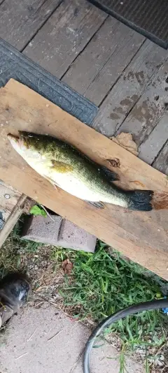
uploaded by: Charlie Pifer

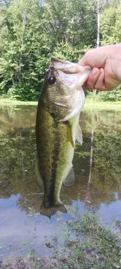
uploaded by: Charlie Pifer

uploaded by: Charlie Pifer

uploaded by: Charlie Pifer

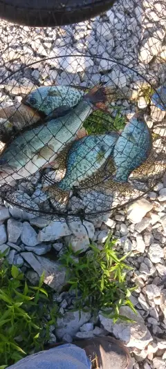
uploaded by: JhunB

uploaded by: JhunB

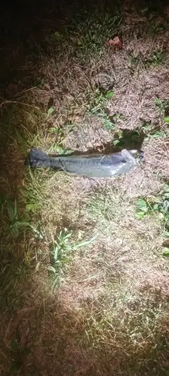
uploaded by: biggreg408

uploaded by: Blackmagic2

uploaded by: bandedwd

uploaded by: Rex_Ursus
Maldehn,Maldeno,Molden,mldn, masachwst,moldeun,Малдэн,Молден,ملدن، ماساچوست,몰든
Best Fishing Spots in the greater Malden area
Wharf's or Jetties are good places to wet a line and meet other fishermen. They often produce a fresh feed of fish and are also great to catch bait fish. As they are often well lit, they also provide a good opportunity for night fishing. There are 26 wharf(s) in this area.
Mystic Wharf - 5km , Tapleys Wharf (historical) - 6km , Constitution Wharf - 6km , Commercial Wharf (historical) - 6km , Grays Wharf (historical) - 6km , Browns Wharf (historical) - 6km , Residence Inn by Marriott Boston Harbor on Tudor Wharf - 6km , Sargents Wharf - 7km , Lewis Wharf - 7km , Boston Marriott Long Wharf - 7km , Exchange Wharf (historical) - 7km , Lewis Wharf (historical) - 7km , Lincoln Wharf - 7km , Rhodes Wharf (historical) - 7km , Battery Wharf - 7km , Union Wharf - 7km , Long Wharf - 7km , Commercial Wharf - 7km , Hancocks Wharf (historical) - 7km , Scarlets Wharf (historical) - 7km , Central Wharf - 7km , Davis Wharf (historical) - 8km , Liverpool Wharf (historical) - 8km , Griffins Wharf (historical) - 8km , Museum Wharf - 8km , India Wharf - 8km
Beaches and Bays are ideal places for land-based fishing. If the beach is shallow and the water is clear then twilight times are usually the best times, especially when they coincide with a major or minor fishing time. Often the points on either side of a beach are the best spots. Or if the beach is large then look for irregularities in the breaking waves, indicating sandbanks and holes. We found 3 beaches and bays in this area.
Orient Heights Beach - 6km , Revere Beach - 7km , Short Beach - 8km
We found a total of 98 potential fishing spots nearby Malden. Below you can find them organized on a map. Points, Headlands, Reefs, Islands, Channels, etc can all be productive fishing spots. As these are user submitted spots, there might be some errors in the exact location. You also need to cross check local fishing regulations. Some of the spots might be in or around marine reserves or other locations that cannot be fished. If you click on a location marker it will bring up some details and a quick link to google search, satellite maps and fishing times. Tip: Click/Tap on a new area to load more fishing spots.
Fellsmere Pond - 2km , Medford Pipe Bridge (historical) - 3km , Fells Reservoir North Dike - 3km , Fells Reservoir Middle Dike - 3km , Amelia Earhart Dam - 3km , Swains Pond - 3km , Towners Pond - 3km , Bellevue Pond - 3km , Quarter Mile Pond - 3km , Ell Pond - 4km , Long Pond - 4km , Wrights Pond Dam - 4km , Island End River - 4km , Spot Pond - 4km , South Reservoir East Dike - 4km , Maiden Bridge - 4km , Great Island - 4km , Stevens Pond - 5km , Mystic Wharf - 5km , Mystic River Bridge - 5km , Doleful Pond - 5km , Middle Reservoir Dike - 5km , Dark Hollow Pond - 5km , South Reservoir Dam - 5km , Chelsea River - 5km , Buckman Pond - 5km , M J Tobin Memorial Bridge - 5km , South Reservoir West Dike - 5km , Chelsea Bridge - 6km , Lechmere Canal - 6km , Dike Pond - 6km , Tapleys Wharf (historical) - 6km , Spring Pond - 6km , Constitution Wharf - 6km , Commercial Wharf (historical) - 6km , Mill Pond - 6km , New Charles River Dam - 6km , Grays Wharf (historical) - 6km , Charles River Dam - 6km , Charles River Bridge (historical) - 6km , Millers River Basin - 6km , Warren Bridge (historical) - 6km , Canal Bridge (historical) - 6km , Griswold Pond Dam - 6km , Browns Wharf (historical) - 6km , Prison Point Bridge (historical) - 6km , Orient Heights Beach - 6km , Residence Inn by Marriott Boston Harbor on Tudor Wharf - 6km , Leverett Circle Connector Bridge - 6km , Leonard P Zakim Bunker Hill Bridge - 6km , Bartons Point (historical) - 6km , North Reservoir Dam - 6km , Broad Canal - 7km , Sargents Wharf - 7km , Mystic Lakes - 7km , Judkins Pond - 7km , Lewis Wharf - 7km , Aberjona Pond - 7km , Boston Marriott Long Wharf - 7km , Exchange Wharf (historical) - 7km , Lewis Wharf (historical) - 7km , Hudsons Point (historical) - 7km , Scotts Pond - 7km , Lincoln Wharf - 7km , John Leo Silver Lake Dam - 7km , Rhodes Wharf (historical) - 7km , Battery Wharf - 7km , Jerrys Pond - 7km , Union Wharf - 7km , Revere Beach - 7km , Upper Mystic Lake Dam - 7km , Long Wharf - 7km , Longfellow Bridge - 7km , Commercial Wharf - 7km , Hancocks Wharf (historical) - 7km , Island of North Boston (historical) - 7km , Scarlets Wharf (historical) - 7km , Lower Pond - 7km , Wedge Pond Dam - 7km , Prankers Pond - 7km , Lower Mystic Lake - 7km , Central Wharf - 7km , Boston Neck - 8km , Frog Pond - 8km , Davis Wharf (historical) - 8km , John A W Pearce Lake Dam - 8km , Liverpool Wharf (historical) - 8km , Northern Avenue Bridge - 8km , River Street Bridge - 8km , Spy Pond - 8km , Little Pond - 8km , Little Fresh Pond - 8km , Short Beach - 8km , Western Avenue Bridge - 8km , Griffins Wharf (historical) - 8km , Eliot Bridge - 8km , Museum Wharf - 8km , India Wharf - 8km
Comments