

Narragansett 🇺🇸
-
Nautical Twilight begins:05:17 amSunrise:06:17 am
-
Sunset:07:10 pmNautical Twilight ends:08:10 pm
-
Moonrise:07:11 pm
-
Moonset:05:58 am
-
Moon over:12:22 am
-
Moon under:12:34 pm
-
Visibility:100%
-
 Full Moon
-
Distance to earth:374,193 kmProximity:74 %
Moon Phases for Narragansett
-
poor Day
-
minor Time:
 04:58 am -
06:58 am
04:58 am -
06:58 am
-
major Time:11:34 am - 01:34 pm
-
minor Time:
06:11 pm -
08:11 pm
-
major Time:11:22 pm - 01:22 am
Tide Clock
Tide Graph
Times
| Tide | Time | Height |
|---|---|---|
| low | 01:38 am | -0.16 ft |
| high | 07:51 am | 3.87 ft |
| low | 01:55 pm | -0.23 ft |
| high | 08:11 pm | 4.04 ft |
| Date | Major Bite Times | Minor Bite Times | Sun | Moon | Moonphase | Tide Times |
|---|---|---|---|---|---|---|
|
Sun, 07 Sep
|
11:34 am -
01:34 pm
11:22 pm -
01:22 am
|
04:58 am -
06:58 am
06:11 pm -
08:11 pm
|
R: 06:17 am S: 07:10 pm |
R: 07:11 pm S: 05:58 am |
Full Moon |
low: 01:38 am
, -0.16 ft
high: 07:51 am
, 3.87 ft
, Coeff: 161
low: 01:55 pm
, -0.23 ft
high: 08:11 pm
, 4.04 ft
, Coeff: 171
|
|
Mon, 08 Sep
|
12:11 am -
02:11 am
12:23 pm -
02:23 pm
|
06:12 am -
08:12 am
06:34 pm -
08:34 pm
|
R: 06:18 am S: 07:08 pm |
R: 07:34 pm S: 07:12 am |
Full Moon |
low: 02:18 am
, -0.36 ft
high: 08:34 am
, 4.1 ft
, Coeff: 175
low: 02:41 pm
, -0.39 ft
high: 08:55 pm
, 4 ft
, Coeff: 169
|
|
Tue, 09 Sep
|
12:58 am -
02:58 am
01:12 pm -
03:12 pm
|
07:28 am -
09:28 am
06:57 pm -
08:57 pm
|
R: 06:19 am S: 07:07 pm |
R: 07:57 pm S: 08:28 am |
Waning Gibbous |
low: 02:58 am
, -0.46 ft
high: 09:19 am
, 4.27 ft
, Coeff: 185
low: 03:28 pm
, -0.43 ft
high: 09:40 pm
, 3.9 ft
, Coeff: 163
|
|
Wed, 10 Sep
|
01:49 am -
03:49 am
02:05 pm -
04:05 pm
|
08:46 am -
10:46 am
07:24 pm -
09:24 pm
|
R: 06:20 am S: 07:05 pm |
R: 08:24 pm S: 09:46 am |
Waning Gibbous |
low: 03:39 am
, -0.49 ft
high: 10:05 am
, 4.3 ft
, Coeff: 187
low: 04:15 pm
, -0.33 ft
high: 10:27 pm
, 3.67 ft
, Coeff: 149
|
|
Thu, 11 Sep
|
02:40 am -
04:40 am
03:00 pm -
05:00 pm
|
10:05 am -
12:05 pm
07:55 pm -
09:55 pm
|
R: 06:21 am S: 07:03 pm |
R: 08:55 pm S: 11:05 am |
Waning Gibbous |
low: 04:23 am
, -0.39 ft
high: 10:55 am
, 4.23 ft
, Coeff: 183
low: 05:05 pm
, -0.13 ft
high: 11:18 pm
, 3.41 ft
, Coeff: 132
|
|
Fri, 12 Sep
|
03:35 am -
05:35 am
03:59 pm -
05:59 pm
|
11:24 am -
01:24 pm
08:34 pm -
10:34 pm
|
R: 06:22 am S: 07:02 pm |
R: 09:34 pm S: 12:24 pm |
Waning Gibbous |
low: 05:09 am
, -0.2 ft
high: 11:49 am
, 4.07 ft
, Coeff: 173
low: 06:01 pm
, 0.13 ft
|
|
Sat, 13 Sep
|
04:31 am -
06:31 am
05:01 pm -
07:01 pm
|
12:41 pm -
02:41 pm
09:22 pm -
11:22 pm
|
R: 06:23 am S: 07:00 pm |
R: 10:22 pm S: 01:41 pm |
Third Quarter Moon |
high: 12:14 am
, 3.15 ft
, Coeff: 116
low: 05:59 am
, 0.03 ft
high: 12:48 pm
, 3.87 ft
, Coeff: 161
low: 07:05 pm
, 0.43 ft
|


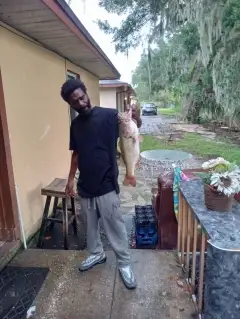
uploaded by: Jon “Kuse”

uploaded by: Elzen Harris

uploaded by: RAMason69

uploaded by: Steven Butcheck

uploaded by: Joey Piercefield

uploaded by: Hoza

uploaded by: John Matthews

uploaded by: JoEllen Disterhaupt

uploaded by: JoEllen Disterhaupt

uploaded by: Charlie Pifer
Best Fishing Spots in the greater Narragansett area
Beaches and Bays are ideal places for land-based fishing. If the beach is shallow and the water is clear then twilight times are usually the best times, especially when they coincide with a major or minor fishing time. Often the points on either side of a beach are the best spots. Or if the beach is large then look for irregularities in the breaking waves, indicating sandbanks and holes. We found 7 beaches and bays in this area.
Dunes Club Beach - 1km , Conochet Club Beach - 1km , Bonnet Shores Beach - 3km , Mackeral Cove Beach - 7km , Scarborough State Beach - 7km , Collins Beach - 7km , Beach Island - 7km
Harbours and Marinas can often times be productive fishing spots for land based fishing as their sheltered environment attracts a wide variety of bait fish. Similar to river mouths, harbour entrances are also great places to fish as lots of fish will move in and out with the rising and falling tides. There are 1 main harbours in this area.
Harbour Island - 6km
We found a total of 97 potential fishing spots nearby Narragansett. Below you can find them organized on a map. Points, Headlands, Reefs, Islands, Channels, etc can all be productive fishing spots. As these are user submitted spots, there might be some errors in the exact location. You also need to cross check local fishing regulations. Some of the spots might be in or around marine reserves or other locations that cannot be fished. If you click on a location marker it will bring up some details and a quick link to google search, satellite maps and fishing times. Tip: Click/Tap on a new area to load more fishing spots.
Sedge Beds Island - 0km , The Narrows - 1km , Pettaquamscutt Cove - 1km , Little Neck - 1km , Gooseberry Island - 1km , Boston Neck - 1km , Dunes Club Beach - 1km , Cormorant Point - 1km , Conochet Club Beach - 1km , Thule Cove - 1km , Little Neck Pond - 2km , River Ledge - 2km , Lake Canonchet - 2km , Bonnet Point - 3km , Bonnet Shores Beach - 3km , Sprague Pond - 3km , Peace Dale Pond Dam - 4km , Pickerel Point - 4km , Stone Water Fence Cove - 4km , Indian Lake Dam - 4km , Indian Lake - 4km , Beavertail Point - 4km , Saugatucket Pond - 4km , Silver Lake - 4km , The Bonnet - 4km , Wesquage Pond - 4km , Long Cove - 5km , Asa Pond - 5km , Rocky Island - 5km , Hull Cove - 5km , Long Bar Point - 5km , Ram Point - 5km , Billington Cove - 5km , Short Point - 5km , Boiling Lot Cove - 5km , Silver Spring Cove - 5km , Upper Pond - 5km , Champlin Cove - 6km , Pine Tree Point - 6km , The Pots - 6km , Harbour Island - 6km , Fox Hill Pond - 6km , Cummock Island - 6km , Congdon Cove - 6km , Toby Point - 6km , Cedar Point - 6km , Wheatfield Cove - 6km , Black Point - 6km , Buttonwood Point - 6km , Spring Cove - 6km , Betty Hull Point - 6km , Bill Island - 6km , Ladd Cove - 6km , Beaver Neck - 6km , Concord Gulf Cove - 7km , Sheffield Cove - 7km , Sassafras Point - 7km , Iron Mine Cove - 7km , Frank Point - 7km , Pork Barrel Island - 7km , Mackerel Cove - 7km , Plato Island - 7km , Smelt Brook Cove - 7km , Southwest Point - 7km , Reel Point - 7km , Horseshoe Point - 7km , Wolcott Cove - 7km , Dutch Island Harbor - 7km , Dutch Island - 7km , Mackeral Cove Beach - 7km , Crown Point - 7km , Gardner Island - 7km , Point Judith Pond - 7km , Beaverhead - 7km , Albro Island - 7km , Scarborough State Beach - 7km , Collins Beach - 7km , Turner Cove - 7km , Cedar Island - 7km , Rye Point - 7km , Locke Point - 7km , Point Judith Neck - 7km , Jonathan Island - 7km , Rum Pond - 7km , Welcome Cove - 7km , Ram Island - 7km , Turner Point - 7km , Beach Island - 7km , Ragged Point - 7km , Casey Point - 8km , Stallion Cove - 8km , Castle Hill Cove - 8km , South Jerry Cove - 8km , Castle Hill - 8km , Graves Point - 8km , Bluff Hill Cove - 8km , Carr Pond Dam - 8km
Comments