


Newington 🇺🇸
-
Nautical Twilight begins:05:34 amSunrise:06:33 am
-
Sunset:06:56 pmNautical Twilight ends:07:55 pm
-
Moonrise:02:59 am
-
Moonset:05:40 pm
-
Moon over:10:19 am
-
Moon under:10:54 pm
-
Visibility:10%
-
 Waning Crescent
-
Distance to earth:383,277 kmProximity:52.6 %
Moon Phases for Newington
-
average Day
-
minor Time:01:59 am - 03:59 am
-
major Time:09:19 am - 11:19 am
-
minor Time:04:40 pm - 06:40 pm
-
major Time:09:54 pm - 11:54 pm
Tide Clock
Tide Graph
Times
| Tide | Time | Height |
|---|---|---|
| high | 12:29 am | 2.3 ft |
| low | 08:28 am | 0.13 ft |
| high | 12:48 pm | 2 ft |
| low | 08:42 pm | 0.2 ft |
| Date | Major Bite Times | Minor Bite Times | Sun | Moon | Moonphase | Tide Times |
|---|---|---|---|---|---|---|
|
Thu, 18 Sep
|
09:19 am -
11:19 am
09:54 pm -
11:54 pm
|
01:59 am -
03:59 am
04:40 pm -
06:40 pm
|
R: 06:33 am S: 06:56 pm |
R: 02:59 am S: 05:40 pm |
Waning Crescent |
high: 12:29 am
, 2.3 ft
, Coeff: 109
low: 08:28 am
, 0.13 ft
high: 12:48 pm
, 2 ft
, Coeff: 85
low: 08:42 pm
, 0.2 ft
|
|
Fri, 19 Sep
|
10:05 am -
12:05 pm
10:39 pm -
12:39 am
|
03:08 am -
05:08 am
05:03 pm -
07:03 pm
|
R: 06:34 am S: 06:55 pm |
R: 04:08 am S: 06:03 pm |
Waning Crescent |
high: 01:17 am
, 2.26 ft
, Coeff: 106
low: 09:16 am
, 0.13 ft
high: 01:33 pm
, 2.1 ft
, Coeff: 93
low: 09:35 pm
, 0.16 ft
|
|
Sat, 20 Sep
|
10:49 am -
12:49 pm
11:21 pm -
01:21 am
|
04:16 am -
06:16 am
05:23 pm -
07:23 pm
|
R: 06:35 am S: 06:53 pm |
R: 05:16 am S: 06:23 pm |
New Moon |
high: 01:59 am
, 2.23 ft
, Coeff: 104
low: 09:59 am
, 0.13 ft
high: 02:14 pm
, 2.23 ft
, Coeff: 104
low: 10:21 pm
, 0.13 ft
|
|
Sun, 21 Sep
|
11:31 am -
01:31 pm
10:59 pm -
12:59 am
|
05:20 am -
07:20 am
05:42 pm -
07:42 pm
|
R: 06:36 am S: 06:51 pm |
R: 06:20 am S: 06:42 pm |
New Moon |
high: 02:39 am
, 2.17 ft
, Coeff: 98
low: 10:39 am
, 0.13 ft
high: 02:55 pm
, 2.3 ft
, Coeff: 109
low: 11:05 pm
, 0.13 ft
|
|
Mon, 22 Sep
|
12:12 pm -
02:12 pm
11:41 pm -
01:41 am
|
06:24 am -
08:24 am
06:00 pm -
08:00 pm
|
R: 06:37 am S: 06:49 pm |
R: 07:24 am S: 07:00 pm |
New Moon |
high: 03:18 am
, 2.1 ft
, Coeff: 93
low: 11:15 am
, 0.16 ft
high: 03:34 pm
, 2.36 ft
, Coeff: 115
low: 11:46 pm
, 0.13 ft
|
|
Tue, 23 Sep
|
12:21 am -
02:21 am
12:53 pm -
02:53 pm
|
07:26 am -
09:26 am
06:20 pm -
08:20 pm
|
R: 06:39 am S: 06:48 pm |
R: 08:26 am S: 07:20 pm |
New Moon |
high: 03:58 am
, 2.03 ft
, Coeff: 88
low: 11:50 am
, 0.23 ft
high: 04:15 pm
, 2.4 ft
, Coeff: 117
|
|
Wed, 24 Sep
|
01:04 am -
03:04 am
01:36 pm -
03:36 pm
|
08:30 am -
10:30 am
06:42 pm -
08:42 pm
|
R: 06:40 am S: 06:46 pm |
R: 09:30 am S: 07:42 pm |
Waxing Crescent |
low: 12:26 am
, 0.16 ft
high: 04:40 am
, 1.94 ft
, Coeff: 79
low: 12:25 pm
, 0.3 ft
high: 04:56 pm
, 2.36 ft
, Coeff: 115
|


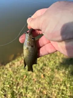
uploaded by: Salim Jamia

uploaded by: rich77

uploaded by: rich77

uploaded by: rich77

uploaded by: Rex_Ursus

uploaded by: bandedwd

uploaded by: Trey Cowan

uploaded by: Trey Cowan

uploaded by: Trey Cowan

uploaded by: Trey Cowan
Nevington,Невингтон
Best Fishing Spots in the greater Newington area
We found a total of 98 potential fishing spots nearby Newington. Below you can find them organized on a map. Points, Headlands, Reefs, Islands, Channels, etc can all be productive fishing spots. As these are user submitted spots, there might be some errors in the exact location. You also need to cross check local fishing regulations. Some of the spots might be in or around marine reserves or other locations that cannot be fished. If you click on a location marker it will bring up some details and a quick link to google search, satellite maps and fishing times. Tip: Click/Tap on a new area to load more fishing spots.
Mill Pond Dam - 1km , Mill Pond - 1km , Lower Pond - 4km , Wood Pond - 5km , Woodridge Lake Dam - 6km , Woodridge Lake - 6km , Wethersfield Cove - 6km , South Reservoir Dike - 6km , Batterson Park Pond - 6km , Batterson Park Pond Dam - 6km , Folly Bridge - 6km , Burnt Hill Reservoir Dam - 6km , William Putnam Memorial Bridge - 7km , South Reservoir Dam - 7km , Beech Swamp Bridge - 7km , Keeney Point - 7km , Hartford Reservoir Number 1 Dam - 7km , Wrights Island (historical) - 8km , Doerrs Pond - 8km , Kensington Dam - 8km , Charter Oak Bridge - 8km , Keeney Cove - 8km , Hartford Reservoir Number 5 Dam - 8km , Hartford Reservoir Number 3 Dam - 8km , Mason Pond - 9km , Bell Pond Dam - 9km , Shuttle Meadow Pond - 9km , Shultz Pond - 9km , Paper Goods Pond Dam - 9km , Loon Lake (historical) - 9km , Hartford Reservoir Number 2 Dam - 9km , Bulkeley Bridge - 9km , Dividend Pond - 9km , Dividend Pond Dam - 9km , Gurney Bridge - 9km , Dyke Pond - 9km , Farmington Reservoir Dam - 9km , Founders Bridge - 9km , Bugbee Reservoir Dam - 10km , Talcott Reservoir Main Dam - 10km , Talcott Dam - 10km , Shuttle Meadow Reservoir Dam - 10km , Sheeps Bridge (historical) - 10km , Sage Pond - 10km , Rams Pond - 10km , Pequabuck Bridge - 10km , Norton Pond - 10km , Kirby Bridge - 10km , Hamlin Pond - 11km , Williams Pond Dam - 11km , Williams Pond - 11km , Talcott Reservoir Diversion Dike - 11km , Swede Pond - 11km , Saw Island - 11km , Rosers Pond - 11km , Potter Pond - 11km , Plainville Reservoir Dam - 11km , Pearson Pond - 11km , New Pond - 11km , Lower Hart Pond Dam - 11km , Great Pond - 11km , Smut Island (historical) - 12km , Upper Hart Pond Dam - 12km , Walton Pond - 12km , Wasel Reservoir Dam - 12km , Welles Pond - 12km , Ely Pond - 12km , Hartford Reservoir 6 South Dam - 12km , Addison Pond Dam - 12km , Gills Pond - 12km , Scotland Road Dam - 13km , Hills Pond - 13km , Kenmere Reservoir Dam - 13km , Hartford Reservoir 6 East Dam - 13km , Brainard Pond - 13km , Lake Erie - 13km , Miner Pond - 13km , Caiglo Pond - 13km , Beaverdam Pond - 13km , Silver Lake Dam - 13km , Silver Lake - 14km , Highland Pond - 14km , Highland Pond Dam - 14km , Hartford Reservoir 6 Southeast Dam - 14km , Cold Springs Dam - 14km , Gildersleeve Island - 14km , Bissell Bridge - 14km , Buckland Pond - 14km , Stones Cove - 14km , Miller Pond - 15km , Treat Pond - 15km , Laurel Lake Dam - 15km , Malones Pond - 15km , Hoe Pond - 15km , Wilcox Pond - 15km , Cold Brook Reservoir Dam - 15km , Wilcox Island - 15km , Laurel Lake - 15km
Comments