

Schicke Point Community 🇺🇸
-
Nautical Twilight begins:05:44 amSunrise:06:38 am
-
Sunset:08:06 pmNautical Twilight ends:09:00 pm
-
Moonrise:03:59 pm
-
Moonset:03:54 am
-
Moon over:10:23 pm
-
Moon under:09:56 am
-
Visibility:79%
-
 Waxing Gibbous
-
Distance to earth:399,714 kmProximity:14 %
Moon Phases for Schicke Point Community
-
poor Day
-
minor Time:02:54 am - 04:54 am
-
major Time:08:56 am - 10:56 am
-
minor Time:02:59 pm - 04:59 pm
-
major Time:09:23 pm - 11:23 pm
Tide Clock
Tide Graph
Times
| Tide | Time | Height |
|---|---|---|
| low | 01:44 am | 0.85 ft |
| high | 05:07 am | 0.89 ft |
| low | 10:59 am | 0.72 ft |
| high | 06:10 pm | 1.15 ft |
| Date | Major Bite Times | Minor Bite Times | Sun | Moon | Moonphase | Tide Times |
|---|---|---|---|---|---|---|
|
Wed, 07 May
|
08:56 am -
10:56 am
09:23 pm -
11:23 pm
|
02:54 am -
04:54 am
02:59 pm -
04:59 pm
|
R: 06:38 am S: 08:06 pm |
R: 03:59 pm S: 03:54 am |
Waxing Gibbous |
low: 01:44 am
, 0.85 ft
high: 05:07 am
, 0.89 ft
, Coeff: 100
low: 10:59 am
, 0.72 ft
high: 06:10 pm
, 1.15 ft
, Coeff: 153
|
|
Thu, 08 May
|
09:36 am -
11:36 am
10:02 pm -
12:02 am
|
03:20 am -
05:20 am
03:52 pm -
05:52 pm
|
R: 06:37 am S: 08:06 pm |
R: 04:52 pm S: 04:20 am |
Waxing Gibbous |
low: 01:25 am
, 0.69 ft
high: 09:05 am
, 0.95 ft
, Coeff: 113
low: 11:19 am
, 0.95 ft
high: 05:22 pm
, 1.15 ft
, Coeff: 153
|
|
Fri, 09 May
|
10:15 am -
12:15 pm
10:42 pm -
12:42 am
|
03:46 am -
05:46 am
04:44 pm -
06:44 pm
|
R: 06:37 am S: 08:07 pm |
R: 05:44 pm S: 04:46 am |
Waxing Gibbous |
low: 01:38 am
, 0.52 ft
high: 04:05 pm
, 1.18 ft
, Coeff: 160
|
|
Sat, 10 May
|
10:55 am -
12:55 pm
11:23 pm -
01:23 am
|
04:14 am -
06:14 am
05:37 pm -
07:37 pm
|
R: 06:36 am S: 08:08 pm |
R: 06:37 pm S: 05:14 am |
Full Moon |
low: 01:55 am
, 0.43 ft
high: 02:40 pm
, 1.25 ft
, Coeff: 173
|
|
Sun, 11 May
|
11:38 am -
01:38 pm
11:10 pm -
01:10 am
|
04:43 am -
06:43 am
06:33 pm -
08:33 pm
|
R: 06:35 am S: 08:08 pm |
R: 07:33 pm S: 05:43 am |
Full Moon |
low: 02:11 am
, 0.36 ft
high: 02:13 pm
, 1.35 ft
, Coeff: 193
|
|
Mon, 12 May
|
12:22 pm -
02:22 pm
11:53 pm -
01:53 am
|
05:16 am -
07:16 am
07:29 pm -
09:29 pm
|
R: 06:35 am S: 08:09 pm |
R: 08:29 pm S: 06:16 am |
Full Moon |
low: 02:25 am
, 0.36 ft
high: 02:40 pm
, 1.38 ft
, Coeff: 200
|
|
Tue, 13 May
|
12:42 am -
02:42 am
01:10 pm -
03:10 pm
|
05:54 am -
07:54 am
08:27 pm -
10:27 pm
|
R: 06:34 am S: 08:09 pm |
R: 09:27 pm S: 06:54 am |
Full Moon |
low: 02:45 am
, 0.33 ft
high: 03:17 pm
, 1.41 ft
, Coeff: 207
|
")


uploaded by: Brad Kleinow

uploaded by: Brad Kleinow

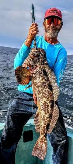
uploaded by: Joey Piercefield

uploaded by: Joey Piercefield

uploaded by: Joey Piercefield

uploaded by: Joey Piercefield

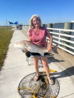
uploaded by: Jeanette Prince

uploaded by: Boojo

uploaded by: jennifer baldwin

uploaded by: jennifer baldwin
Best Fishing Spots in the greater Schicke Point Community area
Beaches and Bays are ideal places for land-based fishing. If the beach is shallow and the water is clear then twilight times are usually the best times, especially when they coincide with a major or minor fishing time. Often the points on either side of a beach are the best spots. Or if the beach is large then look for irregularities in the breaking waves, indicating sandbanks and holes. We found 14 beaches and bays in this area.
Carancahua Bay - 5km , Shell Beach - 6km , Turtle Bay - 9km , Keller Bay - 11km , Palacios Bayou - 14km , Coon Island Bay - 14km , Tres Palacios Bay - 14km , East Bay Yacht Harbor Marina - 16km , Cox Bay - 16km , Matagorda Bay - 17km , LaSalle Bayou - 20km , Hilberts Bayou - 20km , Broad Bayou - 20km , Blind Bayou - 20km
Harbours and Marinas can often times be productive fishing spots for land based fishing as their sheltered environment attracts a wide variety of bait fish. Similar to river mouths, harbour entrances are also great places to fish as lots of fish will move in and out with the rising and falling tides. There are 4 main harbours in this area.
At Last Marina - 1km, Port Alto Boat Shed Marina - 6km, East Bay Yacht Harbor Marina - 16km, Indianola Fishing Center Marina - 19km
We found a total of 51 potential fishing spots nearby Schicke Point Community. Below you can find them organized on a map. Points, Headlands, Reefs, Islands, Channels, etc can all be productive fishing spots. As these are user submitted spots, there might be some errors in the exact location. You also need to cross check local fishing regulations. Some of the spots might be in or around marine reserves or other locations that cannot be fished. If you click on a location marker it will bring up some details and a quick link to google search, satellite maps and fishing times. Tip: Click/Tap on a new area to load more fishing spots.
At Last Marina - 1km , Schicke Point - 1km , Redfish Lake - 4km , Well Point - 5km , Salt Lake - 5km , Carancahua Bay - 5km , Port Alto Boat Shed Marina - 6km , Lund Motte - 6km , Sartwelle Lakes - 6km , Shell Beach - 6km , Turtle Point - 8km , Turtle Bay - 9km , Keller Bay - 11km , Jensen Point - 11km , Coon Island - 12km , Oliver Point - 12km , Rupert Point - 13km , Mud Point - 13km , Hotel Point - 13km , Palacios Bayou - 14km , Palacios Point - 14km , Coon Island Bay - 14km , Tres Palacios Bay - 14km , Sand Point - 15km , East Bay Yacht Harbor Marina - 16km , Cox Point - 16km , Cox Bay - 16km , Rhodes Point - 16km , Dredge Spoil Lake Levee - 17km , Coxs Creek Dam - 17km , Matagorda Bay - 17km , Evaporation Lake Number 1 Levee - 17km , Old Channel - 17km , Grassy Point - 17km , Oyster Lake - 17km , Raw Water Lake Levee - 18km , Clear Lake Levee - 18km , Mud Lake Number 4 Levee - 18km , Evaporation Lake Number 2 Levee - 18km , Evaporation Lake Dam - 18km , Evaporation Lake Number 3 Levee - 18km , Storm Lake Levee - 19km , Indianola Fishing Center Marina - 19km , Rattlesnake Point - 19km , Indian Point - 19km , LaSalle Bayou - 20km , Old Town Lake - 20km , Indianola Island - 20km , Hilberts Bayou - 20km , Broad Bayou - 20km , Blind Bayou - 20km
Comments