


Shell Island 🇺🇸
-
Nautical Twilight begins:05:50 amSunrise:06:44 am
-
Sunset:08:22 pmNautical Twilight ends:09:17 pm
-
Moonrise:12:19 am
-
Moonset:01:20 pm
-
Moon over:06:49 am
-
Moon under:07:07 pm
-
Visibility:54%
-
 Third Quarter Moon
-
Distance to earth:364,664 kmProximity:96.3 %
Moon Phases for Shell Island
-
poor Day
-
major Time:
 05:49 am -
07:49 am
05:49 am -
07:49 am
-
minor Time:12:20 pm - 02:20 pm
-
major Time:06:07 pm - 08:07 pm
-
minor Time:11:19 pm - 01:19 am
Tide Clock
Tide Graph
Times
| Tide | Time | Height |
|---|---|---|
| low | 12:16 am | 0.66 ft |
| high | 06:18 am | 2.36 ft |
| low | 01:11 pm | 0.46 ft |
| high | 06:56 pm | 1.8 ft |
| Date | Major Bite Times | Minor Bite Times | Sun | Moon | Moonphase | Tide Times |
|---|---|---|---|---|---|---|
|
Thu, 17 Jul
|
05:49 am -
07:49 am
06:07 pm -
08:07 pm
|
12:20 pm -
02:20 pm
11:19 pm -
01:19 am
|
R: 06:44 am S: 08:22 pm |
R: 12:19 am S: 01:20 pm |
Third Quarter Moon |
low: 12:16 am
, 0.66 ft
high: 06:18 am
, 2.36 ft
, Coeff: 109
low: 01:11 pm
, 0.46 ft
high: 06:56 pm
, 1.8 ft
, Coeff: 65
|
|
Fri, 18 Jul
|
06:39 am -
08:39 am
06:59 pm -
08:59 pm
|
01:24 pm -
03:24 pm
11:55 pm -
01:55 am
|
R: 06:45 am S: 08:22 pm |
R: 12:55 am S: 02:24 pm |
Third Quarter Moon |
low: 01:05 am
, 0.98 ft
high: 07:04 am
, 2.46 ft
, Coeff: 117
low: 02:24 pm
, 0.23 ft
high: 09:11 pm
, 1.64 ft
, Coeff: 52
|
|
Sat, 19 Jul
|
07:33 am -
09:33 am
07:56 pm -
09:56 pm
|
12:35 am -
02:35 am
02:31 pm -
04:31 pm
|
R: 06:45 am S: 08:21 pm |
R: 01:35 am S: 03:31 pm |
Third Quarter Moon |
low: 02:03 am
, 1.25 ft
high: 07:58 am
, 2.53 ft
, Coeff: 123
low: 03:37 pm
, -0.03 ft
high: 11:26 pm
, 1.71 ft
, Coeff: 57
|
|
Sun, 20 Jul
|
08:30 am -
10:30 am
08:57 pm -
10:57 pm
|
01:20 am -
03:20 am
03:40 pm -
05:40 pm
|
R: 06:46 am S: 08:21 pm |
R: 02:20 am S: 04:40 pm |
Waning Crescent |
low: 03:10 am
, 1.41 ft
high: 09:01 am
, 2.59 ft
, Coeff: 128
low: 04:45 pm
, -0.3 ft
|
|
Mon, 21 Jul
|
09:30 am -
11:30 am
10:00 pm -
12:00 am
|
02:13 am -
04:13 am
04:48 pm -
06:48 pm
|
R: 06:46 am S: 08:20 pm |
R: 03:13 am S: 05:48 pm |
Waning Crescent |
high: 12:39 am
, 1.8 ft
, Coeff: 65
low: 04:20 am
, 1.44 ft
high: 10:10 am
, 2.66 ft
, Coeff: 133
low: 05:47 pm
, -0.49 ft
|
|
Tue, 22 Jul
|
10:32 am -
12:32 pm
11:05 pm -
01:05 am
|
03:13 am -
05:13 am
05:51 pm -
07:51 pm
|
R: 06:47 am S: 08:20 pm |
R: 04:13 am S: 06:51 pm |
Waning Crescent |
high: 01:29 am
, 1.87 ft
, Coeff: 70
low: 05:22 am
, 1.38 ft
high: 11:15 am
, 2.72 ft
, Coeff: 138
low: 06:41 pm
, -0.62 ft
|
|
Wed, 23 Jul
|
11:33 am -
01:33 pm
10:59 pm -
12:59 am
|
04:19 am -
06:19 am
06:47 pm -
08:47 pm
|
R: 06:47 am S: 08:19 pm |
R: 05:19 am S: 07:47 pm |
New Moon |
high: 02:08 am
, 1.9 ft
, Coeff: 73
low: 06:17 am
, 1.28 ft
high: 12:14 pm
, 2.76 ft
, Coeff: 141
low: 07:31 pm
, -0.69 ft
|


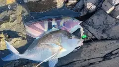
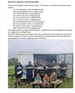
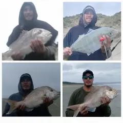
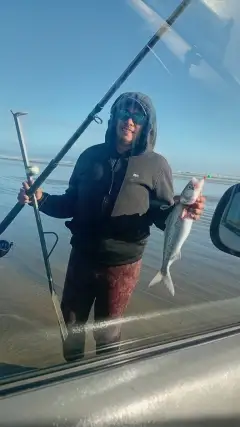
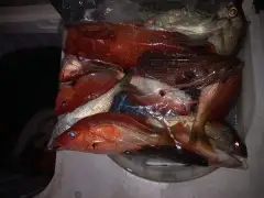
uploaded by: Judge Gyger

uploaded by: Hoza

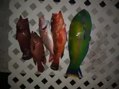
uploaded by: Hoza

uploaded by: Hoza

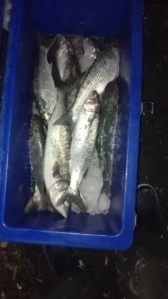
uploaded by: Wayne Robinson_1

uploaded by: Hoza

uploaded by: Wayne Robinson_1

uploaded by: Hoza

uploaded by: JBWalker

uploaded by: primerone
Best Fishing Spots in the greater Shell Island area
Beaches and Bays are ideal places for land-based fishing. If the beach is shallow and the water is clear then twilight times are usually the best times, especially when they coincide with a major or minor fishing time. Often the points on either side of a beach are the best spots. Or if the beach is large then look for irregularities in the breaking waves, indicating sandbanks and holes. We found 34 beaches and bays in this area.
Hall Bay - 1km , Rookery Bay - 1km , Johnson Bay - 2km , Nature Conservancy Bay - 3km , Periwinkle Bay - 5km , Sand Hill Bay - 5km , Tarpon Bay - 5km , Collier Bay - 6km , Marco Bay - 6km , McIlvane Bay - 6km , Shell Bay - 6km , Bartell Bay - 7km , East Marco Bay - 7km , Factory Bay - 7km , One Island Bay - 7km , Smokehouse Bay - 8km , Unknown Bay - 8km , Addison Bay - 9km , Dollar Bay - 9km , Upper Addison Bay - 9km , Marco Beach - 10km , Barfield Bay - 12km , Naples Bay - 12km , Roberts Bay - 12km , Blue Hill Bay - 14km , Caxambas Bay - 14km , Goodland Bay - 14km , Grassy Bay - 15km , Lighter Bay - 15km , Mud Bay - 15km , Palm Bay - 15km , Sugar Bay - 15km , Little Grassy Bay - 16km , Blackwater Bay - 17km
Harbours and Marinas can often times be productive fishing spots for land based fishing as their sheltered environment attracts a wide variety of bait fish. Similar to river mouths, harbour entrances are also great places to fish as lots of fish will move in and out with the rising and falling tides. There are 6 main harbours in this area.
Southpointe Marina - 10km, Gulf Shores Marina - 11km, Harmony Shores Mobile Home Port - 12km, Brookside Marina - 14km, Ole Marina Docks - 14km, Port - O - Call Marina - 14km
We found a total of 100 potential fishing spots nearby Shell Island. Below you can find them organized on a map. Points, Headlands, Reefs, Islands, Channels, etc can all be productive fishing spots. As these are user submitted spots, there might be some errors in the exact location. You also need to cross check local fishing regulations. Some of the spots might be in or around marine reserves or other locations that cannot be fished. If you click on a location marker it will bring up some details and a quick link to google search, satellite maps and fishing times. Tip: Click/Tap on a new area to load more fishing spots.
Shell Island - 0km , Hall Bay - 1km , Rookery Bay - 1km , Henderson Creek - 2km , Johnson Bay - 2km , Cannon Island - 3km , Johnson Snapper Hole - 3km , Little Marco Island - 3km , Munlin Creek - 3km , Munlin Island - 3km , Nature Conservancy Bay - 3km , Umbrella Island - 3km , The Woods - 3km , Bob Everett Point - 4km , The First National - 4km , Halloway Island - 4km , Johnson Island - 4km , Rookery Channel - 4km , Keewaydin Island - 5km , Periwinkle Bay - 5km , Sand Hill Bay - 5km , Sea Oat Island - 5km , Tarpon Bay - 5km , Capri Pass - 6km , Coconut Island - 6km , Collier Bay - 6km , Flotilla Passage - 6km , Marco Bay - 6km , McIlvane Bay - 6km , North Point - 6km , Shell Bay - 6km , Stingaree Island - 6km , Bartell Bay - 7km , Bear Point - 7km , Bear Point Cove - 7km , East Marco Bay - 7km , Factory Bay - 7km , One Island Bay - 7km , South Point - 7km , Three Island Cove - 7km , Albert Island - 8km , Charity Island - 8km , Railroad Islet - 8km , Sanctuary Sound - 8km , Smokehouse Bay - 8km , Unknown Bay - 8km , Addison Bay - 9km , Dollar Bay - 9km , The Muddies - 9km , Upper Addison Bay - 9km , Big Key - 10km , Marco Beach - 10km , Rattlesnake Hammock - 10km , Southpointe Marina - 10km , Big Marco River - 11km , Rookery Island - 11km , Turtle Island - 11km , Gulf Shores Marina - 11km , Alpha Key - 12km , Barfield Bay - 12km , Beta Key - 12km , Naples Bay - 12km , Roberts Bay - 12km , Smokehouse Creek - 12km , Harmony Shores Mobile Home Port - 12km , Crayton Cove - 13km , David Key - 13km , Henry Key - 13km , Pig Key - 13km , Blue Hill Bay - 14km , Blue Hill Creek - 14km , Caxambas Bay - 14km , Currys Island - 14km , Dickmans Island - 14km , Dickmans Point - 14km , Goodland Bay - 14km , Highland Point - 14km , Horrs Island - 14km , Little Tide Key - 14km , Pass Key - 14km , Royal Palm Hammock Creek - 14km , Brookside Marina - 14km , Ole Marina Docks - 14km , Port - O - Call Marina - 14km , Fred Key - 15km , Grassy Bay - 15km , Lighter Bay - 15km , Margaret Key - 15km , Mud Bay - 15km , Palm Bay - 15km , Sugar Bay - 15km , Helen Key - 16km , Kice Island - 16km , Little Grassy Bay - 16km , Neal Key - 16km , Ramsey Key - 16km , Blackwater Bay - 17km , Tripod Key - 17km , Brush Island - 18km , Coon Key - 18km
Comments