Terramar Beach 🇺🇸
-
Nautical Twilight begins:05:31 amSunrise:06:27 am
-
Sunset:08:06 pmNautical Twilight ends:09:02 pm
-
Moonrise:11:14 pm
-
Moonset:08:19 am
-
Moon over:03:26 am
-
Moon under:03:46 pm
-
Visibility:92%
-
 Waning Gibbous
-
Distance to earth:396,714 kmProximity:21.1 %
Moon Phases for Terramar Beach
-
good Day
-
major Time:02:26 am - 04:26 am
-
minor Time:07:19 am - 09:19 am
-
major Time:02:46 pm - 04:46 pm
-
minor Time:10:14 pm - 12:14 am
Tide Clock
Tide Graph
Times
| Tide | Time | Height |
|---|---|---|
| low | 02:26 am | -0.07 ft |
| high | 11:40 am | 1.05 ft |
| Date | Major Bite Times | Minor Bite Times | Sun | Moon | Moonphase | Tide Times |
|---|---|---|---|---|---|---|
|
Thu, 15 May
|
02:26 am -
04:26 am
02:46 pm -
04:46 pm
|
07:19 am -
09:19 am
10:14 pm -
12:14 am
|
R: 06:27 am S: 08:06 pm |
R: 11:14 pm S: 08:19 am |
Waning Gibbous |
low: 02:26 am
, -0.07 ft
high: 11:40 am
, 1.05 ft
, Coeff: 120
|
|
Fri, 16 May
|
03:19 am -
05:19 am
03:39 pm -
05:39 pm
|
08:15 am -
10:15 am
11:03 pm -
01:03 am
|
R: 06:26 am S: 08:07 pm |
R: - S: 09:15 am |
Waning Gibbous |
low: 03:07 am
, -0.07 ft
high: 12:41 pm
, 1.05 ft
, Coeff: 120
|
|
Sat, 17 May
|
04:08 am -
06:08 am
04:30 pm -
06:30 pm
|
09:14 am -
11:14 am
11:03 pm -
01:03 am
|
R: 06:26 am S: 08:08 pm |
R: 12:03 am S: 10:14 am |
Waning Gibbous |
low: 03:52 am
, -0.03 ft
high: 01:39 pm
, 1.02 ft
, Coeff: 114
|
|
Sun, 18 May
|
05:01 am -
07:01 am
05:21 pm -
07:21 pm
|
10:16 am -
12:16 pm
11:47 pm -
01:47 am
|
R: 06:25 am S: 08:08 pm |
R: 12:47 am S: 11:16 am |
Third Quarter Moon |
low: 04:41 am
, -0 ft
high: 02:23 pm
, 1.02 ft
, Coeff: 114
|
|
Mon, 19 May
|
05:52 am -
07:52 am
06:10 pm -
08:10 pm
|
12:27 am -
02:27 am
11:18 am -
01:18 pm
|
R: 06:25 am S: 08:09 pm |
R: 01:27 am S: 12:18 pm |
Third Quarter Moon |
low: 05:35 am
, 0.03 ft
high: 02:51 pm
, 0.98 ft
, Coeff: 107
|
|
Tue, 20 May
|
06:41 am -
08:41 am
06:57 pm -
08:57 pm
|
01:02 am -
03:02 am
12:21 pm -
02:21 pm
|
R: 06:24 am S: 08:09 pm |
R: 02:02 am S: 01:21 pm |
Third Quarter Moon |
low: 06:33 am
, 0.13 ft
high: 03:08 pm
, 0.92 ft
, Coeff: 95
low: 10:10 pm
, 0.66 ft
|
|
Wed, 21 May
|
07:29 am -
09:29 am
07:45 pm -
09:45 pm
|
01:34 am -
03:34 am
01:24 pm -
03:24 pm
|
R: 06:24 am S: 08:10 pm |
R: 02:34 am S: 02:24 pm |
Third Quarter Moon |
high: 12:41 am
, 0.69 ft
, Coeff: 51
low: 07:37 am
, 0.26 ft
high: 03:20 pm
, 0.89 ft
, Coeff: 89
low: 09:30 pm
, 0.49 ft
|
 🎣🚐✨")

")

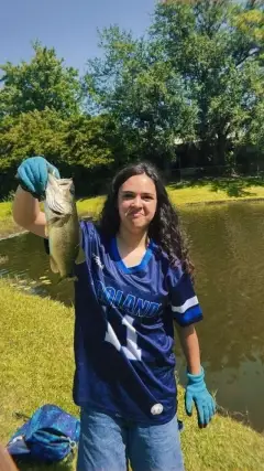
uploaded by: Kayla Smith

uploaded by: papafish

uploaded by: papafish

uploaded by: jennifer baldwin

uploaded by: jennifer baldwin

uploaded by: jennifer baldwin

uploaded by: tajiran

uploaded by: Joey Piercefield

uploaded by: Joey Piercefield

uploaded by: Joey Piercefield
Best Fishing Spots in the greater Terramar Beach area
Beaches and Bays are ideal places for land-based fishing. If the beach is shallow and the water is clear then twilight times are usually the best times, especially when they coincide with a major or minor fishing time. Often the points on either side of a beach are the best spots. Or if the beach is large then look for irregularities in the breaking waves, indicating sandbanks and holes. We found 25 beaches and bays in this area.
Cow Bayou - 7km , Ostermayer Bayou - 8km , Chocolate Bay - 10km , New Bayou Point - 10km , Jamaica Beach - 10km , Wharton Bayou - 11km , Bastrop Bay - 12km , Oyster Lake Bayou - 12km , Butterowe Bayou - 12km , Oak Bayou - 13km , Pirates Beach - 14km , Pirates Beach Marina - 14km , Palm Beach - 14km , Christmas Bay - 15km , Persimmon Bayou - 16km , Eckert Bayou - 16km , Bermuda Beach - 16km , Lost Bay - 16km , West Beach - 17km , Mentzel Bayou - 17km , West Bay - 17km , Gangs Bayou - 19km , Ganas Bayou - 19km , Oxen Bayou - 19km , Highland Bayou Diversion Channel - 20km
Harbours and Marinas can often times be productive fishing spots for land based fishing as their sheltered environment attracts a wide variety of bait fish. Similar to river mouths, harbour entrances are also great places to fish as lots of fish will move in and out with the rising and falling tides. There are 2 main harbours in this area.
Marina at Sea Isle - 2km, Pirates Beach Marina - 14km
We found a total of 74 potential fishing spots nearby Terramar Beach. Below you can find them organized on a map. Points, Headlands, Reefs, Islands, Channels, etc can all be productive fishing spots. As these are user submitted spots, there might be some errors in the exact location. You also need to cross check local fishing regulations. Some of the spots might be in or around marine reserves or other locations that cannot be fished. If you click on a location marker it will bring up some details and a quick link to google search, satellite maps and fishing times. Tip: Click/Tap on a new area to load more fishing spots.
Marina at Sea Isle - 2km , Snake Island - 3km , Snake Island Cove - 4km , Maggies Point - 5km , Maggies Cove - 5km , McAllis Point - 6km , Bird Islands - 6km , Alligator Point - 7km , Shell Island Point - 7km , Shell Island - 7km , Halls Lake - 7km , Cow Bayou - 7km , Cedar Lake - 7km , Bird Island Cove - 7km , Ostermayer Bayou - 8km , Carancahua Point - 9km , San Luis Island - 9km , Bird Island - 9km , Amarada Cut - 9km , Jumbile Cove - 9km , Chocolate Bay - 10km , New Bayou Point - 10km , Mud Island - 10km , Jamaica Beach - 10km , Shell Point - 11km , Oyster Lake - 11km , Mud Cut - 11km , Moodys Island - 11km , Humble Cut - 11km , Carancahua Cove - 11km , Wharton Bayou - 11km , Bastrop Bay - 12km , Oyster Lake Bayou - 12km , Carancahua Lake - 12km , Butterowe Bayou - 12km , Horse Grove Point - 12km , Christmas Point - 13km , Dana Cove - 13km , Alligator Slough - 13km , Grassy Point - 13km , Oak Bayou - 13km , Lake Como - 14km , Pirates Beach - 14km , Pirates Cove - 14km , Pirates Beach Marina - 14km , Dalehite Cove - 14km , Palm Beach - 14km , Hoeckers Point - 14km , Follets Island - 15km , Christmas Bay - 15km , Alligator Lake - 15km , Lost Lake - 16km , Persimmon Bayou - 16km , Starvation Cove - 16km , Eckert Bayou - 16km , Bermuda Beach - 16km , Lost Bay - 16km , West Beach - 17km , Amoco Chemicals Reservoir Levee - 17km , Mentzel Bayou - 17km , Melager Cove - 17km , West Bay - 17km , Greens Lake - 17km , Cox Lake - 18km , Oak Ditch - 18km , Galveston Island - 18km , Gangs Bayou - 19km , Ganas Bayou - 19km , Oxen Bayou - 19km , Rattlesnake Point - 19km , Monsanto Reservoir Levee - 20km , Wolf Lake - 20km , Flamingo Isles - 20km , Highland Bayou Diversion Channel - 20km
Comments