
West Raleigh 🇺🇸
-
Nautical Twilight begins:05:55 amSunrise:06:50 am
-
Sunset:07:35 pmNautical Twilight ends:08:30 pm
-
Moonrise:07:37 pm
-
Moonset:06:33 am
-
Moon over:12:51 am
-
Moon under:01:05 pm
-
Visibility:100%
-
 Full Moon
-
Distance to earth:374,193 kmProximity:74 %
Moon Phases for West Raleigh
-
poor Day
-
minor Time:
 05:33 am -
07:33 am
05:33 am -
07:33 am
-
major Time:12:05 pm - 02:05 pm
-
minor Time:
06:37 pm -
08:37 pm
-
major Time:11:51 pm - 01:51 am
| Date | Major Bite Times | Minor Bite Times | Sun | Moon | Moonphase |
|---|---|---|---|---|---|
|
Sun, 07 Sep
|
12:05 pm -
02:05 pm
11:51 pm -
01:51 am
|
05:33 am -
07:33 am
06:37 pm -
08:37 pm
|
R: 06:50 am S: 07:35 pm |
R: 07:37 pm S: 06:33 am |
Full Moon |
|
Mon, 08 Sep
|
12:39 am -
02:39 am
12:54 pm -
02:54 pm
|
06:44 am -
08:44 am
07:04 pm -
09:04 pm
|
R: 06:51 am S: 07:33 pm |
R: 08:04 pm S: 07:44 am |
Full Moon |
|
Tue, 09 Sep
|
01:27 am -
03:27 am
01:43 pm -
03:43 pm
|
07:54 am -
09:54 am
07:33 pm -
09:33 pm
|
R: 06:52 am S: 07:32 pm |
R: 08:33 pm S: 08:54 am |
Waning Gibbous |
|
Wed, 10 Sep
|
02:16 am -
04:16 am
02:35 pm -
04:35 pm
|
09:06 am -
11:06 am
08:04 pm -
10:04 pm
|
R: 06:53 am S: 07:30 pm |
R: 09:04 pm S: 10:06 am |
Waning Gibbous |
|
Thu, 11 Sep
|
03:10 am -
05:10 am
03:31 pm -
05:31 pm
|
10:21 am -
12:21 pm
08:41 pm -
10:41 pm
|
R: 06:53 am S: 07:29 pm |
R: 09:41 pm S: 11:21 am |
Waning Gibbous |
|
Fri, 12 Sep
|
04:03 am -
06:03 am
04:29 pm -
06:29 pm
|
11:36 am -
01:36 pm
09:23 pm -
11:23 pm
|
R: 06:54 am S: 07:27 pm |
R: 10:23 pm S: 12:36 pm |
Waning Gibbous |
|
Sat, 13 Sep
|
05:12 am -
07:12 am
05:32 pm -
07:32 pm
|
12:49 pm -
02:49 pm
10:15 pm -
12:15 am
|
R: 06:55 am S: 07:26 pm |
R: 11:15 pm S: 01:49 pm |
Third Quarter Moon |


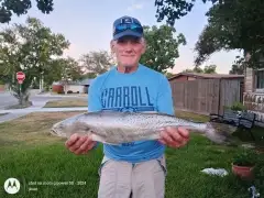
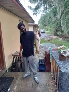
uploaded by: Jon “Kuse”

uploaded by: Elzen Harris

uploaded by: RAMason69

uploaded by: Steven Butcheck

uploaded by: Joey Piercefield

uploaded by: Hoza

uploaded by: John Matthews

uploaded by: JoEllen Disterhaupt

uploaded by: JoEllen Disterhaupt

uploaded by: Charlie Pifer
Best Fishing Spots in the greater West Raleigh area
Beaches and Bays are ideal places for land-based fishing. If the beach is shallow and the water is clear then twilight times are usually the best times, especially when they coincide with a major or minor fishing time. Often the points on either side of a beach are the best spots. Or if the beach is large then look for irregularities in the breaking waves, indicating sandbanks and holes. We found 2 beaches and bays in this area.
Camp Durant Lake Number Two Dam - 14km , Camp Durant Lake Number One Dam - 14km
We found a total of 84 potential fishing spots nearby West Raleigh. Below you can find them organized on a map. Points, Headlands, Reefs, Islands, Channels, etc can all be productive fishing spots. As these are user submitted spots, there might be some errors in the exact location. You also need to cross check local fishing regulations. Some of the spots might be in or around marine reserves or other locations that cannot be fished. If you click on a location marker it will bring up some details and a quick link to google search, satellite maps and fishing times. Tip: Click/Tap on a new area to load more fishing spots.
Lake Johnson Dam - 3km , Lake Raleigh Dam - 3km , Raleigh Municipal Lake Dam - 5km , NCSU Pond Number One Dam - 5km , Longview Dam - 6km , Dover Pond A Dam - 7km , Dix Hill Conf Center Pond Dam - 7km , Woodland Pond Dam - 7km , Dam Number Eleven A Crabtree Creek Watershed - 7km , Timberlake Lower Dam - 7km , Lakemont Dam - 7km , Yates Millpond Dam - 8km , Dam Number Thirteen Crabtree Creek Watershed - 8km , Jones Lake Dam - 8km , NC State University Farm Unit Number Two Dam - 8km , Woodys Lake - 9km , Northshore Lake Dam - 9km , Reedy Creek Lake Dam - 9km , Rothgeb Pond Dam - 9km , Lake Lynn - 10km , Turfgrass Lake Number Two Dam - 10km , Dam Number Twenty-Two B Crabtree Creek Watershed - 10km , Turfgrass Lake Number Three Dam - 10km , Emily Babcock Dam - 10km , Turfgrass Lake Number One Dam - 10km , Carolina Lake Dam - 10km , Foxcroft Lake Dam - 11km , Eagle Crest Golf Course Dam - 11km , Lake Wheeler Dam - 11km , North Ridge Lower Dam - 11km , Lake Anne Dam - 11km , Bridges Lake - 11km , Baker Pond Dam - 11km , Dunnaway Lake Dam - 12km , McGregor Downs Lake Dam - 12km , Milburnie Fish Club Lake Dam - 12km , North Ridge Upper Dam - 12km , Beaverdam Lake Dam - 12km , Penny Pond Dam - 12km , Poole Bridge - 12km , Shaw Lake Dam - 12km , Fuller Pond Dam - 12km , Umstead Park Lake Lower Dam - 12km , Bagwell Pond Dam - 13km , Neuseoca Lake Dam - 13km , Umstead Park Lake Upper Dam - 13km , Upper Springdale Estates Dam - 13km , Lake Crabtree - 13km , Matthews Lake Dam - 13km , Lower Springdale Estates Dam - 13km , Greshams Lake Dam - 13km , Holiday Acres Lake Dam - 13km , Poole Lake Number One Dam - 14km , Hoffman Lake Dam - 14km , Camp Durant Lake Number Two Dam - 14km , Camp Durant Lake Number One Dam - 14km , Crabtree Creek W/S Number Eighteen Dam - 14km , Continental Can Company Lake Dam - 15km , Lake Benson Dam - 15km , Stonebridge Dam - 15km , Apex Lake Dam - 15km , Angus Barn Pond Dam - 15km , Myrick Pond Dam - 16km , Ragsdale Pond Dam - 16km , Kings Pond Dam - 17km , Wake Crossroads Lake Dam - 17km , Hatches Pond Dam - 17km , Crabtree Creek W/S Structure Number One Dam - 18km , Crabtree Creek W/S Structure Number Two Dam - 18km , Battles Bridge (historical) - 18km , Coachmans Trail Dam - 18km , Falls of the Neuse Dam - 19km , Sunset Lake Dam - 19km , Watkins Pond Dam - 19km , Baucoms Bridge - 19km , Poole Lake Dam - 19km , Grey Pond Dam - 19km , Hammonds Pond Dam - 19km , Brown Lake Dam - 19km , Bass Lake Dam - 20km , Slaughter Pond Dam - 20km , Blackley Pond Dam - 20km , Julians Lake Dam - 20km , Wakefield Pond Number One Dam - 20km
Comments