


Port Williams 🇨🇦
-
Nautical Twilight begins:05:55 amSunrise:06:58 am
-
Sunset:07:26 pmNautical Twilight ends:08:29 pm
-
Moonrise:01:58 am
-
Moonset:05:49 pm
-
Moon over:09:53 am
-
Moon under:10:31 pm
-
Visibility:18%
-
 Waning Crescent
-
Distance to earth:378,365 kmProximity:64.2 %
Moon Phases for Port Williams
-
good Day
-
minor Time:12:58 am - 02:58 am
-
major Time:08:53 am - 10:53 am
-
minor Time:04:49 pm - 06:49 pm
-
major Time:09:31 pm - 11:31 pm
Tide Clock
Tide Graph
Times
| Tide | Time | Height |
|---|---|---|
| low | 03:46 am | 7.19 ft |
| high | 09:59 am | 39.44 ft |
| low | 04:14 pm | 8.17 ft |
| high | 10:25 pm | 42.19 ft |
| Date | Major Bite Times | Minor Bite Times | Sun | Moon | Moonphase | Tide Times |
|---|---|---|---|---|---|---|
|
Wed, 17 Sep
|
08:53 am -
10:53 am
09:31 pm -
11:31 pm
|
12:58 am -
02:58 am
04:49 pm -
06:49 pm
|
R: 06:58 am S: 07:26 pm |
R: 01:58 am S: 05:49 pm |
Waning Crescent |
low: 03:46 am
, 7.19 ft
high: 09:59 am
, 39.44 ft
, Coeff: 73
low: 04:14 pm
, 8.17 ft
high: 10:25 pm
, 42.19 ft
, Coeff: 84
|
|
Thu, 18 Sep
|
09:44 am -
11:44 am
10:21 pm -
12:21 am
|
02:14 am -
04:14 am
05:14 pm -
07:14 pm
|
R: 06:59 am S: 07:24 pm |
R: 03:14 am S: 06:14 pm |
Waning Crescent |
low: 04:52 am
, 6.33 ft
high: 11:04 am
, 40.81 ft
, Coeff: 78
low: 05:16 pm
, 6.96 ft
high: 11:26 pm
, 43.47 ft
, Coeff: 89
|
|
Fri, 19 Sep
|
10:30 am -
12:30 pm
11:05 pm -
01:05 am
|
03:27 am -
05:27 am
05:34 pm -
07:34 pm
|
R: 07:00 am S: 07:22 pm |
R: 04:27 am S: 06:34 pm |
Waning Crescent |
low: 05:48 am
, 5.31 ft
high: 11:58 am
, 42.32 ft
, Coeff: 84
low: 06:10 pm
, 5.68 ft
|
|
Sat, 20 Sep
|
11:14 am -
01:14 pm
10:40 pm -
12:40 am
|
04:37 am -
06:37 am
05:51 pm -
07:51 pm
|
R: 07:01 am S: 07:20 pm |
R: 05:37 am S: 06:51 pm |
New Moon |
high: 12:17 am
, 44.59 ft
, Coeff: 93
low: 06:37 am
, 4.49 ft
high: 12:44 pm
, 43.54 ft
, Coeff: 89
low: 06:56 pm
, 4.69 ft
|
|
Sun, 21 Sep
|
11:56 am -
01:56 pm
11:23 pm -
01:23 am
|
05:45 am -
07:45 am
06:08 pm -
08:08 pm
|
R: 07:03 am S: 07:18 pm |
R: 06:45 am S: 07:08 pm |
New Moon |
high: 01:02 am
, 45.21 ft
, Coeff: 95
low: 07:20 am
, 4.1 ft
high: 01:24 pm
, 44.29 ft
, Coeff: 92
low: 07:38 pm
, 4.13 ft
|
|
Mon, 22 Sep
|
12:04 am -
02:04 am
12:37 pm -
02:37 pm
|
06:51 am -
08:51 am
06:24 pm -
08:24 pm
|
R: 07:04 am S: 07:17 pm |
R: 07:51 am S: 07:24 pm |
New Moon |
high: 01:43 am
, 45.24 ft
, Coeff: 95
low: 07:58 am
, 4.23 ft
high: 02:01 pm
, 44.59 ft
, Coeff: 93
low: 08:17 pm
, 4.04 ft
|
|
Tue, 23 Sep
|
12:46 am -
02:46 am
01:19 pm -
03:19 pm
|
07:57 am -
09:57 am
06:41 pm -
08:41 pm
|
R: 07:05 am S: 07:15 pm |
R: 08:57 am S: 07:41 pm |
New Moon |
high: 02:20 am
, 44.82 ft
, Coeff: 94
low: 08:34 am
, 4.72 ft
high: 02:36 pm
, 44.42 ft
, Coeff: 92
low: 08:53 pm
, 4.3 ft
|


uploaded by: Michael Mayse

uploaded by: Michael Mayse

uploaded by: Heathen Monk

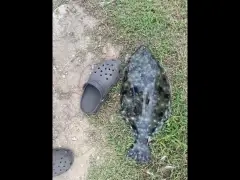
uploaded by: Flounder pounder

uploaded by: Stephen Spencer

uploaded by: Jon “Kuse”

uploaded by: Elzen Harris

uploaded by: RAMason69

uploaded by: Steven Butcheck

uploaded by: Joey Piercefield
Best Fishing Spots in the greater Port Williams area
Beaches and Bays are ideal places for land-based fishing. If the beach is shallow and the water is clear then twilight times are usually the best times, especially when they coincide with a major or minor fishing time. Often the points on either side of a beach are the best spots. Or if the beach is large then look for irregularities in the breaking waves, indicating sandbanks and holes. We found 12 beaches and bays in this area.
Evangeline Beach - 9km , Medford Beach - 11km , Stoney Bar - 13km , Houston Beach - 14km , Bennett Bay - 15km , Blue Beach - 16km , Caroline Beach - 16km , Pineo Beach - 16km , Long Beach - 17km , Eastern Bar - 17km , Lower North Bay - 18km , Upper North Bay - 20km
Harbours and Marinas can often times be productive fishing spots for land based fishing as their sheltered environment attracts a wide variety of bait fish. Similar to river mouths, harbour entrances are also great places to fish as lots of fish will move in and out with the rising and falling tides. There are 2 main harbours in this area.
Porter Point - 6km, Baxters Harbour - 16km
We found a total of 58 potential fishing spots nearby Port Williams. Below you can find them organized on a map. Points, Headlands, Reefs, Islands, Channels, etc can all be productive fishing spots. As these are user submitted spots, there might be some errors in the exact location. You also need to cross check local fishing regulations. Some of the spots might be in or around marine reserves or other locations that cannot be fished. If you click on a location marker it will bring up some details and a quick link to google search, satellite maps and fishing times. Tip: Click/Tap on a new area to load more fishing spots.
Hales Creek - 4km , Starrs Point - 4km , Woodburn Creek - 6km , White Rock Pond - 6km , Habitant Creek - 6km , Porter Point - 6km , Oak Point - 7km , Long Island Head - 8km , Hellgate Pond - 8km , Long Island - 9km , Killams Pond - 9km , Evangeline Beach - 9km , Longspell Point - 9km , Lumsden Pond - 10km , Bass Creek - 10km , Medford Beach - 11km , Second Creek - 11km , Pereaux Creek - 11km , Boot Island - 12km , West Point - 12km , Sunken Lake - 12km , Oak Island - 12km , Paddys Island - 12km , Stoney Bar - 13km , Little Lake - 13km , Wood Lake - 14km , Mill Creek - 14km , Moosehorn Lake - 14km , Silver Lake - 14km , Sheffield Lake - 14km , Houston Beach - 14km , Bennett Bay - 15km , Baxters Harbour - 16km , Black Hole - 16km , Stovepipe Island - 16km , Methals Lake - 16km , Blue Beach - 16km , Caroline Beach - 16km , Davidson Lake - 16km , Pineo Beach - 16km , Race Point - 17km , Tupper Lake - 17km , Blomidon Peninsula - 17km , Sheddley Point - 17km , Ross Creek - 17km , Long Beach - 17km , Eastern Bar - 17km , Little River Lake - 17km , McGee Lake - 17km , McLeod Point - 17km , Lower North Bay - 18km , Moose Island - 18km , Gaspereau Lake - 19km , Black River Lake - 19km , Ells Creek - 20km , Nabs Island - 20km , Upper North Bay - 20km , Trout River Pond - 20km
Comments