

East Machias 🇺🇸
-
Nautical Twilight begins:04:23 amSunrise:05:32 am
-
Sunset:07:35 pmNautical Twilight ends:08:44 pm
-
Moonrise:11:04 pm
-
Moonset:02:32 pm
-
Moon over:06:23 am
-
Moon under:06:48 pm
-
Visibility:45%
-
 Third Quarter Moon
-
Distance to earth:363,881 kmProximity:98.2 %
Moon Phases for East Machias
-
average Day
-
major Time:
 05:23 am -
07:23 am
05:23 am -
07:23 am
-
minor Time:01:32 pm - 03:32 pm
-
major Time:
05:48 pm -
07:48 pm
-
minor Time:10:04 pm - 12:04 am
Tide Clock
Tide Graph
Times
| Tide | Time | Height |
|---|---|---|
| high | 04:43 am | 12.63 ft |
| low | 10:54 am | 0.52 ft |
| high | 05:09 pm | 13.42 ft |
| low | 11:32 pm | 0.2 ft |
| Date | Major Bite Times | Minor Bite Times | Sun | Moon | Moonphase | Tide Times |
|---|---|---|---|---|---|---|
|
Sat, 16 Aug
|
05:23 am -
07:23 am
05:48 pm -
07:48 pm
|
01:32 pm -
03:32 pm
10:04 pm -
12:04 am
|
R: 05:32 am S: 07:35 pm |
R: 11:04 pm S: 02:32 pm |
Third Quarter Moon |
high: 04:43 am
, 12.63 ft
, Coeff: 109
low: 10:54 am
, 0.52 ft
high: 05:09 pm
, 13.42 ft
, Coeff: 120
low: 11:32 pm
, 0.2 ft
|
|
Sun, 17 Aug
|
06:31 am -
08:31 am
06:51 pm -
08:51 pm
|
02:48 pm -
04:48 pm
10:54 pm -
12:54 am
|
R: 05:33 am S: 07:34 pm |
R: 11:54 pm S: 03:48 pm |
Third Quarter Moon |
high: 05:44 am
, 12.11 ft
, Coeff: 101
low: 11:55 am
, 0.98 ft
high: 06:11 pm
, 13.12 ft
, Coeff: 116
|
|
Mon, 18 Aug
|
07:35 am -
09:35 am
07:55 pm -
09:55 pm
|
03:54 pm -
05:54 pm
11:56 pm -
01:56 am
|
R: 05:35 am S: 07:32 pm |
R: - S: 04:54 pm |
Waning Crescent |
low: 12:37 am
, 0.43 ft
high: 06:51 am
, 11.78 ft
, Coeff: 96
low: 01:00 pm
, 1.28 ft
high: 07:17 pm
, 12.99 ft
, Coeff: 114
|
|
Tue, 19 Aug
|
08:21 am -
10:21 am
08:57 pm -
10:57 pm
|
04:47 pm -
06:47 pm
11:56 pm -
01:56 am
|
R: 05:36 am S: 07:30 pm |
R: 12:56 am S: 05:47 pm |
Waning Crescent |
low: 01:44 am
, 0.46 ft
high: 07:58 am
, 11.75 ft
, Coeff: 95
low: 02:07 pm
, 1.25 ft
high: 08:23 pm
, 13.06 ft
, Coeff: 115
|
|
Wed, 20 Aug
|
09:17 am -
11:17 am
09:56 pm -
11:56 pm
|
01:08 am -
03:08 am
05:26 pm -
07:26 pm
|
R: 05:37 am S: 07:29 pm |
R: 02:08 am S: 06:26 pm |
Waning Crescent |
low: 02:48 am
, 0.23 ft
high: 09:03 am
, 11.98 ft
, Coeff: 99
low: 03:10 pm
, 0.98 ft
high: 09:25 pm
, 13.29 ft
, Coeff: 119
|
|
Thu, 21 Aug
|
10:11 am -
12:11 pm
10:49 pm -
12:49 am
|
02:25 am -
04:25 am
05:57 pm -
07:57 pm
|
R: 05:38 am S: 07:27 pm |
R: 03:25 am S: 06:57 pm |
New Moon |
low: 03:48 am
, -0.1 ft
high: 10:02 am
, 12.34 ft
, Coeff: 104
low: 04:08 pm
, 0.59 ft
high: 10:21 pm
, 13.55 ft
, Coeff: 122
|
|
Fri, 22 Aug
|
11:00 am -
01:00 pm
10:23 pm -
12:23 am
|
03:41 am -
05:41 am
06:20 pm -
08:20 pm
|
R: 05:39 am S: 07:25 pm |
R: 04:41 am S: 07:20 pm |
New Moon |
low: 04:41 am
, -0.39 ft
high: 10:53 am
, 12.73 ft
, Coeff: 110
low: 05:00 pm
, 0.23 ft
high: 11:11 pm
, 13.71 ft
, Coeff: 125
|


uploaded by: Munta

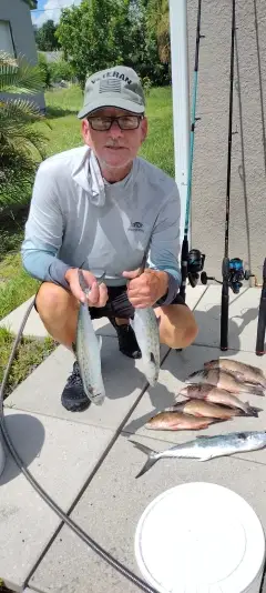
uploaded by: todd douglas

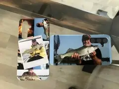
uploaded by: primerone
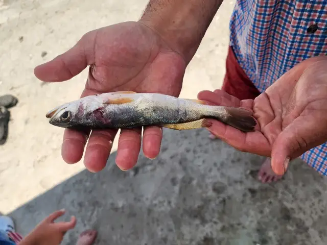
uploaded by: Ryan Frazier

uploaded by: Hoza

uploaded by: Alan Baker

uploaded by: Granpa C

uploaded by: Asaad S Shalbi

uploaded by: Hoza

uploaded by: Hoza
Best Fishing Spots in the greater East Machias area
Beaches and Bays are ideal places for land-based fishing. If the beach is shallow and the water is clear then twilight times are usually the best times, especially when they coincide with a major or minor fishing time. Often the points on either side of a beach are the best spots. Or if the beach is large then look for irregularities in the breaking waves, indicating sandbanks and holes. We found 9 beaches and bays in this area.
Little Bay - 6km , Holmes Bay - 8km , East Branch Little Kennebec Bay - 9km , West Branch Little Kennebec Bay - 10km , Davis Beach - 11km , Jasper Beach - 11km , Machias Bay - 12km , Little Kennebec Bay - 13km , Grays Beach - 13km
We found a total of 96 potential fishing spots nearby East Machias. Below you can find them organized on a map. Points, Headlands, Reefs, Islands, Channels, etc can all be productive fishing spots. As these are user submitted spots, there might be some errors in the exact location. You also need to cross check local fishing regulations. Some of the spots might be in or around marine reserves or other locations that cannot be fished. If you click on a location marker it will bring up some details and a quick link to google search, satellite maps and fishing times. Tip: Click/Tap on a new area to load more fishing spots.
Bangor Hydro Dam - 0km , Stevens Cove - 2km , Simpson Island - 2km , Shipyard Cove - 2km , Marshall Point - 3km , Woodruff Cove - 3km , Newcomb Point - 3km , Chase Mill Dam - 3km , Crocker Point - 3km , Petegrow Cove - 4km , Little Lily Lake - 5km , Middle River Dam - 5km , Libby Cove - 5km , Hooper Point - 5km , Randall Point - 5km , Long Point - 6km , Little Bay - 6km , Lily Lake - 6km , Holmes Point - 6km , Hadley Lake - 6km , Gardner Lake - 6km , Fort O'Brien Point - 6km , Cottage Cove - 6km , Sanborn Cove - 6km , Township Rock - 7km , Birch Point - 7km , Holmes Pond - 7km , Little Point - 8km , Larrabee Cove - 8km , L Point - 8km , Josh Pond - 8km , Holmes Bay - 8km , Hog Island - 8km , Salt Island - 8km , Second Lake - 8km , East Branch Little Kennebec Bay - 9km , Indian Cove - 9km , Spruce Cove - 9km , Hammond Pond - 9km , Foss Point - 9km , Round Island - 9km , Red Point - 10km , Loon Lake - 10km , Marks Lake Dam - 10km , Indian Lake - 10km , Avery Rock - 10km , West Branch Little Kennebec Bay - 10km , Bare Island - 10km , Waleback Cove - 10km , Second Marks Lake - 10km , Sprague Neck - 10km , Smith Point - 10km , Clamshell Cove - 10km , Davis Beach - 11km , Long Lake - 11km , Yellow Head - 11km , Marston Point - 11km , Bar Island - 11km , Mill Pond - 11km , Moose Snare Cove - 11km , Keeley Lake - 11km , Rocky Lake Dam - 11km , Jasper Beach - 11km , Bucks Harbor - 11km , Bucks Neck - 11km , Shiny Lake - 11km , Six Mile Lake - 11km , Chance Island - 11km , Yoho Creek - 12km , Machias Bay - 12km , Sunken Lake - 12km , Johnson Point - 12km , Bucks Head - 12km , Orange Lake - 12km , Porcupine Island - 12km , Deep Cove - 12km , Seavey Lake - 12km , Duck Cove - 12km , Great Brook Lake - 12km , Point Ruth - 12km , Collins Branch - 12km , Colbeth Rock - 12km , Little Kennebec Bay - 13km , Howard Point - 13km , Howard Cove - 13km , Hope Island - 13km , Foster Lake - 13km , Great Pond - 13km , Harmon Lake - 13km , Great Pond Cove - 13km , Grays Beach - 13km , Bog Lake - 14km , Mill Dam - 14km , Grassy Point - 14km , Sea Wall Point - 14km , Cranberry Pond - 14km
Comments