

McDonough 🇺🇸
-
Nautical Twilight begins:06:18 amSunrise:07:12 am
-
Sunset:07:59 pmNautical Twilight ends:08:53 pm
-
Moonrise:06:21 pm
-
Moonset:03:37 am
-
Moon over:11:17 pm
-
Moon under:10:59 am
-
Visibility:89%
-
 Waxing Gibbous
-
Distance to earth:388,555 kmProximity:40.2 %
Moon Phases for McDonough
-
poor Day
-
minor Time:02:37 am - 04:37 am
-
major Time:09:59 am - 11:59 am
-
minor Time:05:21 pm - 07:21 pm
-
major Time:10:17 pm - 12:17 am
| Date | Major Bite Times | Minor Bite Times | Sun | Moon | Moonphase |
|---|---|---|---|---|---|
|
Thu, 04 Sep
|
09:59 am -
11:59 am
10:17 pm -
12:17 am
|
02:37 am -
04:37 am
05:21 pm -
07:21 pm
|
R: 07:12 am S: 07:59 pm |
R: 06:21 pm S: 03:37 am |
Waxing Gibbous |
|
Fri, 05 Sep
|
10:50 am -
12:50 pm
11:06 pm -
01:06 am
|
03:43 am -
05:43 am
05:57 pm -
07:57 pm
|
R: 07:12 am S: 07:58 pm |
R: 06:57 pm S: 04:43 am |
Waxing Gibbous |
|
Sat, 06 Sep
|
11:40 am -
01:40 pm
11:25 pm -
01:25 am
|
04:51 am -
06:51 am
06:29 pm -
08:29 pm
|
R: 07:13 am S: 07:56 pm |
R: 07:29 pm S: 05:51 am |
Full Moon |
|
Sun, 07 Sep
|
12:13 am -
02:13 am
12:28 pm -
02:28 pm
|
05:59 am -
07:59 am
06:58 pm -
08:58 pm
|
R: 07:14 am S: 07:55 pm |
R: 07:58 pm S: 06:59 am |
Full Moon |
|
Mon, 08 Sep
|
01:01 am -
03:01 am
01:17 pm -
03:17 pm
|
07:07 am -
09:07 am
07:27 pm -
09:27 pm
|
R: 07:14 am S: 07:54 pm |
R: 08:27 pm S: 08:07 am |
Full Moon |
|
Tue, 09 Sep
|
01:50 am -
03:50 am
02:07 pm -
04:07 pm
|
08:16 am -
10:16 am
07:58 pm -
09:58 pm
|
R: 07:15 am S: 07:52 pm |
R: 08:58 pm S: 09:16 am |
Waning Gibbous |
|
Wed, 10 Sep
|
02:39 am -
04:39 am
02:58 pm -
04:58 pm
|
09:26 am -
11:26 am
08:31 pm -
10:31 pm
|
R: 07:16 am S: 07:51 pm |
R: 09:31 pm S: 10:26 am |
Waning Gibbous |


uploaded by: Steven Butcheck

uploaded by: Joey Piercefield

uploaded by: Hoza

uploaded by: John Matthews

uploaded by: JoEllen Disterhaupt

uploaded by: JoEllen Disterhaupt

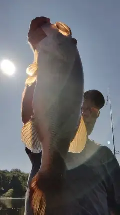
uploaded by: Charlie Pifer

uploaded by: Charlie Pifer

uploaded by: Charlie Pifer

uploaded by: Charlie Pifer
Best Fishing Spots in the greater McDonough area
Beaches and Bays are ideal places for land-based fishing. If the beach is shallow and the water is clear then twilight times are usually the best times, especially when they coincide with a major or minor fishing time. Often the points on either side of a beach are the best spots. Or if the beach is large then look for irregularities in the breaking waves, indicating sandbanks and holes. We found 1 beaches and bays in this area.
Camp Orr Dam - 16km
We found a total of 94 potential fishing spots nearby McDonough. Below you can find them organized on a map. Points, Headlands, Reefs, Islands, Channels, etc can all be productive fishing spots. As these are user submitted spots, there might be some errors in the exact location. You also need to cross check local fishing regulations. Some of the spots might be in or around marine reserves or other locations that cannot be fished. If you click on a location marker it will bring up some details and a quick link to google search, satellite maps and fishing times. Tip: Click/Tap on a new area to load more fishing spots.
McGarity Lake Dam - 2km , S H Lake Dam - 2km , Green Valley Golf Course Dam - 3km , Hardeman Dam - 3km , Walkers Bridge - 3km , Sowell Bridge - 4km , Boyds Lake Dam - 5km , Air Line Bridge - 6km , Iris Lake East Dam - 6km , Steele Dam - 6km , Lake Foster Dam - 7km , Lake Ola Dam - 7km , McMillens Bridge - 7km , Dailey Dam - 8km , Jones Lake Dam - 8km , Painted Turtle Lake Dam - 8km , Davis Dam - 9km , Clayton County Reservoir Dam - 9km , Crumbley Lake Dam - 9km , Ragan Bridge - 9km , Belk-Elrod Lake Dam - 10km , Copelands Bridge - 10km , Davis Lake - 10km , Double Bridges - 10km , Duggan Lake Dam - 10km , Greens Bridge - 10km , Hiram Cook Dam - 10km , Rape Lake Dam - 10km , Weems Lake Dam - 10km , Fausel Lake Dam - 11km , Lake Erma Dam - 11km , Southern States Lake Dam - 11km , Vulcan Materials Quarry Lake Dam - 11km , Butler Bridge - 13km , County Line Lake Dam - 13km , Harbin Dam - 13km , Hetrick Lake Dam - 13km , Schinder Dam - 13km , Scotts Dam - 13km , Sinback Dam - 13km , Agresearch Lake Dam - 14km , Deerun Lake Dam - 14km , Lake Shamrock Dam - 14km , Lion Country Lake Dam - 14km , Oglesby Bridge - 14km , Stroup Lake Dam - 14km , Cindy Lake Dam - 15km , Askew Lakes-North Dam - 15km , Floyds Lake Dam - 15km , Lake Spivey Dam - 15km , Manning Lake Dam - 15km , Miriatoto Lake Dam - 15km , Winns Bridge - 15km , Dickson Dam - 16km , Camp Orr Dam - 16km , Collins Lake Dam - 16km , Feagins Dam - 16km , Lake Amah Lee Dam - 16km , Meadow Brook Dam - 16km , Swan Lake Dam - 16km , Ingram Lake Dam - 17km , Ingram Dam - 17km , Lake Talmadge Dam - 17km , Minska Pinska Dam - 17km , Monastery Lake Dam - 17km , Pine Wood Shores Lake Dam - 17km , Drakes Landing Dam - 18km , Hatcher Lake Dam - 18km , Hermans Lake Dam - 18km , Indian Lake Dam - 18km , Lower Haizlip Lake Dam - 18km , McKnight Bridge (historical) - 18km , Regents Lake Dam - 18km , Sims Bridge - 18km , Southern Fruit Lake Dam - 18km , Southern Fruit Lake Dam B - 18km , Sunset Hills Dam - 18km , Twilly Lake Dam - 18km , Upper Haizlip Lake Dam - 18km , Childers Lake Dam - 19km , Drakes Lake Dam - 19km , Dundee Lake Dam - 19km , Frog Pond - 19km , Horton Lake Dam - 19km , Lake Katherine Dam - 19km , Log Cabin Pond - 19km , Stewart Bridge - 19km , Bunyon Lake Dam - 20km , Cowan Dam - 20km , Mize Lake Dam - 20km , News Bridge - 20km , Richmond Pond - 20km , Shappard Lake Dam - 20km , Taylors Lake Dam - 20km
Comments