

Sugar Creek 🇺🇸
-
Nautical Twilight begins:05:50 amSunrise:06:48 am
-
Sunset:07:45 pmNautical Twilight ends:08:43 pm
-
Moonrise:06:19 pm
-
Moonset:03:02 am
-
Moon over:10:56 pm
-
Moon under:10:40 am
-
Visibility:89%
-
 Waxing Gibbous
-
Distance to earth:388,356 kmProximity:40.7 %
Moon Phases for Sugar Creek
-
poor Day
-
minor Time:02:02 am - 04:02 am
-
major Time:09:40 am - 11:40 am
-
minor Time:05:19 pm - 07:19 pm
-
major Time:09:56 pm - 11:56 pm
| Date | Major Bite Times | Minor Bite Times | Sun | Moon | Moonphase |
|---|---|---|---|---|---|
|
Thu, 04 Sep
|
09:40 am -
11:40 am
09:56 pm -
11:56 pm
|
02:02 am -
04:02 am
05:19 pm -
07:19 pm
|
R: 06:48 am S: 07:45 pm |
R: 06:19 pm S: 03:02 am |
Waxing Gibbous |
|
Fri, 05 Sep
|
10:31 am -
12:31 pm
10:45 pm -
12:45 am
|
03:12 am -
05:12 am
05:50 pm -
07:50 pm
|
R: 06:49 am S: 07:43 pm |
R: 06:50 pm S: 04:12 am |
Waxing Gibbous |
|
Sat, 06 Sep
|
11:21 am -
01:21 pm
11:08 pm -
01:08 am
|
04:25 am -
06:25 am
06:18 pm -
08:18 pm
|
R: 06:50 am S: 07:42 pm |
R: 07:18 pm S: 05:25 am |
Full Moon |
|
Sun, 07 Sep
|
12:10 pm -
02:10 pm
11:57 pm -
01:57 am
|
05:37 am -
07:37 am
06:43 pm -
08:43 pm
|
R: 06:51 am S: 07:40 pm |
R: 07:43 pm S: 06:37 am |
Full Moon |
|
Mon, 08 Sep
|
12:45 am -
02:45 am
12:58 pm -
02:58 pm
|
06:49 am -
08:49 am
07:08 pm -
09:08 pm
|
R: 06:52 am S: 07:39 pm |
R: 08:08 pm S: 07:49 am |
Full Moon |
|
Tue, 09 Sep
|
01:33 am -
03:33 am
01:48 pm -
03:48 pm
|
08:03 am -
10:03 am
07:34 pm -
09:34 pm
|
R: 06:53 am S: 07:37 pm |
R: 08:34 pm S: 09:03 am |
Waning Gibbous |
|
Wed, 10 Sep
|
02:23 am -
04:23 am
02:40 pm -
04:40 pm
|
09:18 am -
11:18 am
08:03 pm -
10:03 pm
|
R: 06:54 am S: 07:35 pm |
R: 09:03 pm S: 10:18 am |
Waning Gibbous |


uploaded by: Steven Butcheck

uploaded by: Joey Piercefield

uploaded by: Hoza

uploaded by: John Matthews

uploaded by: JoEllen Disterhaupt

uploaded by: JoEllen Disterhaupt

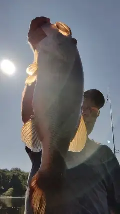
uploaded by: Charlie Pifer

uploaded by: Charlie Pifer

uploaded by: Charlie Pifer

uploaded by: Charlie Pifer
Best Fishing Spots in the greater Sugar Creek area
Harbours and Marinas can often times be productive fishing spots for land based fishing as their sheltered environment attracts a wide variety of bait fish. Similar to river mouths, harbour entrances are also great places to fish as lots of fish will move in and out with the rising and falling tides. There are 2 main harbours in this area.
Blue Springs Marina - 15km, Jacomo Marina - 17km
We found a total of 62 potential fishing spots nearby Sugar Creek. Below you can find them organized on a map. Points, Headlands, Reefs, Islands, Channels, etc can all be productive fishing spots. As these are user submitted spots, there might be some errors in the exact location. You also need to cross check local fishing regulations. Some of the spots might be in or around marine reserves or other locations that cannot be fished. If you click on a location marker it will bring up some details and a quick link to google search, satellite maps and fishing times. Tip: Click/Tap on a new area to load more fishing spots.
Harry S Truman Bridge - 5km , Union Lake Dam - 5km , Great Midwest Corporation Dam - 7km , Bales Lake - 7km , Great Midwest Lake Dam - 7km , Hines Lake Dam - 7km , Riss Lake Dam - 7km , Liberty Bend Bridge - 8km , Winnetonka Lake Dam - 10km , Independence-Liberty Bridge - 10km , Bogler Lake Dam - 10km , Paseo Bridge - 11km , Horseshoe Lake - 11km , Virginia Holding Corporation South Lake Dam - 11km , Blue Mills Island (historical) - 11km , Broadway Bridge - 12km , Catholic Diocese of Kansas City - Saint Joseph Lake Dam - 12km , Virginia Holding Corporation North Lake Dam - 12km , Number 173 Dam (historical) - 12km , Independence Chute (historical) - 12km , ASB Bridge - 12km , Wildwood Dam - 13km , Flaceys Lake - 13km , Commandeer Fishing Lakes Upper Dam - 13km , Commandeer Fishing Lakes Incorporated Dam - 13km , Odd Fellows Home Lake Dam - 13km , Carp Lake Dam - 13km , Shady Lake Dam - 13km , Gregory Boulevard Dam - 14km , Moore Lake Dam - 14km , Morgan Lake Dam - 14km , Lakewood West Dam - 14km , Lakewood East Dam - 14km , Blue Springs Quad Number 1 Dam - 14km , The Lagoon - 14km , Little Blue Road Dam - 15km , Lake Tapawingo Dam - 15km , Lewis and Clark Viaduct - 15km , Hearth and Home Development Company Lake Dam (historical) - 15km , Blue Springs Marina - 15km , Holly Lake Dam - 16km , Fairfax Bridge - 16km , Enloe Lake Dam - 16km , Chapel Woods Golf Course Lake Dam - 16km , Unity Lake Number 2 Dam - 17km , Houston Lake Dam - 17km , Hodge Park Lake Dam - 17km , Jacomo Marina - 17km , Number 374 Dam - 17km , McCoy Dam - 18km , Sailboat Cove - 18km , Number 79 Dam (historical) - 18km , Unity Lake Number 1 Dam - 18km , Wales Lake Dam - Number Name 784 - 18km , Lake Jacomo Dam - 18km , Ligget Cove - 19km , Number 380 Dam - 19km , Deerhorn Lake Dam - 19km , Hendren Dam - 19km , Christiansen Lake Dam - 20km , Tomahawk Road Bridge - 20km , Sunny Shores Dam - 20km
Comments