
Branch 🇺🇸
-
Nautical Twilight begins:05:45 amSunrise:06:48 am
-
Sunset:07:26 pmNautical Twilight ends:08:30 pm
-
Moonrise:11:32 pm
-
Moonset:03:40 pm
-
Moon over:07:16 am
-
Moon under:07:36 pm
-
Visibility:47%
-
 Third Quarter Moon
-
Distance to earth:367,044 kmProximity:90.7 %
Moon Phases for Branch
-
average Day
-
major Time:
 06:16 am -
08:16 am
06:16 am -
08:16 am
-
minor Time:02:40 pm - 04:40 pm
-
major Time:
06:36 pm -
08:36 pm
-
minor Time:10:32 pm - 12:32 am
| Date | Major Bite Times | Minor Bite Times | Sun | Moon | Moonphase |
|---|---|---|---|---|---|
|
Sun, 14 Sep
|
06:16 am -
08:16 am
06:36 pm -
08:36 pm
|
02:40 pm -
04:40 pm
10:32 pm -
12:32 am
|
R: 06:48 am S: 07:26 pm |
R: 11:32 pm S: 03:40 pm |
Third Quarter Moon |
|
Mon, 15 Sep
|
07:17 am -
09:17 am
07:37 pm -
09:37 pm
|
03:34 pm -
05:34 pm
11:41 pm -
01:41 am
|
R: 06:50 am S: 07:24 pm |
R: - S: 04:34 pm |
Third Quarter Moon |
|
Tue, 16 Sep
|
07:58 am -
09:58 am
08:36 pm -
10:36 pm
|
04:16 pm -
06:16 pm
11:41 pm -
01:41 am
|
R: 06:51 am S: 07:22 pm |
R: 12:41 am S: 05:16 pm |
Waning Crescent |
|
Wed, 17 Sep
|
08:52 am -
10:52 am
09:30 pm -
11:30 pm
|
12:57 am -
02:57 am
04:47 pm -
06:47 pm
|
R: 06:52 am S: 07:20 pm |
R: 01:57 am S: 05:47 pm |
Waning Crescent |
|
Thu, 18 Sep
|
09:41 am -
11:41 am
10:18 pm -
12:18 am
|
02:12 am -
04:12 am
05:10 pm -
07:10 pm
|
R: 06:53 am S: 07:18 pm |
R: 03:12 am S: 06:10 pm |
Waning Crescent |
|
Fri, 19 Sep
|
10:28 am -
12:28 pm
11:04 pm -
01:04 am
|
03:26 am -
05:26 am
05:30 pm -
07:30 pm
|
R: 06:54 am S: 07:16 pm |
R: 04:26 am S: 06:30 pm |
Waning Crescent |
|
Sat, 20 Sep
|
11:12 am -
01:12 pm
10:38 pm -
12:38 am
|
04:37 am -
06:37 am
05:47 pm -
07:47 pm
|
R: 06:56 am S: 07:15 pm |
R: 05:37 am S: 06:47 pm |
New Moon |


uploaded by: Stephen Spencer

uploaded by: Jon “Kuse”

uploaded by: Elzen Harris

uploaded by: RAMason69

uploaded by: Steven Butcheck

uploaded by: Joey Piercefield

uploaded by: Hoza

uploaded by: John Matthews

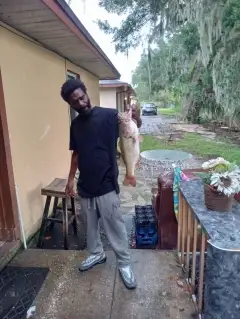
uploaded by: JoEllen Disterhaupt

uploaded by: JoEllen Disterhaupt
Best Fishing Spots in the greater Branch area
We found a total of 92 potential fishing spots nearby Branch. Below you can find them organized on a map. Points, Headlands, Reefs, Islands, Channels, etc can all be productive fishing spots. As these are user submitted spots, there might be some errors in the exact location. You also need to cross check local fishing regulations. Some of the spots might be in or around marine reserves or other locations that cannot be fished. If you click on a location marker it will bring up some details and a quick link to google search, satellite maps and fishing times. Tip: Click/Tap on a new area to load more fishing spots.
County Ditch Number Seven - 2km , County Ditch Number Five - 4km , County Ditch Number Three - 5km , Mud Lake - 5km , Peterson Slough - 6km , County Ditch Number Ten - 7km , Grass Lake - 7km , Horseleg Lake - 7km , Horseshoe Lake - 7km , Hurley Lake - 7km , North Pool - 7km , Sunrise River Pool 3 Dam - 7km , Sunrise River Dam - 7km , Tamarack Lake - 7km , Chain Lake - 8km , Knute Lake - 8km , Long Lake - 8km , Rice Lake - 8km , Upper Birch Lake - 8km , Lower Birch Lake - 9km , Pine Island - 9km , Twin Lakes - 9km , Vibo Lake - 9km , Hoffman Lake - 10km , Spring Lake - 10km , Sunrise Lake - 10km , Sunrise River Pool 1 Dam - 10km , Trulson Wildlife Pond Dam - 10km , Fawn Lake - 11km , Judicial Ditch Number Two - 11km , Lily Pond - 11km , Lake Mattson - 11km , Rat Lake - 11km , Fish Lake - 12km , Judicial Ditch Number Four - 12km , Pet Lake - 12km , School Lake - 12km , Swamp Lake - 12km , Big Pine Lake - 13km , Little Pine Lake - 13km , Lake Martha - 13km , North Lindstrom Lake - 13km , Ryan Lake - 13km , Typo Lake - 13km , Wallmark Lake - 13km , County Ditch Number Thirteen - 14km , Lake Ellen - 14km , Lake Emily - 14km , Little Green Lake - 14km , Little Horseshoe Lake - 14km , North Center Lake - 14km , Pioneer Lake - 14km , South Lindstrom Lake - 14km , County Ditch Number Ninteen - 15km , County Ditch Number Twenty - 15km , Little Lake - 15km , Martin Lake - 15km , Point Pleasant - 15km , Sam Lake - 15km , Asp Lake - 16km , Chisago Lake - 16km , Lindberg Point - 16km , Mandall Lake - 16km , Robour Lake - 16km , Schlimmer Point - 16km , South Center Lake - 16km , Sunset Point - 16km , White Stone Lake - 16km , County Ditch Number Nine - 17km , Green Lake - 17km , Island Lake - 17km , Jonason Lake - 17km , Kroon Lake - 17km , Neander Lake - 17km , Ashton Lake - 18km , Comfort Lake - 18km , Linn Lake - 18km , Skogman Lake - 18km , Boos Lake - 19km , Goose Lake - 19km , Heims Lake - 19km , Linwood Lake - 19km , Little Comfort Lake - 19km , Ogren Lake - 19km , Pearson Lake - 19km , Peterson Lake - 19km , Pine Lake - 19km , Skunk Lake - 19km , Alexis Lake - 20km , Bloom Lake - 20km , County Ditch Number Six - 20km , Judicial Ditch Number One - 20km
Comments