


Broad Brook 🇺🇸
-
Nautical Twilight begins:05:33 amSunrise:06:33 am
-
Sunset:06:56 pmNautical Twilight ends:07:55 pm
-
Moonrise:02:57 am
-
Moonset:05:40 pm
-
Moon over:10:18 am
-
Moon under:10:53 pm
-
Visibility:10%
-
 Waning Crescent
-
Distance to earth:383,277 kmProximity:52.6 %
Moon Phases for Broad Brook
-
average Day
-
minor Time:01:57 am - 03:57 am
-
major Time:09:18 am - 11:18 am
-
minor Time:04:40 pm - 06:40 pm
-
major Time:09:53 pm - 11:53 pm
Tide Clock
Tide Graph
Times
| Tide | Time | Height |
|---|---|---|
| high | 12:35 am | 2.26 ft |
| low | 08:24 am | 0.26 ft |
| high | 01:10 pm | 1.94 ft |
| low | 08:37 pm | 0.33 ft |
| Date | Major Bite Times | Minor Bite Times | Sun | Moon | Moonphase | Tide Times |
|---|---|---|---|---|---|---|
|
Thu, 18 Sep
|
09:18 am -
11:18 am
09:53 pm -
11:53 pm
|
01:57 am -
03:57 am
04:40 pm -
06:40 pm
|
R: 06:33 am S: 06:56 pm |
R: 02:57 am S: 05:40 pm |
Waning Crescent |
high: 12:35 am
, 2.26 ft
, Coeff: 117
low: 08:24 am
, 0.26 ft
high: 01:10 pm
, 1.94 ft
, Coeff: 89
low: 08:37 pm
, 0.33 ft
|
|
Fri, 19 Sep
|
10:04 am -
12:04 pm
10:38 pm -
12:38 am
|
03:07 am -
05:07 am
05:02 pm -
07:02 pm
|
R: 06:34 am S: 06:54 pm |
R: 04:07 am S: 06:02 pm |
Waning Crescent |
high: 01:30 am
, 2.23 ft
, Coeff: 114
low: 09:11 am
, 0.26 ft
high: 01:56 pm
, 2.07 ft
, Coeff: 100
low: 09:28 pm
, 0.23 ft
|
|
Sat, 20 Sep
|
10:48 am -
12:48 pm
11:21 pm -
01:21 am
|
04:15 am -
06:15 am
05:22 pm -
07:22 pm
|
R: 06:35 am S: 06:52 pm |
R: 05:15 am S: 06:22 pm |
New Moon |
high: 02:18 am
, 2.23 ft
, Coeff: 114
low: 09:54 am
, 0.23 ft
high: 02:37 pm
, 2.2 ft
, Coeff: 111
low: 10:15 pm
, 0.2 ft
|
|
Sun, 21 Sep
|
11:30 am -
01:30 pm
10:58 pm -
12:58 am
|
05:20 am -
07:20 am
05:41 pm -
07:41 pm
|
R: 06:36 am S: 06:50 pm |
R: 06:20 am S: 06:41 pm |
New Moon |
high: 02:59 am
, 2.17 ft
, Coeff: 109
low: 10:34 am
, 0.23 ft
high: 03:15 pm
, 2.26 ft
, Coeff: 117
low: 11:00 pm
, 0.16 ft
|
|
Mon, 22 Sep
|
12:11 pm -
02:11 pm
11:39 pm -
01:39 am
|
06:23 am -
08:23 am
05:59 pm -
07:59 pm
|
R: 06:37 am S: 06:49 pm |
R: 07:23 am S: 06:59 pm |
New Moon |
high: 03:37 am
, 2.1 ft
, Coeff: 103
low: 11:13 am
, 0.26 ft
high: 03:51 pm
, 2.33 ft
, Coeff: 123
low: 11:42 pm
, 0.2 ft
|
|
Tue, 23 Sep
|
12:20 am -
02:20 am
12:52 pm -
02:52 pm
|
07:26 am -
09:26 am
06:19 pm -
08:19 pm
|
R: 06:38 am S: 06:47 pm |
R: 08:26 am S: 07:19 pm |
New Moon |
high: 04:13 am
, 2.03 ft
, Coeff: 97
low: 11:51 am
, 0.3 ft
high: 04:27 pm
, 2.33 ft
, Coeff: 123
|
|
Wed, 24 Sep
|
01:03 am -
03:03 am
01:35 pm -
03:35 pm
|
08:30 am -
10:30 am
06:41 pm -
08:41 pm
|
R: 06:39 am S: 06:45 pm |
R: 09:30 am S: 07:41 pm |
Waxing Crescent |
low: 12:25 am
, 0.23 ft
high: 04:49 am
, 1.97 ft
, Coeff: 91
low: 12:30 pm
, 0.36 ft
high: 05:03 pm
, 2.3 ft
, Coeff: 120
|


uploaded by: Salim Jamia

uploaded by: rich77

uploaded by: rich77

uploaded by: rich77

uploaded by: Rex_Ursus

uploaded by: bandedwd

uploaded by: Trey Cowan

uploaded by: Trey Cowan

uploaded by: Trey Cowan

uploaded by: Trey Cowan
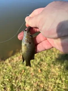
Best Fishing Spots in the greater Broad Brook area
Harbours and Marinas can often times be productive fishing spots for land based fishing as their sheltered environment attracts a wide variety of bait fish. Similar to river mouths, harbour entrances are also great places to fish as lots of fish will move in and out with the rising and falling tides. There are 1 main harbours in this area.
Porter Reservoir Dam - 16km
We found a total of 100 potential fishing spots nearby Broad Brook. Below you can find them organized on a map. Points, Headlands, Reefs, Islands, Channels, etc can all be productive fishing spots. As these are user submitted spots, there might be some errors in the exact location. You also need to cross check local fishing regulations. Some of the spots might be in or around marine reserves or other locations that cannot be fished. If you click on a location marker it will bring up some details and a quick link to google search, satellite maps and fishing times. Tip: Click/Tap on a new area to load more fishing spots.
Osborne Pond - 1km , Broad Brook Millpond Dam - 1km , Broad Brook Millpond - 1km , Creamery Pond - 3km , Windsorville Pond - 3km , Windsorville Pond Dam - 3km , Thompson Pond - 4km , Bradleys Pond - 4km , Dexter Cuffin Junior Bridge - 6km , Cast and Blast Pond Dam - 6km , Kings Island - 7km , Powder Mill Ponds - 7km , Turks Island - 7km , Cannon Pond - 7km , Olds and Whipple Pond - 8km , Scitico Dam - 8km , Stowes Pond - 8km , Enfield Bridge (historical) - 9km , Reeds Pond - 9km , Somersville Pond - 9km , Brickyard Pond - 9km , Crescent Lake Dam - 10km , Enfield Dam - 10km , Hockanum River Dam - 10km , Lafayette Pond - 10km , Lake Bonair Dam - 10km , Paper Mill Pond Dam - 10km , Paper Mill Pond - 10km , Schwartz Pond - 10km , Schwartz Pond Dam - 10km , Somersville Pond Dam - 10km , Lake Bonair - 10km , Dobsonville Pond - 11km , Dobsonville Pond Dam - 11km , Freshwater Pond - 11km , Freshwater Pond Dam - 11km , Podunk Pond Dam - 11km , Shady Lake - 11km , Shenipsit Lake Dam - 11km , Tankerhoosen Lake - 11km , Tankerhoosen Lake North Dam - 11km , Vintons Millpond - 11km , Wetherell Pond - 11km , Aldon Mill Pond Dam - 11km , Rainbow Pond Dam - 12km , Rainbow Dam - 12km , Spring Dam Pond - 12km , Walker Reservoir East Dam - 12km , Bromes Pond - 12km , Bungee Lake Lower Dam - 12km , Cranberry Pond - 13km , Lydall Pond Number 1 Dam - 13km , Shaker Pond - 13km , Shaker Pond Dam - 13km , Silver Birch Pond - 13km , Union Pond Dam - 13km , Barber Pond - 13km , Barber Pond Dam - 13km , Goodwin Pond - 14km , Risley Reservoir Dam - 14km , Wetstone Tobacco Company Dam Number 3 - 14km , Bissell Bridge - 14km , Crystal Lake Dam - 15km , Great Pond - 15km , Hilliards Pond - 15km , Laurel Lake Dam - 15km , Pomercy Dam - 15km , Pomeroy Dam - 15km , Upper Bolton Lake Dam - 15km , Longmeadow Country Club Dam - 15km , Cider Millpond - 15km , Laurel Lake - 16km , Lower Bolton Lake Dam - 16km , Porter Reservoir Dam - 16km , Scotland Road Dam - 16km , Tolland Marsh Pond - 16km , Turner Park Dam - 16km , Blue Hills Dam - 16km , Bolton Notch Pond - 16km , Bradway Dam - 16km , Bradway Pond - 16km , Ellis Dam - 17km , Folly Pond - 17km , Goulds Pond - 17km , Howard Reservoir Dam - 17km , Hurds Lake Dam - 17km , Keeney Street Pond - 17km , Kent Hollow Dam - 17km , Sun Valley Lake Dam - 17km , Whitney Dam - 17km , Wintonbury Dam - 17km , Case Pond - 17km , Case Pond Upper Dam - 17km , Globe Hollow Reservoir Dam - 18km , Whites Pond - 18km , Whites Pond Dam - 18km , Forest Park Upper Dam - 18km , Taylor Pond - 18km , Bloomfield Dam - 18km , Founders Bridge - 19km
Comments