Dardenne Prairie 🇺🇸
-
Nautical Twilight begins:05:47 amSunrise:06:44 am
-
Sunset:07:12 pmNautical Twilight ends:08:09 pm
-
Moonrise:-
-
Moonset:03:55 pm
-
Moon over:08:08 am
-
Moon under:08:28 pm
-
Visibility:36%
-
 Third Quarter Moon
-
Distance to earth:370,293 kmProximity:83.1 %
Moon Phases for Dardenne Prairie
-
average Day
-
minor Time:12:01 am - 02:01 am
-
major Time:07:08 am - 09:08 am
-
minor Time:02:55 pm - 04:55 pm
-
major Time:07:28 pm - 09:28 pm
| Date | Major Bite Times | Minor Bite Times | Sun | Moon | Moonphase |
|---|---|---|---|---|---|
|
Mon, 15 Sep
|
07:08 am -
09:08 am
07:28 pm -
09:28 pm
|
12:01 am -
02:01 am
02:55 pm -
04:55 pm
|
R: 06:44 am S: 07:12 pm |
R: - S: 03:55 pm |
Third Quarter Moon |
|
Tue, 16 Sep
|
07:50 am -
09:50 am
08:26 pm -
10:26 pm
|
12:01 am -
02:01 am
03:40 pm -
05:40 pm
|
R: 06:44 am S: 07:11 pm |
R: 01:01 am S: 04:40 pm |
Waning Crescent |
|
Wed, 17 Sep
|
08:44 am -
10:44 am
09:19 pm -
11:19 pm
|
01:12 am -
03:12 am
04:17 pm -
06:17 pm
|
R: 06:45 am S: 07:09 pm |
R: 02:12 am S: 05:17 pm |
Waning Crescent |
|
Thu, 18 Sep
|
09:34 am -
11:34 am
10:08 pm -
12:08 am
|
02:22 am -
04:22 am
04:47 pm -
06:47 pm
|
R: 06:46 am S: 07:08 pm |
R: 03:22 am S: 05:47 pm |
Waning Crescent |
|
Fri, 19 Sep
|
10:20 am -
12:20 pm
10:53 pm -
12:53 am
|
03:29 am -
05:29 am
05:12 pm -
07:12 pm
|
R: 06:47 am S: 07:06 pm |
R: 04:29 am S: 06:12 pm |
Waning Crescent |
|
Sat, 20 Sep
|
11:04 am -
01:04 pm
10:33 pm -
12:33 am
|
04:34 am -
06:34 am
05:34 pm -
07:34 pm
|
R: 06:48 am S: 07:04 pm |
R: 05:34 am S: 06:34 pm |
New Moon |
|
Sun, 21 Sep
|
11:45 am -
01:45 pm
11:14 pm -
01:14 am
|
05:36 am -
07:36 am
05:55 pm -
07:55 pm
|
R: 06:49 am S: 07:03 pm |
R: 06:36 am S: 06:55 pm |
New Moon |


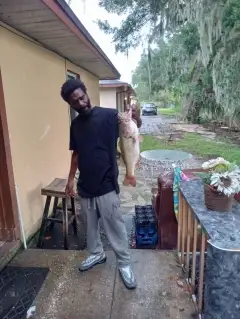
uploaded by: Heathen Monk

uploaded by: Flounder pounder

uploaded by: Stephen Spencer

uploaded by: Jon “Kuse”

uploaded by: Elzen Harris

uploaded by: RAMason69

uploaded by: Steven Butcheck

uploaded by: Joey Piercefield

uploaded by: Hoza

uploaded by: John Matthews
Best Fishing Spots in the greater Dardenne Prairie area
We found a total of 99 potential fishing spots nearby Dardenne Prairie. Below you can find them organized on a map. Points, Headlands, Reefs, Islands, Channels, etc can all be productive fishing spots. As these are user submitted spots, there might be some errors in the exact location. You also need to cross check local fishing regulations. Some of the spots might be in or around marine reserves or other locations that cannot be fished. If you click on a location marker it will bring up some details and a quick link to google search, satellite maps and fishing times. Tip: Click/Tap on a new area to load more fishing spots.
Browns Lake Dam - 4km , August A Busch Lake Number 40 Dam - 5km , August A Busch Lake Number 8 Dam - 5km , August A Busch Lake Number 35 Dam - 5km , Busch Wildlife Area-Survey 1778 Dam - 5km , Busch Wildlife Area-Survey 297 Dam - 5km , Busch Wildlife Area-Survey 887 Dam - 5km , Diermann Recreation Area Dam - 5km , August A Busch Lake Number 33 Dam - 5km , Lake Saint Louis Dam - 5km , Schidinger-Hannigan-Hoffman Lake Dam - 5km , August A Busch Lake Number 15 Dam - 6km , August A Busch Lake Number 570 Dam - 6km , August A Busch Lake Number 6 Dam - 6km , August A Busch Lake Number 7 Dam - 6km , Busch Wildlife Area Section 15 Dam - 6km , Lake Sainte Louise Dam - 6km , Oakridge Estates Lake Dam - 6km , August A Busch Lake Number 51 Dam - 7km , Podhorns Dam - 7km , University of Missouri Experimental Farm Dam - 7km , Camden Pond - 7km , August A Busch Refuge Lake Dam - 7km , August A Busch Lake Number 16 Dam - 8km , Busch Wildlife Area Section 27 Dam - 8km , Busch Wildlife Area Section 36 Dam - 8km , Schulte Lake Section 18 Dam - 8km , August A Busch Lake Number 21 - 8km , August A Busch Lake Number 600 Dam - 9km , Brommelsieck Lake Dam - 9km , McNair Lake Dam - 9km , Robert Schulte Dam - 9km , Hueffmeir Lake Dam - 10km , Kolb Lake Dam - 10km , Park Charles South Number 1 Dam - 10km , Apprill Lake Dam - 11km , Bridlespur Lake Dam - 11km , Clement Lake Dam - 11km , Daniel Boone Bridge - 11km , Fette Lake Dam - 11km , Hammel Lake Dam - 11km , Lauer Island - 11km , Park Charles South Number 2 Dam - 11km , Stevener Lake Dam - 11km , Lewveke Island - 11km , Grassy Lake - 12km , Howell Island - 12km , Lakeview Acres Dam - 12km , Lharky Lake - 12km , Maple Lake - 12km , New Melle Lake Estates Dam - 12km , Pallardy Lake - 12km , Arnot Lake Dam - 13km , Centaur Chute - 13km , Citizens Mortgage Investment Corporation Section 36 Dam - 13km , Clear Lake - 13km , Johnson Island - 13km , Mosley Lake Dam - 13km , Mud Lake - 13km , Berry Park Dam - 14km , Bonhomme Island - 14km , Fish Slough - 14km , Greens Chute - 14km , Horseshoe Lake - 14km , Barrett Lake - 15km , Borgelt Lake Dam - 15km , Gettemeier Lake Dam - 15km , Lake Dan-Bea Dam - 15km , Lost Lake Dam - 15km , Muich Lake Dam - 15km , The Bluffs Lake Dam - 15km , Wolk Lake Dam - 15km , Birnbaum Lake Dam - 16km , Island Number 508 - 16km , Langosch Lake Dam - 16km , Peruque Island - 16km , Two Branch Island - 16km , W G Fienup Lake Dam - 16km , Apple Island - 17km , Jackson Dam - 17km , Johnson Lake Dam - 17km , Sweden Island - 17km , Thompson Lake Dam - 17km , Warwick Downs Lake Dam - 17km , Hat Island - 18km , Martin Towhead - 18km , Bernard Lake - 18km , Carlie Lake Dam - 18km , Catfish Island - 18km , Cuivre Canal - 18km , Felix Struckoff Dam - 18km , Holts Lake Dam - 18km , Kehrs Mill Trail East Lake Dam - 18km , Kehrs Mill Trail Lower Lake Dam - 18km , Kehrs Mill Trails Upper Lake Dam - 18km , Koenig Dam - 18km , Raewood Lake Dam - 18km , Twin Lakes - 18km , Arrowhead Estates Lower Dam - 19km
Comments