


Glen Head 🇺🇸
-
Nautical Twilight begins:05:39 amSunrise:06:37 am
-
Sunset:07:00 pmNautical Twilight ends:07:58 pm
-
Moonrise:03:05 am
-
Moonset:05:42 pm
-
Moon over:10:23 am
-
Moon under:10:58 pm
-
Visibility:10%
-
 Waning Crescent
-
Distance to earth:383,277 kmProximity:52.6 %
Moon Phases for Glen Head
-
average Day
-
minor Time:02:05 am - 04:05 am
-
major Time:09:23 am - 11:23 am
-
minor Time:04:42 pm - 06:42 pm
-
major Time:09:58 pm - 11:58 pm
Tide Clock
Tide Graph
Times
| Tide | Time | Height |
|---|---|---|
| low | 03:59 am | 0.26 ft |
| high | 10:00 am | 7.58 ft |
| low | 04:18 pm | 0.46 ft |
| high | 10:24 pm | 8.07 ft |
| Date | Major Bite Times | Minor Bite Times | Sun | Moon | Moonphase | Tide Times |
|---|---|---|---|---|---|---|
|
Thu, 18 Sep
|
09:23 am -
11:23 am
09:58 pm -
11:58 pm
|
02:05 am -
04:05 am
04:42 pm -
06:42 pm
|
R: 06:37 am S: 07:00 pm |
R: 03:05 am S: 05:42 pm |
Waning Crescent |
low: 03:59 am
, 0.26 ft
high: 10:00 am
, 7.58 ft
, Coeff: 113
low: 04:18 pm
, 0.46 ft
high: 10:24 pm
, 8.07 ft
, Coeff: 125
|
|
Fri, 19 Sep
|
10:09 am -
12:09 pm
10:43 pm -
12:43 am
|
03:14 am -
05:14 am
05:05 pm -
07:05 pm
|
R: 06:38 am S: 06:58 pm |
R: 04:14 am S: 06:05 pm |
Waning Crescent |
low: 04:49 am
, 0.07 ft
high: 10:47 am
, 7.91 ft
, Coeff: 121
low: 05:08 pm
, 0.1 ft
high: 11:11 pm
, 8.17 ft
, Coeff: 128
|
|
Sat, 20 Sep
|
10:53 am -
12:53 pm
11:25 pm -
01:25 am
|
04:21 am -
06:21 am
05:26 pm -
07:26 pm
|
R: 06:39 am S: 06:56 pm |
R: 05:21 am S: 06:26 pm |
New Moon |
low: 05:33 am
, 0 ft
high: 11:31 am
, 8.1 ft
, Coeff: 126
low: 05:53 pm
, -0.1 ft
high: 11:54 pm
, 8.1 ft
, Coeff: 126
|
|
Sun, 21 Sep
|
11:34 am -
01:34 pm
11:02 pm -
01:02 am
|
05:24 am -
07:24 am
05:45 pm -
07:45 pm
|
R: 06:40 am S: 06:55 pm |
R: 06:24 am S: 06:45 pm |
New Moon |
low: 06:14 am
, 0.07 ft
high: 12:09 pm
, 8.17 ft
, Coeff: 128
low: 06:34 pm
, -0.13 ft
|
|
Mon, 22 Sep
|
12:16 pm -
02:16 pm
11:45 pm -
01:45 am
|
06:27 am -
08:27 am
06:05 pm -
08:05 pm
|
R: 06:41 am S: 06:53 pm |
R: 07:27 am S: 07:05 pm |
New Moon |
high: 12:32 am
, 7.97 ft
, Coeff: 123
low: 06:51 am
, 0.23 ft
high: 12:43 pm
, 8.1 ft
, Coeff: 126
low: 07:13 pm
, -0.03 ft
|
|
Tue, 23 Sep
|
12:25 am -
02:25 am
12:57 pm -
02:57 pm
|
07:29 am -
09:29 am
06:25 pm -
08:25 pm
|
R: 06:42 am S: 06:51 pm |
R: 08:29 am S: 07:25 pm |
New Moon |
high: 01:07 am
, 7.71 ft
, Coeff: 116
low: 07:22 am
, 0.49 ft
high: 01:11 pm
, 7.97 ft
, Coeff: 123
low: 07:46 pm
, 0.2 ft
|
|
Wed, 24 Sep
|
01:08 am -
03:08 am
01:40 pm -
03:40 pm
|
08:32 am -
10:32 am
06:48 pm -
08:48 pm
|
R: 06:43 am S: 06:50 pm |
R: 09:32 am S: 07:48 pm |
Waxing Crescent |
high: 01:35 am
, 7.45 ft
, Coeff: 109
low: 07:42 am
, 0.75 ft
high: 01:31 pm
, 7.84 ft
, Coeff: 119
low: 08:13 pm
, 0.49 ft
|


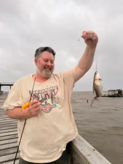
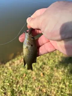
uploaded by: Jeff Bollenbacher

uploaded by: Salim Jamia

uploaded by: rich77

uploaded by: rich77

uploaded by: rich77

uploaded by: Rex_Ursus

uploaded by: bandedwd

uploaded by: Trey Cowan

uploaded by: Trey Cowan

uploaded by: Trey Cowan
Best Fishing Spots in the greater Glen Head area
Beaches and Bays are ideal places for land-based fishing. If the beach is shallow and the water is clear then twilight times are usually the best times, especially when they coincide with a major or minor fishing time. Often the points on either side of a beach are the best spots. Or if the beach is large then look for irregularities in the breaking waves, indicating sandbanks and holes. We found 20 beaches and bays in this area.
Tappen Beach - 2km , Bar Beach - 3km , Pratts Beach - 6km , East Beach - 7km , The Creek Beach - 8km , Beekman Beach - 8km , Creek Club Beach - 8km , Meudon Beach - 8km , Oak Neck Beach - 9km , Manhasset Bay - 9km , Stehli Beach - 9km , West Harbor Beach - 10km , Ferry Beach - 10km , Oyster Bay Harbor - 10km , Bayville Bridge - 10km , Oyster Bay - 11km , Centre Island Beach - 12km , Little Neck Bay - 13km , Lloyd Beach - 14km , Pelham Bay - 14km
Harbours and Marinas can often times be productive fishing spots for land based fishing as their sheltered environment attracts a wide variety of bait fish. Similar to river mouths, harbour entrances are also great places to fish as lots of fish will move in and out with the rising and falling tides. There are 3 main harbours in this area.
Shelter Harbor Marina - 8km, Hague Basin - 12km, City Island Harbor - 13km
We found a total of 97 potential fishing spots nearby Glen Head. Below you can find them organized on a map. Points, Headlands, Reefs, Islands, Channels, etc can all be productive fishing spots. As these are user submitted spots, there might be some errors in the exact location. You also need to cross check local fishing regulations. Some of the spots might be in or around marine reserves or other locations that cannot be fished. If you click on a location marker it will bring up some details and a quick link to google search, satellite maps and fishing times. Tip: Click/Tap on a new area to load more fishing spots.
Mott Cove - 2km , Scudders Pond - 2km , Carpenter Neck - 2km , Tappen Beach - 2km , Carpenters Neck - 2km , Mosquito Cove - 3km , Carpenter Point - 3km , Bar Beach - 3km , Swan Lake - 4km , Mosquito Neck - 4km , Hempstead Harbor - 4km , Mott Point - 5km , Weeks Point - 5km , Roslyn Pond - 5km , Manhasset Neck - 5km , Red Spring Point - 5km , Dosoris Island - 6km , Mill Pond - 6km , West Pond - 6km , Pratts Beach - 6km , Peacock Point - 7km , East Island - 7km , Old Westbury Pond - 7km , East Beach - 7km , Dosoris Pond - 7km , Matinecock Point - 7km , Kentuck Pond - 7km , Toms Point - 7km , Leeds Pond - 7km , Oak Neck Creek - 8km , Fox Point - 8km , West Harbor - 8km , Spring Lake - 8km , The Creek Beach - 8km , Mill Neck - 8km , Beekman Beach - 8km , Shelter Harbor Marina - 8km , Creek Club Beach - 8km , Meudon Beach - 8km , Plum Point - 9km , Whitney Lake - 9km , Prospect Point - 9km , Cyrus Point - 9km , Oak Neck Beach - 9km , Oak - 9km , Manhasset Bay - 9km , Stehli Beach - 9km , Colonial Road Bridge - 9km , West Harbor Beach - 10km , Ferry Beach - 10km , Oyster Bay Harbor - 10km , Ridder Pond - 10km , Oak Neck Point - 10km , Moses Point - 10km , Barker Point - 10km , Bayville Bridge - 10km , Brickyard Point - 10km , Sands Point - 10km , Great Neck - 10km , Pine Island (historical) - 11km , Oyster Bay - 11km , Lake Success - 11km , Hewlett Point - 11km , Centre Island - 11km , The Cove - 11km , Hague Basin - 12km , Elm Point - 12km , Center Island - 12km , Centre Island Beach - 12km , Cove Neck - 12km , Cove Point - 12km , Little Neck Bay - 13km , Edgewater Point - 13km , Flat Rock Island - 13km , Milton Point - 13km , Delancey Point - 13km , Pea Island - 13km , Davids Island - 13km , Parsonage Point - 13km , Columbia Island - 13km , Rat Island - 13km , City Island Harbor - 13km , Hart Island - 13km , Little Neck - 13km , Rocky Point - 13km , Huckleberry Island - 13km , Rye Point - 13km , Cold Spring Harbor - 13km , Inner Harbor - 14km , Throgs Point - 14km , Mamaroneck Harbor - 14km , Orienta Point - 14km , Larchmont Harbor - 14km , Lloyd Beach - 14km , Pelham Bay - 14km , Oak Island - 14km , Oakland Lake - 14km
Comments