


Hewlett Harbor 🇺🇸
-
Nautical Twilight begins:05:39 amSunrise:06:37 am
-
Sunset:07:00 pmNautical Twilight ends:07:58 pm
-
Moonrise:03:06 am
-
Moonset:05:41 pm
-
Moon over:10:23 am
-
Moon under:10:57 pm
-
Visibility:10%
-
 Waning Crescent
-
Distance to earth:383,277 kmProximity:52.6 %
Moon Phases for Hewlett Harbor
-
average Day
-
minor Time:02:06 am - 04:06 am
-
major Time:09:23 am - 11:23 am
-
minor Time:04:41 pm - 06:41 pm
-
major Time:09:57 pm - 11:57 pm
Tide Clock
Tide Graph
Times
| Tide | Time | Height |
|---|---|---|
| low | 12:47 am | 0.26 ft |
| high | 06:38 am | 3.9 ft |
| low | 12:49 pm | 0.43 ft |
| high | 06:56 pm | 4.46 ft |
| Date | Major Bite Times | Minor Bite Times | Sun | Moon | Moonphase | Tide Times |
|---|---|---|---|---|---|---|
|
Thu, 18 Sep
|
09:23 am -
11:23 am
09:57 pm -
11:57 pm
|
02:06 am -
04:06 am
04:41 pm -
06:41 pm
|
R: 06:37 am S: 07:00 pm |
R: 03:06 am S: 05:41 pm |
Waning Crescent |
low: 12:47 am
, 0.26 ft
high: 06:38 am
, 3.9 ft
, Coeff: 103
low: 12:49 pm
, 0.43 ft
high: 06:56 pm
, 4.46 ft
, Coeff: 129
|
|
Fri, 19 Sep
|
10:09 am -
12:09 pm
10:43 pm -
12:43 am
|
03:14 am -
05:14 am
05:05 pm -
07:05 pm
|
R: 06:38 am S: 06:58 pm |
R: 04:14 am S: 06:05 pm |
Waning Crescent |
low: 01:34 am
, 0.1 ft
high: 07:30 am
, 4.13 ft
, Coeff: 114
low: 01:40 pm
, 0.3 ft
high: 07:45 pm
, 4.53 ft
, Coeff: 132
|
|
Sat, 20 Sep
|
10:53 am -
12:53 pm
11:25 pm -
01:25 am
|
04:21 am -
06:21 am
05:26 pm -
07:26 pm
|
R: 06:39 am S: 06:57 pm |
R: 05:21 am S: 06:26 pm |
New Moon |
low: 02:18 am
, -0 ft
high: 08:16 am
, 4.36 ft
, Coeff: 125
low: 02:28 pm
, 0.2 ft
high: 08:28 pm
, 4.56 ft
, Coeff: 134
|
|
Sun, 21 Sep
|
11:35 am -
01:35 pm
11:04 pm -
01:04 am
|
05:25 am -
07:25 am
05:46 pm -
07:46 pm
|
R: 06:40 am S: 06:55 pm |
R: 06:25 am S: 06:46 pm |
New Moon |
low: 02:59 am
, -0.07 ft
high: 08:56 am
, 4.53 ft
, Coeff: 132
low: 03:12 pm
, 0.13 ft
high: 09:07 pm
, 4.49 ft
, Coeff: 131
|
|
Mon, 22 Sep
|
12:16 pm -
02:16 pm
11:45 pm -
01:45 am
|
06:27 am -
08:27 am
06:05 pm -
08:05 pm
|
R: 06:41 am S: 06:53 pm |
R: 07:27 am S: 07:05 pm |
New Moon |
low: 03:36 am
, -0.03 ft
high: 09:34 am
, 4.59 ft
, Coeff: 135
low: 03:54 pm
, 0.13 ft
high: 09:44 pm
, 4.36 ft
, Coeff: 125
|
|
Tue, 23 Sep
|
12:25 am -
02:25 am
12:57 pm -
02:57 pm
|
07:29 am -
09:29 am
06:26 pm -
08:26 pm
|
R: 06:42 am S: 06:51 pm |
R: 08:29 am S: 07:26 pm |
New Moon |
low: 04:12 am
, 0.03 ft
high: 10:11 am
, 4.56 ft
, Coeff: 134
low: 04:34 pm
, 0.2 ft
high: 10:22 pm
, 4.17 ft
, Coeff: 115
|
|
Wed, 24 Sep
|
01:09 am -
03:09 am
01:40 pm -
03:40 pm
|
08:32 am -
10:32 am
06:49 pm -
08:49 pm
|
R: 06:43 am S: 06:50 pm |
R: 09:32 am S: 07:49 pm |
Waxing Crescent |
low: 04:45 am
, 0.2 ft
high: 10:47 am
, 4.46 ft
, Coeff: 129
low: 05:12 pm
, 0.3 ft
high: 10:59 pm
, 3.94 ft
, Coeff: 105
|


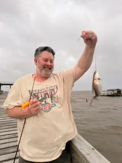
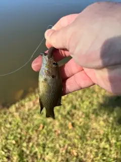
uploaded by: rich77

uploaded by: rich77

uploaded by: rich77

uploaded by: Rex_Ursus

uploaded by: bandedwd

uploaded by: Trey Cowan

uploaded by: Trey Cowan

uploaded by: Trey Cowan

uploaded by: Trey Cowan

uploaded by: Michael Mayse
Best Fishing Spots in the greater Hewlett Harbor area
Beaches and Bays are ideal places for land-based fishing. If the beach is shallow and the water is clear then twilight times are usually the best times, especially when they coincide with a major or minor fishing time. Often the points on either side of a beach are the best spots. Or if the beach is large then look for irregularities in the breaking waves, indicating sandbanks and holes. We found 19 beaches and bays in this area.
Hewlett Bay - 1km , Brosewere Bay - 3km , Long Beach Road Bridge - 5km , Hicks Beach - 5km , Bannister Bay - 6km , East Atlantic Beach - 6km , Head of Bay - 6km , Long Beach - 6km , Atlantic Beach - 7km , Atlantic Beach Bridge - 7km , Middle Bay - 7km , Baldwin Bay - 8km , Randall Bay - 8km , Lido Beach - 8km , Little Bay - 9km , Bay of Fundy - 11km , Grassy Bay - 11km , Jones Bay - 11km , Merrick Bay - 11km
Harbours and Marinas can often times be productive fishing spots for land based fishing as their sheltered environment attracts a wide variety of bait fish. Similar to river mouths, harbour entrances are also great places to fish as lots of fish will move in and out with the rising and falling tides. There are 1 main harbours in this area.
Freeport Marina - 9km
We found a total of 99 potential fishing spots nearby Hewlett Harbor. Below you can find them organized on a map. Points, Headlands, Reefs, Islands, Channels, etc can all be productive fishing spots. As these are user submitted spots, there might be some errors in the exact location. You also need to cross check local fishing regulations. Some of the spots might be in or around marine reserves or other locations that cannot be fished. If you click on a location marker it will bring up some details and a quick link to google search, satellite maps and fishing times. Tip: Click/Tap on a new area to load more fishing spots.
Hewlett Point - 1km , Cauerbach Canal - 1km , Willow Pond - 1km , Grand Canal - 1km , Grant Pond - 1km , Hewlett Bay - 1km , Pearsalls Hassock - 2km , Hawlett Hassock - 2km , Brosewere Bay - 3km , Cedar Island - 3km , Cedar Island Marsh - 3km , Three Cornered Hassock - 3km , Big Hassock - 4km , Jeckyl Island - 4km , Charles Point - 4km , Crooked Creek - 4km , South Black Banks Hassock - 4km , Duck Point - 4km , Smith Pond - 4km , Simmons Hassock - 4km , Sand Bar Point - 4km , Post Marsh - 4km , Green Sedge Point - 4km , North Black Banks Hassock - 4km , Island Park Channel - 4km , Island Park Harbor - 4km , Long Beach Road Bridge - 5km , California Canal - 5km , Waukena Waterway - 5km , Shell Harbor - 5km , Uncle Daniels Point - 5km , Schodack Pond - 5km , Norton Point - 5km , Hicks Beach - 5km , The Lagoon - 5km , Bannister Bay - 6km , Bob Jones Canal - 6km , Hagen Canal - 6km , Ouimet Canal - 6km , Sarazen Canal - 6km , Conselyeas Pond - 6km , Thurston Basin - 6km , East Atlantic Beach - 6km , East Channel Islands - 6km , Sage Pond - 6km , Parsonage Island - 6km , Parsonage Cove - 6km , Head of Bay - 6km , Long Beach - 6km , Atlantic Beach - 7km , Atlantic Beach Bridge - 7km , Milburn Pond - 7km , Cinder Island - 7km , Grass Hassock - 7km , Northwest Point - 7km , North Cinder Island - 7km , Ingraham Hassock - 7km , Motts Basin - 7km , Middle Bay - 7km , Baldwin Bay - 8km , Woodclift Canal - 8km , Silver Point - 8km , Sea Dog Island - 8km , Randall Bay - 8km , Norton Basin - 8km , Motts Point - 8km , Middle Island - 8km , Long Meadow Island - 8km , Lido Beach - 8km , Black Point - 9km , Bass Channel Island (historical) - 9km , Freeport Marina - 9km , Hudson Channel - 9km , Jo Co Creek - 9km , Little Bay - 9km , Alder Island - 10km , Long Creek Bridge - 10km , Stadium Park Canal - 10km , Sommerville Basin - 10km , North Meadow Island - 10km , East Meadow Pond - 10km , Big Mucks Creek - 10km , Fighting Island - 10km , East Aler Island - 10km , Conchs Hole Point - 10km , Baisley Pond - 10km , Bay of Fundy - 11km , Winhole Point - 11km , Grassy Bay - 11km , Green Point - 11km , Winhole Hassock - 11km , Mullener Pond - 11km , Jones Bay - 11km , West Crow Island - 11km , Merrick Point - 11km , Meadow Island - 11km , Merrick Bay - 11km , Vernam Basin - 11km , Brant Point - 11km
Comments