
Irmo 🇺🇸
-
Nautical Twilight begins:06:15 amSunrise:07:08 am
-
Sunset:07:31 pmNautical Twilight ends:08:24 pm
-
Moonrise:01:38 am
-
Moonset:04:46 pm
-
Moon over:09:12 am
-
Moon under:09:46 pm
-
Visibility:26%
-
 Waning Crescent
-
Distance to earth:374,096 kmProximity:74.2 %
Moon Phases for Irmo
-
good Day
-
minor Time:12:38 am - 02:38 am
-
major Time:08:12 am - 10:12 am
-
minor Time:03:46 pm - 05:46 pm
-
major Time:08:46 pm - 10:46 pm
| Date | Major Bite Times | Minor Bite Times | Sun | Moon | Moonphase |
|---|---|---|---|---|---|
|
Tue, 16 Sep
|
08:12 am -
10:12 am
08:46 pm -
10:46 pm
|
12:38 am -
02:38 am
03:46 pm -
05:46 pm
|
R: 07:08 am S: 07:31 pm |
R: 01:38 am S: 04:46 pm |
Waning Crescent |
|
Wed, 17 Sep
|
09:06 am -
11:06 am
09:40 pm -
11:40 pm
|
01:46 am -
03:46 am
04:26 pm -
06:26 pm
|
R: 07:08 am S: 07:30 pm |
R: 02:46 am S: 05:26 pm |
Waning Crescent |
|
Thu, 18 Sep
|
09:56 am -
11:56 am
10:28 pm -
12:28 am
|
02:53 am -
04:53 am
04:59 pm -
06:59 pm
|
R: 07:09 am S: 07:28 pm |
R: 03:53 am S: 05:59 pm |
Waning Crescent |
|
Fri, 19 Sep
|
10:42 am -
12:42 pm
11:13 pm -
01:13 am
|
03:57 am -
05:57 am
05:27 pm -
07:27 pm
|
R: 07:10 am S: 07:27 pm |
R: 04:57 am S: 06:27 pm |
Waning Crescent |
|
Sat, 20 Sep
|
11:25 am -
01:25 pm
10:55 pm -
12:55 am
|
04:58 am -
06:58 am
05:53 pm -
07:53 pm
|
R: 07:11 am S: 07:25 pm |
R: 05:58 am S: 06:53 pm |
New Moon |
|
Sun, 21 Sep
|
12:07 pm -
02:07 pm
11:38 pm -
01:38 am
|
05:57 am -
07:57 am
06:17 pm -
08:17 pm
|
R: 07:11 am S: 07:24 pm |
R: 06:57 am S: 07:17 pm |
New Moon |
|
Mon, 22 Sep
|
12:19 am -
02:19 am
12:48 pm -
02:48 pm
|
06:55 am -
08:55 am
06:41 pm -
08:41 pm
|
R: 07:12 am S: 07:23 pm |
R: 07:55 am S: 07:41 pm |
New Moon |


uploaded by: Heathen Monk

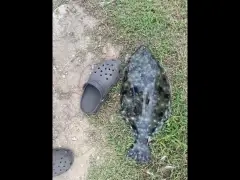
uploaded by: Flounder pounder

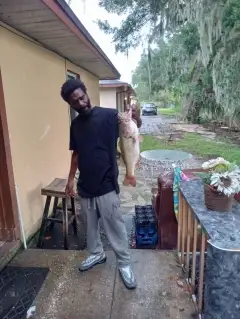
uploaded by: Stephen Spencer

uploaded by: Jon “Kuse”

uploaded by: Elzen Harris

uploaded by: RAMason69

uploaded by: Steven Butcheck

uploaded by: Joey Piercefield

uploaded by: Hoza

uploaded by: John Matthews
Best Fishing Spots in the greater Irmo area
We found a total of 70 potential fishing spots nearby Irmo. Below you can find them organized on a map. Points, Headlands, Reefs, Islands, Channels, etc can all be productive fishing spots. As these are user submitted spots, there might be some errors in the exact location. You also need to cross check local fishing regulations. Some of the spots might be in or around marine reserves or other locations that cannot be fished. If you click on a location marker it will bring up some details and a quick link to google search, satellite maps and fishing times. Tip: Click/Tap on a new area to load more fishing spots.
Lake Quail Valley Dam D-1277 - 2km , Coldstream Pond Dam - 2km , Harbison New Town Lake A D-0057 Dam - 3km , South Carolina Noname 32088 Dam - 3km , South Carolina Noname 32095 D-1705 Dam - 3km , Whitehall Subdivision Complex Dam - 3km , South Carolina Noname 32080 D-0957 Dam - 5km , Saluda Dam - 5km , Rocky Point - 5km , Corley Island - 5km , Lake Murray Dam - 5km , Bookman Island - 8km , Susie Ebert Island - 8km , Hickory Island - 8km , South Carolina Noname 40092 D-0542 Dam - 8km , Boatrights Island - 9km , Jim Spence Islands - 9km , Main Line Ditch - 9km , Quail Hollow Lake Number Two Dam D-4010 - 10km , Quail Hollow Lake Number One Dam D-4009 - 10km , Wetze Pond D-0540 Dam - 10km , South Carolina Noname 32087 D-1714 Dam - 11km , Shimmys Pond - 11km , South Carolina Noname 32043 D-0984 Dam - 12km , Huffman Island - 12km , Ashley Bridge - 12km , South Carolina Noname 40091 D-0273 Dam - 12km , Columbia Water Reservoir Dam - 12km , Lunch Island - 12km , Haltiwanger Island - 13km , South Carolina Noname 24007 D-1263 Dam - 13km , Bundrick Island - 13km , Columbia Canal - 13km , Lexington Mill Pond Dam - 13km , Counts Island - 13km , South Carolina Noname 32030 D-0959 Dam - 14km , South Carolina Noname 32044 D-1010 Dam - 14km , South Carolina Noname 40047 D-0543 Dam - 14km , Alcorn Dam D-0244 - 14km , Lincolnshire Community Lake D-0544 Dam - 14km , Timmerman Bridge - 14km , Georges Pond - 15km , Columbia Power Plant Dam - 15km , Hawkins Pond D-1569 Dam - 15km , Shealys Pond Dam D-1718 - 15km , Horse Pond - 15km , South Carolina Noname 32045 D-0950 Dam - 15km , South Carolina Noname 40036 D-0271 Dam - 16km , South Carolina Noname 32008 D-1717 Dam - 16km , Keels Lake D-0293 Dam - 16km , Chapin Park Dam D-1706 - 16km , Browns Bridge - 16km , Shull Island - 16km , Gervais Street Bridge - 16km , South Carolina Noname 32077 D-0951 Dam - 18km , South Carolina Noname 32101 D-1711 Dam - 18km , South Carolina Noname 40002 Dam - 18km , South Carolina Noname 40049 D-0551 Dam - 18km , South Carolina Noname 32009 D-0961 Dam - 18km , South Carolina Noname 32015 D-1719 Dam - 18km , South Carolina Noname 32002 D-0960 Dam - 18km , South Carolina Noname 32028 D-0965 Dam - 19km , Glenns Bridge - 19km , South Carolina Noname 32036 D-0953 Dam - 19km , South Carolina Noname 32031 D-0962 Dam - 19km , South Carolina Noname 32010 D-0966 Dam - 20km , South Carolina Noname 20025 D-1673 Dam - 20km , South Carolina Noname 32046 D-0944 Dam - 20km , South Carolina Noname 20024 D-1571 Dam - 20km , Smiths Pond D-0541 Dam - 20km
Comments