
Lanham 🇺🇸
-
Nautical Twilight begins:05:51 amSunrise:06:48 am
-
Sunset:07:17 pmNautical Twilight ends:08:14 pm
-
Moonrise:-
-
Moonset:03:58 pm
-
Moon over:08:10 am
-
Moon under:08:30 pm
-
Visibility:37%
-
 Third Quarter Moon
-
Distance to earth:370,142 kmProximity:83.5 %
Moon Phases for Lanham
-
average Day
-
minor Time:12:02 am - 02:02 am
-
major Time:07:10 am - 09:10 am
-
minor Time:02:58 pm - 04:58 pm
-
major Time:07:30 pm - 09:30 pm
Tide Clock
Tide Graph
Times
| Tide | Time | Height |
|---|---|---|
| high | 03:00 am | 3.44 ft |
| low | 10:36 am | 0.56 ft |
| high | 03:50 pm | 2.85 ft |
| low | 10:29 pm | 0.56 ft |
| Date | Major Bite Times | Minor Bite Times | Sun | Moon | Moonphase | Tide Times |
|---|---|---|---|---|---|---|
|
Mon, 15 Sep
|
07:10 am -
09:10 am
07:30 pm -
09:30 pm
|
12:02 am -
02:02 am
02:58 pm -
04:58 pm
|
R: 06:48 am S: 07:17 pm |
R: - S: 03:58 pm |
Third Quarter Moon |
high: 03:00 am
, 3.44 ft
, Coeff: 134
low: 10:36 am
, 0.56 ft
high: 03:50 pm
, 2.85 ft
, Coeff: 98
low: 10:29 pm
, 0.56 ft
|
|
Tue, 16 Sep
|
07:53 am -
09:53 am
08:29 pm -
10:29 pm
|
12:02 am -
02:02 am
03:44 pm -
05:44 pm
|
R: 06:49 am S: 07:15 pm |
R: 01:02 am S: 04:44 pm |
Waning Crescent |
high: 04:12 am
, 3.35 ft
, Coeff: 128
low: 11:39 am
, 0.52 ft
high: 04:59 pm
, 2.89 ft
, Coeff: 100
low: 11:39 pm
, 0.52 ft
|
|
Wed, 17 Sep
|
08:47 am -
10:47 am
09:22 pm -
11:22 pm
|
01:13 am -
03:13 am
04:21 pm -
06:21 pm
|
R: 06:50 am S: 07:14 pm |
R: 02:13 am S: 05:21 pm |
Waning Crescent |
high: 05:24 am
, 3.31 ft
, Coeff: 126
low: 12:38 pm
, 0.46 ft
high: 06:02 pm
, 2.99 ft
, Coeff: 106
|
|
Thu, 18 Sep
|
09:37 am -
11:37 am
10:11 pm -
12:11 am
|
02:23 am -
04:23 am
04:51 pm -
06:51 pm
|
R: 06:51 am S: 07:12 pm |
R: 03:23 am S: 05:51 pm |
Waning Crescent |
low: 12:43 am
, 0.46 ft
high: 06:27 am
, 3.35 ft
, Coeff: 128
low: 01:32 pm
, 0.36 ft
high: 06:58 pm
, 3.12 ft
, Coeff: 114
|
|
Fri, 19 Sep
|
10:23 am -
12:23 pm
10:56 pm -
12:56 am
|
03:31 am -
05:31 am
05:16 pm -
07:16 pm
|
R: 06:52 am S: 07:11 pm |
R: 04:31 am S: 06:16 pm |
Waning Crescent |
low: 01:42 am
, 0.33 ft
high: 07:23 am
, 3.41 ft
, Coeff: 132
low: 02:22 pm
, 0.26 ft
high: 07:50 pm
, 3.28 ft
, Coeff: 124
|
|
Sat, 20 Sep
|
11:07 am -
01:07 pm
10:36 pm -
12:36 am
|
04:36 am -
06:36 am
05:38 pm -
07:38 pm
|
R: 06:52 am S: 07:09 pm |
R: 05:36 am S: 06:38 pm |
New Moon |
low: 02:36 am
, 0.26 ft
high: 08:12 am
, 3.44 ft
, Coeff: 134
low: 03:07 pm
, 0.2 ft
high: 08:36 pm
, 3.38 ft
, Coeff: 130
|
|
Sun, 21 Sep
|
11:48 am -
01:48 pm
11:17 pm -
01:17 am
|
05:38 am -
07:38 am
05:59 pm -
07:59 pm
|
R: 06:53 am S: 07:07 pm |
R: 06:38 am S: 06:59 pm |
New Moon |
low: 03:25 am
, 0.23 ft
high: 08:57 am
, 3.44 ft
, Coeff: 134
low: 03:48 pm
, 0.2 ft
high: 09:18 pm
, 3.48 ft
, Coeff: 136
|


uploaded by: Stephen Spencer

uploaded by: Jon “Kuse”

uploaded by: Elzen Harris

uploaded by: RAMason69

uploaded by: Steven Butcheck

uploaded by: Joey Piercefield

uploaded by: Hoza

uploaded by: John Matthews

uploaded by: JoEllen Disterhaupt

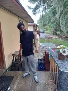
uploaded by: JoEllen Disterhaupt
Best Fishing Spots in the greater Lanham area
Wharf's or Jetties are good places to wet a line and meet other fishermen. They often produce a fresh feed of fish and are also great to catch bait fish. As they are often well lit, they also provide a good opportunity for night fishing. There are 6 wharf(s) in this area.
Magazine Wharf - 13km , Barrys Wharf (historical) - 16km , Navy Yard Wharf (historical) - 16km , Morris and Nicholson Wharf - 17km , Notley Young Wharf (historical) - 17km , Commissioners Wharf (historical) - 18km
Beaches and Bays are ideal places for land-based fishing. If the beach is shallow and the water is clear then twilight times are usually the best times, especially when they coincide with a major or minor fishing time. Often the points on either side of a beach are the best spots. Or if the beach is large then look for irregularities in the breaking waves, indicating sandbanks and holes. We found 1 beaches and bays in this area.
Bathing Beach - 18km
Harbours and Marinas can often times be productive fishing spots for land based fishing as their sheltered environment attracts a wide variety of bait fish. Similar to river mouths, harbour entrances are also great places to fish as lots of fish will move in and out with the rising and falling tides. There are 7 main harbours in this area.
Anacostia Marina - 14km, Seafairers Marina - 14km, Buzzard Point Marina - 17km, Gangplank Marina - 17km, Washington Marina - 17km, James Creek Marina - 18km, Georgetown Suites Harbour - 18km
We found a total of 100 potential fishing spots nearby Lanham. Below you can find them organized on a map. Points, Headlands, Reefs, Islands, Channels, etc can all be productive fishing spots. As these are user submitted spots, there might be some errors in the exact location. You also need to cross check local fishing regulations. Some of the spots might be in or around marine reserves or other locations that cannot be fished. If you click on a location marker it will bring up some details and a quick link to google search, satellite maps and fishing times. Tip: Click/Tap on a new area to load more fishing spots.
Greenbelt Dam - 5km , Soil Conservation Service Lake Dam - 5km , High Bridge - 8km , Northampton Lake Dam - 9km , Redington Lake Dam - 9km , Bluegill Pond - 10km , Blue Pond - 10km , Cash Creek Dam - 10km , Farm Pond - 10km , Mallard Pond - 10km , Kingman Lake - 11km , Allen Pond Dam - 11km , Duvall Bridge - 11km , Duvall Ponds - 11km , Hance Pond - 11km , Shaffners Ponds - 11km , Benning Bridge - 12km , Burnham Barrier - 12km , Charles Richard Drew Bridge - 12km , Tete Du Pont - 12km , Whitney Young Memorial Bridge - 12km , Brock Bridge - 12km , Contee Main Settling Pond Dam - 12km , Lemons Bridge (historical) - 12km , Magazine Wharf - 13km , Anacostia Marina - 14km , Anacostia Railroad Bridge - 14km , Evans Point - 14km , John Phillip Sousa Bridge - 14km , Seafairers Marina - 14km , Laurel Lake - 14km , Priest Bridge - 14km , Eleventh Street Bridge - 15km , Sixteenth Steet Bridge - 15km , Tiger Bridge - 15km , Governor Bridge - 15km , Walking Fish Pond - 15km , Officer Kevin J Welsh Memorial Bridge - 15km , Barrys Wharf (historical) - 16km , Bluff Bridge - 16km , Boulder Bridge and Ross Drive Bridge - 16km , Cantilever Bridge - 16km , Harvard Street Bridge - 16km , Market Bridge (historical) - 16km , Navy Yard Wharf (historical) - 16km , Poplar Point - 16km , Riley Spring Bridge - 16km , Rolling Meadow Bridge - 16km , Washington City Canal (historical) - 16km , Simonds Bridge - 16km , Boundary Bridge - 17km , Buzzard Point - 17km , Buzzard Point Marina - 17km , Duke Ellington Memorial Bridge - 17km , Francis Case Memorial Bridge - 17km , Frederick Douglass Memorial Bridge - 17km , Fron Bridge - 17km , Gangplank Marina - 17km , Iron Bridge - 17km , Klingle Ford Bridge - 17km , Morris and Nicholson Wharf - 17km , Notley Young Wharf (historical) - 17km , P Street Bridge - 17km , Pebble Dash Bridge - 17km , Rapids Bridge - 17km , Ripps Island (historical) - 17km , Shoreham Hill Bridge - 17km , Tenth Street Mall Bridge - 17km , Washington Marina - 17km , William Howard Taft Bridge - 17km , Woodley Bridge (historical) - 17km , Old Forge Bridge - 17km , Soldier Lake Dam - 17km , Arland D Williams Junior Memorial Bridge - 18km , Babcock Lakes (historical) - 18km , Bathing Beach - 18km , Carp Pond (historical) - 18km , Commissioners Wharf (historical) - 18km , Devils Chair Bridge - 18km , Dumbarton Bridge - 18km , Greenleaf Point - 18km , Hains Point - 18km , Inlet Bridge - 18km , James Creek Marina - 18km , K Street Bridge - 18km , Kutz Bridge - 18km , Lock 1 - 18km , Lock 2 - 18km , Lock 3 - 18km , M Street Bridge - 18km , Massachusetts Avenue Bridge - 18km , Outlet Bridge - 18km , Potomac Railroad Bridge - 18km , Rochambeau Memorial Bridge - 18km , Thompsons Bridge (historical) - 18km , Burba Lake Dam - 18km , Queen Anne Bridge - 18km , Georgetown Suites Harbour - 18km , Long Bridge - 18km , Arlington Memorial Bridge - 19km
Comments