McLendon-Chisholm 🇺🇸
-
Nautical Twilight begins:06:16 amSunrise:07:08 am
-
Sunset:07:33 pmNautical Twilight ends:08:25 pm
-
Moonrise:12:40 am
-
Moonset:03:57 pm
-
Moon over:08:18 am
-
Moon under:08:51 pm
-
Visibility:36%
-
 Third Quarter Moon
-
Distance to earth:370,293 kmProximity:83.1 %
Moon Phases for McLendon-Chisholm
-
average Day
-
major Time:07:18 am - 09:18 am
-
minor Time:02:57 pm - 04:57 pm
-
major Time:07:51 pm - 09:51 pm
-
minor Time:11:40 pm - 01:40 am
| Date | Major Bite Times | Minor Bite Times | Sun | Moon | Moonphase |
|---|---|---|---|---|---|
|
Mon, 15 Sep
|
07:18 am -
09:18 am
07:51 pm -
09:51 pm
|
02:57 pm -
04:57 pm
11:40 pm -
01:40 am
|
R: 07:08 am S: 07:33 pm |
R: 12:40 am S: 03:57 pm |
Third Quarter Moon |
|
Tue, 16 Sep
|
08:15 am -
10:15 am
08:49 pm -
10:49 pm
|
12:46 am -
02:46 am
03:45 pm -
05:45 pm
|
R: 07:09 am S: 07:31 pm |
R: 01:46 am S: 04:45 pm |
Waning Crescent |
|
Wed, 17 Sep
|
09:09 am -
11:09 am
09:42 pm -
11:42 pm
|
01:53 am -
03:53 am
04:26 pm -
06:26 pm
|
R: 07:10 am S: 07:30 pm |
R: 02:53 am S: 05:26 pm |
Waning Crescent |
|
Thu, 18 Sep
|
09:59 am -
11:59 am
10:31 pm -
12:31 am
|
02:59 am -
04:59 am
04:59 pm -
06:59 pm
|
R: 07:10 am S: 07:29 pm |
R: 03:59 am S: 05:59 pm |
Waning Crescent |
|
Fri, 19 Sep
|
10:45 am -
12:45 pm
11:15 pm -
01:15 am
|
04:02 am -
06:02 am
05:28 pm -
07:28 pm
|
R: 07:11 am S: 07:27 pm |
R: 05:02 am S: 06:28 pm |
Waning Crescent |
|
Sat, 20 Sep
|
11:28 am -
01:28 pm
10:58 pm -
12:58 am
|
05:02 am -
07:02 am
05:54 pm -
07:54 pm
|
R: 07:12 am S: 07:26 pm |
R: 06:02 am S: 06:54 pm |
New Moon |
|
Sun, 21 Sep
|
12:10 pm -
02:10 pm
11:41 pm -
01:41 am
|
06:01 am -
08:01 am
06:19 pm -
08:19 pm
|
R: 07:12 am S: 07:25 pm |
R: 07:01 am S: 07:19 pm |
New Moon |


uploaded by: Stephen Spencer

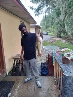
uploaded by: Jon “Kuse”

uploaded by: Elzen Harris

uploaded by: RAMason69

uploaded by: Steven Butcheck

uploaded by: Joey Piercefield

uploaded by: Hoza

uploaded by: John Matthews

uploaded by: JoEllen Disterhaupt

uploaded by: JoEllen Disterhaupt
Best Fishing Spots in the greater McLendon-Chisholm area
Harbours and Marinas can often times be productive fishing spots for land based fishing as their sheltered environment attracts a wide variety of bait fish. Similar to river mouths, harbour entrances are also great places to fish as lots of fish will move in and out with the rising and falling tides. There are 1 main harbours in this area.
Porter Lake Dam - 13km
We found a total of 61 potential fishing spots nearby McLendon-Chisholm. Below you can find them organized on a map. Points, Headlands, Reefs, Islands, Channels, etc can all be productive fishing spots. As these are user submitted spots, there might be some errors in the exact location. You also need to cross check local fishing regulations. Some of the spots might be in or around marine reserves or other locations that cannot be fished. If you click on a location marker it will bring up some details and a quick link to google search, satellite maps and fishing times. Tip: Click/Tap on a new area to load more fishing spots.
Soil Conservation Service Site 8 Dam - 1km , Soil Conservation Service Site 14a Dam - 2km , Soil Conservation Service Site 11 Dam - 3km , Soil Conservation Service Site 7 Dam - 4km , Soil Conservation Service Site 6 Dam - 4km , Soil Conservation Service Site 15 Dam - 4km , Soil Conservation Service Site 13 Dam - 4km , Soil Conservation Service Site 16 Dam - 5km , Soil Conservation Service Site 5 Dam - 5km , Soil Conservation Service Site 18 Dam - 5km , Soil Conservation Service Site 4 Dam - 6km , Soil Conservation Service Site 3 Dam - 6km , University Park Lake Dam - 7km , Soil Conservation Service Site 16a Dam - 7km , Soil Conservation Service Site 5c Dam - 7km , Soil Conservation Service Site 2 Dam - 7km , Roberts Lake Dam - 7km , Soil Conservation Service Site 1b Dam - 8km , Soil Conservation Service Site 1a Dam - 8km , Soil Conservation Service Site 19 Dam - 8km , Soil Conservation Service Site 5b Dam - 8km , Soil Conservation Service Site 5a Dam - 8km , Soil Conservation Service Site 9 Dam - 8km , Soil Conservation Service Site 9a Dam - 9km , Rainbow Lake - 9km , Soil Conservation Service Site 21a Dam - 10km , Soil Conservation Service Site 10 Dam - 10km , Terrell Country Club Lake Dam - 10km , Soil Conservation Service Site 4a Dam - 11km , Soil Conservation Service Site 3g Dam - 11km , Tawakoni Balancing Reservoir Levee - 11km , Greenes Lake Dam - 12km , Soil Conservation Service Site 4b Dam - 13km , Porter Lake Dam - 13km , Rockwall-Forney Dam - 13km , Rockwell-Forney Dam - 13km , Soil Conservation Service Site 3f Dam - 13km , Corder Lake - 13km , Thompson Slough - 13km , North Haven Construction Company Lake Dam - 14km , Soil Conservation Service Site 3e Dam - 14km , Soil Conservation Service Site 3c Dam - 15km , Soil Conservation Service Site 3b Dam - 16km , Soil Conservation Service Site 11d Dam - 16km , Soil Conservation Service Site 11f Dam - 16km , Mathew Lake Dam - 16km , Sampeck Lake Dam - 17km , Soil Conservation Service Site 3a Dam - 17km , Soil Conservation Service Site 11g Dam - 17km , Soil Conservation Service Site 11b Dam - 18km , Soil Conservation Service Site 50c Dam - 18km , Boyd Lake Dam - 19km , Soil Conservation Service Site 31 Dam - 19km , Soil Conservation Service Site 12 Dam - 19km , Soil Conservation Service Site 11h Dam - 19km , Soil Conservation Service Site 11a Dam - 19km , Murphy Lake Dam - 19km , Soil Conservation Service Site 32 Dam - 20km , Soil Conservation Service Site 11k Dam - 20km , Soil Conservation Service Site 1 Dam - 20km , Wilson Lake - 20km
Comments