


Millbourne 🇺🇸
-
Nautical Twilight begins:05:47 amSunrise:06:45 am
-
Sunset:07:04 pmNautical Twilight ends:08:02 pm
-
Moonrise:04:22 am
-
Moonset:06:10 pm
-
Moon over:11:16 am
-
Moon under:11:49 pm
-
Visibility:5%
-
 Waning Crescent
-
Distance to earth:388,003 kmProximity:41.5 %
Moon Phases for Millbourne
-
average Day
-
minor Time:03:22 am - 05:22 am
-
major Time:10:16 am - 12:16 pm
-
minor Time:
 05:10 pm -
07:10 pm
05:10 pm -
07:10 pm
-
major Time:10:49 pm - 12:49 am
Tide Clock
Tide Graph
Times
| Tide | Time | Height |
|---|---|---|
| low | 06:59 am | 0.49 ft |
| high | 12:11 pm | 6.27 ft |
| low | 07:08 pm | 0.56 ft |
| Date | Major Bite Times | Minor Bite Times | Sun | Moon | Moonphase | Tide Times |
|---|---|---|---|---|---|---|
|
Fri, 19 Sep
|
10:16 am -
12:16 pm
10:49 pm -
12:49 am
|
03:22 am -
05:22 am
05:10 pm -
07:10 pm
|
R: 06:45 am S: 07:04 pm |
R: 04:22 am S: 06:10 pm |
Waning Crescent |
low: 06:59 am
, 0.49 ft
high: 12:11 pm
, 6.27 ft
, Coeff: 97
low: 07:08 pm
, 0.56 ft
|
|
Sat, 20 Sep
|
11:00 am -
01:00 pm
10:28 pm -
12:28 am
|
04:28 am -
06:28 am
05:32 pm -
07:32 pm
|
R: 06:46 am S: 07:03 pm |
R: 05:28 am S: 06:32 pm |
New Moon |
high: 12:33 am
, 6.89 ft
, Coeff: 114
low: 07:47 am
, 0.43 ft
high: 12:59 pm
, 6.46 ft
, Coeff: 102
low: 07:58 pm
, 0.56 ft
|
|
Sun, 21 Sep
|
11:41 am -
01:41 pm
11:09 pm -
01:09 am
|
05:31 am -
07:31 am
05:52 pm -
07:52 pm
|
R: 06:47 am S: 07:01 pm |
R: 06:31 am S: 06:52 pm |
New Moon |
high: 01:19 am
, 6.86 ft
, Coeff: 114
low: 08:31 am
, 0.43 ft
high: 01:44 pm
, 6.59 ft
, Coeff: 106
low: 08:45 pm
, 0.56 ft
|
|
Mon, 22 Sep
|
12:23 pm -
02:23 pm
11:52 pm -
01:52 am
|
06:34 am -
08:34 am
06:12 pm -
08:12 pm
|
R: 06:48 am S: 06:59 pm |
R: 07:34 am S: 07:12 pm |
New Moon |
high: 02:02 am
, 6.73 ft
, Coeff: 110
low: 09:12 am
, 0.49 ft
high: 02:26 pm
, 6.66 ft
, Coeff: 108
low: 09:30 pm
, 0.62 ft
|
|
Tue, 23 Sep
|
12:33 am -
02:33 am
01:04 pm -
03:04 pm
|
07:35 am -
09:35 am
06:33 pm -
08:33 pm
|
R: 06:49 am S: 06:58 pm |
R: 08:35 am S: 07:33 pm |
New Moon |
high: 02:44 am
, 6.59 ft
, Coeff: 106
low: 09:51 am
, 0.59 ft
high: 03:06 pm
, 6.69 ft
, Coeff: 109
low: 10:14 pm
, 0.69 ft
|
|
Wed, 24 Sep
|
01:16 am -
03:16 am
01:47 pm -
03:47 pm
|
08:37 am -
10:37 am
06:57 pm -
08:57 pm
|
R: 06:50 am S: 06:56 pm |
R: 09:37 am S: 07:57 pm |
Waxing Crescent |
high: 03:26 am
, 6.4 ft
, Coeff: 101
low: 10:28 am
, 0.69 ft
high: 03:45 pm
, 6.69 ft
, Coeff: 109
low: 10:56 pm
, 0.75 ft
|
|
Thu, 25 Sep
|
01:59 am -
03:59 am
02:31 pm -
04:31 pm
|
09:39 am -
11:39 am
07:23 pm -
09:23 pm
|
R: 06:51 am S: 06:54 pm |
R: 10:39 am S: 08:23 pm |
Waxing Crescent |
high: 04:08 am
, 6.17 ft
, Coeff: 94
low: 11:04 am
, 0.79 ft
high: 04:25 pm
, 6.66 ft
, Coeff: 108
low: 11:39 pm
, 0.82 ft
|


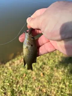
uploaded by: Jeff Bollenbacher

uploaded by: Salim Jamia

uploaded by: rich77

uploaded by: rich77

uploaded by: rich77

uploaded by: Rex_Ursus

uploaded by: bandedwd

uploaded by: Trey Cowan

uploaded by: Trey Cowan

uploaded by: Trey Cowan
Best Fishing Spots in the greater Millbourne area
We found a total of 100 potential fishing spots nearby Millbourne. Below you can find them organized on a map. Points, Headlands, Reefs, Islands, Channels, etc can all be productive fishing spots. As these are user submitted spots, there might be some errors in the exact location. You also need to cross check local fishing regulations. Some of the spots might be in or around marine reserves or other locations that cannot be fished. If you click on a location marker it will bring up some details and a quick link to google search, satellite maps and fishing times. Tip: Click/Tap on a new area to load more fishing spots.
Millbourne Dam - 1km , Concourse Lake - 3km , Naylors Run Dam - 3km , Centennial Lake - 4km , Columbia Bridge - 5km , Fairmount Dam - 5km , Gibson Point - 5km , Girard Bridge - 5km , Kent Dam - 5km , University Avenue Bridge - 5km , Girard Avenue Bridge - 5km , Strawberry Bridge - 6km , Harkness Point - 7km , Point Breeze - 7km , Yankee Point - 7km , Falls Bridge - 7km , Green Lane Bridge - 7km , Griscom Dam - 7km , Gustine Lake - 7km , Register Dam - 7km , Pencoyd Bridge - 7km , Dove Lake - 8km , Dove Lake Dam - 8km , Flat Rock Dam - 8km , Henry Avenue Bridge - 8km , Lock Number Sixty-Eight - 8km , Platt Memorial Bridge - 8km , Manayunk Canal - 8km , Big Thoroughfare - 9km , Girard Point - 9km , Hay Island - 9km , Little Thoroughfare - 9km , Meadow Lake - 9km , Province Island - 9km , Lake Lenape Dam - 9km , Trout Lake Dam - 9km , Walnut Lane Bridge - 9km , Girard Point Bridge - 9km , Franklin Bridge - 10km , Benjamin Franklin Bridge - 10km , Calcon Hook (historical) - 10km , Greenwich Island - 10km , Pa-237 Dam - 10km , Reserve Basin - 10km , Smith Island - 10km , Smith Island (historical) - 10km , Wind Mill Island (historical) - 10km , Devils Pool - 10km , Sinott Dam - 10km , Cooper Point - 11km , Kaighn Point - 11km , Crum Creek Dam - 11km , Hog Island - 11km , Tinicum Island (historical) - 11km , Joyce Dam - 11km , Margaree Dam - 11km , Morris Estate Dam - 11km , Eagle Point - 12km , Lodge Point - 12km , Washington Point Neck - 12km , Whitman Bridge - 12km , Geist Storage Dam - 12km , Greenwich Point - 12km , Walt Whitman Bridge - 12km , Windy Point - 12km , Mitchell Dam - 12km , Bramell Point - 13km , Gloucester Point - 13km , Main Ditch - 13km , Petty Island - 13km , White Bridge - 13km , Broomall Lake Dam - 13km , Broomalls Dam - 13km , Little Tinicum Island - 13km , Earles Lake - 13km , George H Earle Junior Dam - 13km , Green Countrie Dam - 13km , Howell Cove - 13km , Camden and Petty Island Bridge - 14km , Crab Point - 14km , Lake Martha - 14km , Red Bridge - 14km , Thompson Point - 14km , Long Point - 14km , Debris Dam - 14km , Middle Dam - 14km , Morris Dam - 14km , Plymouth Dam - 14km , Sherry Lake - 14km , Upper Dam - 14km , Aunt Debs Ditch - 15km , Bell Lake - 15km , Betsy Ross Fixed Bridge - 15km , Cooper River Parkway Dam - 15km , Fisher Point - 15km , Monds Island - 15km , Sand Ditch - 15km , Mill Dam - 15km , Pa-219 Dam - 15km , Mill Club Dam - 15km
Comments