
Sherman Oaks 🇺🇸
-
Nautical Twilight begins:05:43 amSunrise:06:36 am
-
Sunset:07:01 pmNautical Twilight ends:07:55 pm
-
Moonrise:12:07 am
-
Moonset:03:33 pm
-
Moon over:07:50 am
-
Moon under:08:24 pm
-
Visibility:35%
-
 Third Quarter Moon
-
Distance to earth:370,600 kmProximity:82.4 %
Moon Phases for Sherman Oaks
-
average Day
-
major Time:06:50 am - 08:50 am
-
minor Time:02:33 pm - 04:33 pm
-
major Time:07:24 pm - 09:24 pm
-
minor Time:11:07 pm - 01:07 am
Tide Clock
Tide Graph
Times
| Tide | Time | Height |
|---|---|---|
| high | 07:09 am | 3.67 ft |
| low | 10:34 am | 3.28 ft |
| high | 04:52 pm | 5.48 ft |
| Date | Major Bite Times | Minor Bite Times | Sun | Moon | Moonphase | Tide Times |
|---|---|---|---|---|---|---|
|
Mon, 15 Sep
|
06:50 am -
08:50 am
07:24 pm -
09:24 pm
|
02:33 pm -
04:33 pm
11:07 pm -
01:07 am
|
R: 06:36 am S: 07:01 pm |
R: 12:07 am S: 03:33 pm |
Third Quarter Moon |
high: 07:09 am
, 3.67 ft
, Coeff: 50
low: 10:34 am
, 3.28 ft
high: 04:52 pm
, 5.48 ft
, Coeff: 114
|
|
Tue, 16 Sep
|
07:47 am -
09:47 am
08:21 pm -
10:21 pm
|
12:14 am -
02:14 am
03:20 pm -
05:20 pm
|
R: 06:37 am S: 07:00 pm |
R: 01:14 am S: 04:20 pm |
Waning Crescent |
low: 12:42 am
, -0.1 ft
high: 07:45 am
, 4.07 ft
, Coeff: 64
low: 12:10 pm
, 2.92 ft
high: 06:09 pm
, 5.68 ft
, Coeff: 121
|
|
Wed, 17 Sep
|
08:40 am -
10:40 am
09:14 pm -
11:14 pm
|
01:21 am -
03:21 am
03:59 pm -
05:59 pm
|
R: 06:38 am S: 06:59 pm |
R: 02:21 am S: 04:59 pm |
Waning Crescent |
low: 01:31 am
, -0.33 ft
high: 08:15 am
, 4.36 ft
, Coeff: 75
low: 01:11 pm
, 2.43 ft
high: 07:08 pm
, 5.84 ft
, Coeff: 127
|
|
Thu, 18 Sep
|
09:30 am -
11:30 am
10:02 pm -
12:02 am
|
02:29 am -
04:29 am
04:32 pm -
06:32 pm
|
R: 06:38 am S: 06:57 pm |
R: 03:29 am S: 05:32 pm |
Waning Crescent |
low: 02:11 am
, -0.36 ft
high: 08:41 am
, 4.66 ft
, Coeff: 85
low: 01:57 pm
, 1.94 ft
high: 07:56 pm
, 5.94 ft
, Coeff: 130
|
|
Fri, 19 Sep
|
10:15 am -
12:15 pm
10:46 pm -
12:46 am
|
03:32 am -
05:32 am
04:59 pm -
06:59 pm
|
R: 06:39 am S: 06:56 pm |
R: 04:32 am S: 05:59 pm |
Waning Crescent |
low: 02:44 am
, -0.26 ft
high: 09:06 am
, 4.89 ft
, Coeff: 93
low: 02:37 pm
, 1.51 ft
high: 08:37 pm
, 5.84 ft
, Coeff: 127
|
|
Sat, 20 Sep
|
10:59 am -
12:59 pm
11:28 pm -
01:28 am
|
04:34 am -
06:34 am
05:24 pm -
07:24 pm
|
R: 06:40 am S: 06:54 pm |
R: 05:34 am S: 06:24 pm |
New Moon |
low: 03:12 am
, -0 ft
high: 09:28 am
, 5.12 ft
, Coeff: 101
low: 03:14 pm
, 1.15 ft
high: 09:15 pm
, 5.64 ft
, Coeff: 120
|
|
Sun, 21 Sep
|
11:40 am -
01:40 pm
11:11 pm -
01:11 am
|
05:32 am -
07:32 am
05:49 pm -
07:49 pm
|
R: 06:40 am S: 06:53 pm |
R: 06:32 am S: 06:49 pm |
New Moon |
low: 03:36 am
, 0.33 ft
high: 09:50 am
, 5.28 ft
, Coeff: 107
low: 03:49 pm
, 0.92 ft
high: 09:50 pm
, 5.31 ft
, Coeff: 108
|


uploaded by: Stephen Spencer

uploaded by: Jon “Kuse”

uploaded by: Elzen Harris

uploaded by: RAMason69

uploaded by: Steven Butcheck

uploaded by: Joey Piercefield

uploaded by: Hoza

uploaded by: John Matthews

uploaded by: JoEllen Disterhaupt

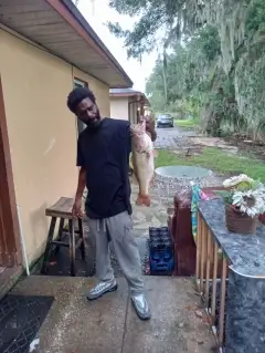
uploaded by: JoEllen Disterhaupt
Best Fishing Spots in the greater Sherman Oaks area
Beaches and Bays are ideal places for land-based fishing. If the beach is shallow and the water is clear then twilight times are usually the best times, especially when they coincide with a major or minor fishing time. Often the points on either side of a beach are the best spots. Or if the beach is large then look for irregularities in the breaking waves, indicating sandbanks and holes. We found 5 beaches and bays in this area.
Palisades Beach - 15km , Castle Rock Beach - 16km , Topanga Beach - 17km , Las Tunas Beach - 18km , Big Rock Beach - 20km
Harbours and Marinas can often times be productive fishing spots for land based fishing as their sheltered environment attracts a wide variety of bait fish. Similar to river mouths, harbour entrances are also great places to fish as lots of fish will move in and out with the rising and falling tides. There are 10 main harbours in this area.
Porter Estate 775 Dam - 16km, Basin E - 19km, Basin C - 19km, Basin D - 19km, Basin F - 19km, Basin G - 19km, Basin H - 19km, Marina del Rey - 20km, Basin A - 20km, Basin B - 20km
We found a total of 78 potential fishing spots nearby Sherman Oaks. Below you can find them organized on a map. Points, Headlands, Reefs, Islands, Channels, etc can all be productive fishing spots. As these are user submitted spots, there might be some errors in the exact location. You also need to cross check local fishing regulations. Some of the spots might be in or around marine reserves or other locations that cannot be fished. If you click on a location marker it will bring up some details and a quick link to google search, satellite maps and fishing times. Tip: Click/Tap on a new area to load more fishing spots.
Sepulveda Dam - 3km , Upper Stone Canyon 6-044 Dam - 4km , Stone Canyon 6-025 Dam - 5km , Upper Franklin 6-027 Dam - 5km , Encino 6-007 Dam - 6km , Lower Franklin 6-014 Dam - 7km , Sawtelle Pressure Break Reservoir 6-021 Dam - 8km , Greystone Reservoir 1061 Dam - 8km , Toluca Lake - 9km , Pacoima Diversion Channel - 10km , Upper Hollywood 6-029 Dam - 11km , Mulholland 6-017 Dam - 11km , Hansen Heights Channel - 12km , La Tuna Canyon Lateral - 12km , Riviera Reservoir 1043 Dam - 12km , Burbank Western Channel - 13km , Reservoir Number 5 4-007 Dam - 13km , Reservoir Number 4 4-006 Dam - 14km , Middle Lake - 14km , Santa Ynez Canyon 6-047 Dam - 14km , Redwing Lake - 14km , Stough Debris Dam - 14km , Hansen Dam - 14km , J W Wisda 1-067 Dam - 14km , Inspiration Point - 15km , Santa Ynez Lake - 15km , Sunset Debris Dam - 15km , La Tuna Debris Dam - 15km , Lower San Fernando 6-015 Dam - 15km , Reservoir Number 1 4-004 Dam - 15km , Palisades Beach - 15km , Green Verdugo 6-043 Dam - 16km , Los Angeles Reservoir 6-050 Dam - 16km , Lower Van Norman Bypass 6-048 Dam - 16km , Porter Estate 775 Dam - 16km , 10th and Western 5-004 Dam - 16km , Brand Debris Dam - 16km , Castle Rock Beach - 16km , Channel Diversion Dike 6-039 Dam - 16km , Brand Park 5-000 Dam - 17km , Yarnell Debris Basin 6-046 Dam - 17km , Rowena 6-018 Dam - 17km , Upper San Fernando 6-028 Dam - 17km , Topanga Beach - 17km , Monteria Lake - 17km , Lopez Dam - 17km , Chatsworth Hi-Line Aqueduct - 17km , Childs Canyon Debris Dam - 17km , Elmwood Debris Dam - 17km , Hillcrest Canyon Debris Dam - 17km , Haines Canyon Channel - 18km , Sepulveda Channel - 18km , Silver Lake 6-051 Dam - 18km , Las Tunas Beach - 18km , Basin E - 19km , Grand Canal - 19km , Basin C - 19km , Schoolhouse Debris Dam - 19km , Basin D - 19km , Basin F - 19km , Basin G - 19km , Basin H - 19km , Blanchard Canyon Channel - 19km , Diederich Reservoir 5-006 Dam - 19km , Centinela Creek Channel - 19km , Chatsworth 6-004 Dam - 19km , Saint Francis Dam - 20km , Wilson Debris Dam - 20km , Marina del Rey - 20km , Haines Canyon Debris Dam - 20km , Dunsmore Canyon Channel - 20km , Ballona Lagoon - 20km , Cooks Canyon Channel - 20km , Basin A - 20km , Basin B - 20km , Blanchard Debris Dam - 20km , Big Rock - 20km , Big Rock Beach - 20km
Comments