
Topsfield 🇺🇸
-
Nautical Twilight begins:05:23 amSunrise:06:23 am
-
Sunset:06:55 pmNautical Twilight ends:07:55 pm
-
Moonrise:-
-
Moonset:03:49 pm
-
Moon over:07:45 am
-
Moon under:08:05 pm
-
Visibility:37%
-
 Third Quarter Moon
-
Distance to earth:370,142 kmProximity:83.5 %
Moon Phases for Topsfield
-
average Day
-
major Time:06:45 am - 08:45 am
-
minor Time:02:49 pm - 04:49 pm
-
major Time:07:05 pm - 09:05 pm
-
minor Time:11:22 pm - 01:22 am
Tide Clock
Tide Graph
Times
| Tide | Time | Height |
|---|---|---|
| high | 06:07 am | 8.3 ft |
| low | 11:59 am | 1.25 ft |
| high | 06:24 pm | 9.65 ft |
| Date | Major Bite Times | Minor Bite Times | Sun | Moon | Moonphase | Tide Times |
|---|---|---|---|---|---|---|
|
Mon, 15 Sep
|
06:45 am -
08:45 am
07:05 pm -
09:05 pm
|
02:49 pm -
04:49 pm
11:22 pm -
01:22 am
|
R: 06:23 am S: 06:55 pm |
R: - S: 03:49 pm |
Third Quarter Moon |
high: 06:07 am
, 8.3 ft
, Coeff: 89
low: 11:59 am
, 1.25 ft
high: 06:24 pm
, 9.65 ft
, Coeff: 116
|
|
Tue, 16 Sep
|
07:27 am -
09:27 am
08:04 pm -
10:04 pm
|
03:33 pm -
05:33 pm
11:22 pm -
01:22 am
|
R: 06:24 am S: 06:53 pm |
R: 12:22 am S: 04:33 pm |
Waning Crescent |
low: 12:52 am
, 0.43 ft
high: 07:17 am
, 8.14 ft
, Coeff: 85
low: 01:05 pm
, 1.41 ft
high: 07:33 pm
, 9.48 ft
, Coeff: 113
|
|
Wed, 17 Sep
|
08:21 am -
10:21 am
08:58 pm -
10:58 pm
|
12:35 am -
02:35 am
04:08 pm -
06:08 pm
|
R: 06:25 am S: 06:51 pm |
R: 01:35 am S: 05:08 pm |
Waning Crescent |
low: 02:00 am
, 0.49 ft
high: 08:25 am
, 8.23 ft
, Coeff: 87
low: 02:12 pm
, 1.35 ft
high: 08:40 pm
, 9.48 ft
, Coeff: 113
|
|
Thu, 18 Sep
|
09:11 am -
11:11 am
09:47 pm -
11:47 pm
|
01:48 am -
03:48 am
04:35 pm -
06:35 pm
|
R: 06:26 am S: 06:50 pm |
R: 02:48 am S: 05:35 pm |
Waning Crescent |
low: 03:03 am
, 0.43 ft
high: 09:27 am
, 8.5 ft
, Coeff: 93
low: 03:15 pm
, 1.08 ft
high: 09:41 pm
, 9.58 ft
, Coeff: 115
|
|
Fri, 19 Sep
|
09:58 am -
11:58 am
10:32 pm -
12:32 am
|
02:59 am -
04:59 am
04:57 pm -
06:57 pm
|
R: 06:27 am S: 06:48 pm |
R: 03:59 am S: 05:57 pm |
Waning Crescent |
low: 03:58 am
, 0.26 ft
high: 10:20 am
, 8.83 ft
, Coeff: 99
low: 04:10 pm
, 0.75 ft
high: 10:34 pm
, 9.68 ft
, Coeff: 117
|
|
Sat, 20 Sep
|
10:41 am -
12:41 pm
11:14 pm -
01:14 am
|
04:07 am -
06:07 am
05:16 pm -
07:16 pm
|
R: 06:28 am S: 06:46 pm |
R: 05:07 am S: 06:16 pm |
New Moon |
low: 04:45 am
, 0.16 ft
high: 11:05 am
, 9.15 ft
, Coeff: 106
low: 04:59 pm
, 0.49 ft
high: 11:20 pm
, 9.71 ft
, Coeff: 117
|
|
Sun, 21 Sep
|
11:23 am -
01:23 pm
10:51 pm -
12:51 am
|
05:13 am -
07:13 am
05:34 pm -
07:34 pm
|
R: 06:29 am S: 06:44 pm |
R: 06:13 am S: 06:34 pm |
New Moon |
low: 05:26 am
, 0.16 ft
high: 11:46 am
, 9.35 ft
, Coeff: 110
low: 05:43 pm
, 0.3 ft
|


uploaded by: Heathen Monk

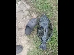
uploaded by: Flounder pounder

uploaded by: Stephen Spencer

uploaded by: Jon “Kuse”

uploaded by: Elzen Harris

uploaded by: RAMason69

uploaded by: Steven Butcheck

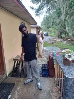
uploaded by: Joey Piercefield

uploaded by: Hoza

uploaded by: John Matthews
Topsfild,tapsfyld, masachwst,Топсфилд,تاپسفیلد، ماساچوست
Best Fishing Spots in the greater Topsfield area
Beaches and Bays are ideal places for land-based fishing. If the beach is shallow and the water is clear then twilight times are usually the best times, especially when they coincide with a major or minor fishing time. Often the points on either side of a beach are the best spots. Or if the beach is large then look for irregularities in the breaking waves, indicating sandbanks and holes. We found 2 beaches and bays in this area.
Dane Street Beach - 12km , Fort Pickering Beach - 13km
Harbours and Marinas can often times be productive fishing spots for land based fishing as their sheltered environment attracts a wide variety of bait fish. Similar to river mouths, harbour entrances are also great places to fish as lots of fish will move in and out with the rising and falling tides. There are 2 main harbours in this area.
Porter River - 10km, Porter Rock - 12km
We found a total of 98 potential fishing spots nearby Topsfield. Below you can find them organized on a map. Points, Headlands, Reefs, Islands, Channels, etc can all be productive fishing spots. As these are user submitted spots, there might be some errors in the exact location. You also need to cross check local fishing regulations. Some of the spots might be in or around marine reserves or other locations that cannot be fished. If you click on a location marker it will bring up some details and a quick link to google search, satellite maps and fishing times. Tip: Click/Tap on a new area to load more fishing spots.
Rockery Pond - 2km , Rowley Bridge - 2km , Mile Brook Dam - 2km , Averills Island - 3km , Teal Pond - 3km , Wolcott Island - 3km , Pine Island - 3km , Pintail Pond - 3km , Crooked Pond - 4km , Fish Brook Dam - 4km , Putnamville Reservoir West Dike - 4km , Putnamville Reservoir East Dike - 4km , Putnamville Reservoir Dam - 4km , Thunder Bridge - 4km , Fowlers Island - 4km , Turkey Island - 5km , Ipswich River Dam - 5km , Lowe Pond Outlet Dam - 5km , Muddy Pond - 5km , Howes Pond Dam - 5km , Boston Brook Dam - 5km , Pleasant Pond - 5km , Stevens Pond - 6km , Danvers Reservoir (historical) - 6km , Cedar Pond - 6km , Wilson Pond - 6km , Pout Pond - 6km , Fourmile Pond Dam - 6km , Hood Pond Dam - 7km , Wenham Lake - 7km , Creighton Pond Dam - 7km , Towne Pond Dam - 7km , Towne Pond - 7km , Sharpners Pond - 7km , Kimballs Pond - 8km , Upper Millpond Dam - 8km , Norwood Pond Dam - 8km , Salem Reservoir Dam - 8km , Middleton Pond Outlet Dam - 8km , Baldpate Pond Dam - 8km , Middleton Pond - 8km , Aunt Betts Pond - 8km , Cutler Pond - 8km , Emerson Brook Lake Street Dam - 8km , Longham Reservoir Outlet Dam - 8km , Bull Brook Reservoir Dam - 9km , Beverly Reservoir Dam - 9km , Dow Brook Reservoir Dam - 9km , Stiles Pond Outlet Dam - 9km , Mill Pond Dam - 9km , Lower Millpond Dam - 9km , Spofford Pond - 9km , Porter River - 10km , Stearns Pond East Dam - 10km , Stearns Pond - 10km , Beaver Pond - 10km , Choate Bridge - 10km , Shoe Pond Dam - 10km , Waters River - 10km , Farnums Mill Pond Dam - 10km , Ipswich Mills Dam - 10km , Crane River - 10km , Sudden Pond - 10km , Swan Pond - 10km , Bradford Pond - 11km , Salters Point - 11km , Fosters Point - 11km , Peters Point - 11km , Pentucket Pond Outlet Dam - 11km , Peabody Reservoir (historical) - 11km , Berry Pond - 11km , Beck Pond - 11km , Salem Pond - 11km , Elginwood Pond Dam - 11km , Elginwood Pond - 11km , Crystal Pond - 11km , Round Pond Dam - 12km , Devils Dishfull Pond Dam - 12km , Rock Pond Dam - 12km , Eagle Island - 12km , Dane Street Beach - 12km , Gravelly Pond - 12km , Coy Pond - 12km , Porter Rock - 12km , Winona Pond Dam - 12km , Beverly Harbor - 12km , Chebacco Lake - 12km , Frye Pond - 12km , Mackerel Cove - 12km , Tuck Point - 12km , Suntaug Lake - 13km , Sydneys Pond Dam - 13km , Hobbs Pond - 13km , Fort Pickering Beach - 13km , Johnsons Pond Dam - 13km , Suntaug Lake Dam - 13km , Hospital Point - 13km , Field Pond Dam - 13km
Comments