


West Nyack 🇺🇸
-
Nautical Twilight begins:05:40 amSunrise:06:39 am
-
Sunset:07:01 pmNautical Twilight ends:08:00 pm
-
Moonrise:03:05 am
-
Moonset:05:44 pm
-
Moon over:10:24 am
-
Moon under:10:59 pm
-
Visibility:10%
-
 Waning Crescent
-
Distance to earth:383,277 kmProximity:52.6 %
Moon Phases for West Nyack
-
average Day
-
minor Time:02:05 am - 04:05 am
-
major Time:09:24 am - 11:24 am
-
minor Time:04:44 pm - 06:44 pm
-
major Time:09:59 pm - 11:59 pm
Tide Clock
Tide Graph
Times
| Tide | Time | Height |
|---|---|---|
| low | 02:19 am | 0.2 ft |
| high | 08:16 am | 3.25 ft |
| low | 02:25 pm | 0.36 ft |
| high | 08:35 pm | 3.64 ft |
| Date | Major Bite Times | Minor Bite Times | Sun | Moon | Moonphase | Tide Times |
|---|---|---|---|---|---|---|
|
Thu, 18 Sep
|
09:24 am -
11:24 am
09:59 pm -
11:59 pm
|
02:05 am -
04:05 am
04:44 pm -
06:44 pm
|
R: 06:39 am S: 07:01 pm |
R: 03:05 am S: 05:44 pm |
Waning Crescent |
low: 02:19 am
, 0.2 ft
high: 08:16 am
, 3.25 ft
, Coeff: 100
low: 02:25 pm
, 0.36 ft
high: 08:35 pm
, 3.64 ft
, Coeff: 122
|
|
Fri, 19 Sep
|
10:11 am -
12:11 pm
10:45 pm -
12:45 am
|
03:15 am -
05:15 am
05:07 pm -
07:07 pm
|
R: 06:40 am S: 06:59 pm |
R: 04:15 am S: 06:07 pm |
Waning Crescent |
low: 03:07 am
, 0.1 ft
high: 09:07 am
, 3.44 ft
, Coeff: 111
low: 03:16 pm
, 0.26 ft
high: 09:22 pm
, 3.71 ft
, Coeff: 125
|
|
Sat, 20 Sep
|
10:54 am -
12:54 pm
11:26 pm -
01:26 am
|
04:22 am -
06:22 am
05:27 pm -
07:27 pm
|
R: 06:41 am S: 06:58 pm |
R: 05:22 am S: 06:27 pm |
New Moon |
low: 03:52 am
, 0 ft
high: 09:50 am
, 3.61 ft
, Coeff: 120
low: 04:04 pm
, 0.2 ft
high: 10:03 pm
, 3.71 ft
, Coeff: 125
|
|
Sun, 21 Sep
|
11:36 am -
01:36 pm
11:04 pm -
01:04 am
|
05:26 am -
07:26 am
05:47 pm -
07:47 pm
|
R: 06:42 am S: 06:56 pm |
R: 06:26 am S: 06:47 pm |
New Moon |
low: 04:33 am
, -0.03 ft
high: 10:30 am
, 3.71 ft
, Coeff: 125
low: 04:49 pm
, 0.16 ft
high: 10:41 pm
, 3.64 ft
, Coeff: 122
|
|
Mon, 22 Sep
|
12:17 pm -
02:17 pm
11:46 pm -
01:46 am
|
06:29 am -
08:29 am
06:06 pm -
08:06 pm
|
R: 06:43 am S: 06:54 pm |
R: 07:29 am S: 07:06 pm |
New Moon |
low: 05:12 am
, 0 ft
high: 11:08 am
, 3.74 ft
, Coeff: 127
low: 05:31 pm
, 0.2 ft
high: 11:18 pm
, 3.51 ft
, Coeff: 115
|
|
Tue, 23 Sep
|
12:26 am -
02:26 am
12:58 pm -
02:58 pm
|
07:31 am -
09:31 am
06:26 pm -
08:26 pm
|
R: 06:44 am S: 06:53 pm |
R: 08:31 am S: 07:26 pm |
New Moon |
low: 05:48 am
, 0.1 ft
high: 11:44 am
, 3.71 ft
, Coeff: 125
low: 06:12 pm
, 0.23 ft
high: 11:55 pm
, 3.35 ft
, Coeff: 105
|
|
Wed, 24 Sep
|
01:09 am -
03:09 am
01:41 pm -
03:41 pm
|
08:34 am -
10:34 am
06:49 pm -
08:49 pm
|
R: 06:45 am S: 06:51 pm |
R: 09:34 am S: 07:49 pm |
Waxing Crescent |
low: 06:22 am
, 0.23 ft
high: 12:20 pm
, 3.64 ft
, Coeff: 122
low: 06:51 pm
, 0.36 ft
|


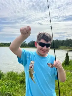
uploaded by: rich77

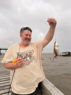
uploaded by: rich77

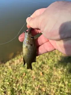
uploaded by: rich77

uploaded by: Rex_Ursus

uploaded by: bandedwd

uploaded by: Trey Cowan

uploaded by: Trey Cowan

uploaded by: Trey Cowan

uploaded by: Trey Cowan

uploaded by: Michael Mayse
Best Fishing Spots in the greater West Nyack area
Beaches and Bays are ideal places for land-based fishing. If the beach is shallow and the water is clear then twilight times are usually the best times, especially when they coincide with a major or minor fishing time. Often the points on either side of a beach are the best spots. Or if the beach is large then look for irregularities in the breaking waves, indicating sandbanks and holes. We found 8 beaches and bays in this area.
Haverstraw Bay - 11km , Croton Bay - 12km , Half Moon Bay Marina - 13km , Stony Point Bay - 15km , Patsys Bay Marina - 15km , Campfire Lake - 16km , Old Sebago Beach - 17km , Ten Eycks Beach - 17km
Harbours and Marinas can often times be productive fishing spots for land based fishing as their sheltered environment attracts a wide variety of bait fish. Similar to river mouths, harbour entrances are also great places to fish as lots of fish will move in and out with the rising and falling tides. There are 13 main harbours in this area.
Hook Mountain Yacht Club - 5km, Julius Peterson Boat Yard - 5km, Tarrytown Marina - 9km, Half Moon Bay Marina - 13km, Haverstraw Marina - 13km, Forest View Boat Basin (historical) - 14km, Penny Bridge Marina - 14km, Minisceongo Yacht Club - 14km, Patsys Bay Marina - 15km, Seaweed Yacht Club - 15km, Willow Cove Marina - 16km, Alpine Boat Basin - 17km, J F Kennedy Memorial Marina - 17km
We found a total of 99 potential fishing spots nearby West Nyack. Below you can find them organized on a map. Points, Headlands, Reefs, Islands, Channels, etc can all be productive fishing spots. As these are user submitted spots, there might be some errors in the exact location. You also need to cross check local fishing regulations. Some of the spots might be in or around marine reserves or other locations that cannot be fished. If you click on a location marker it will bring up some details and a quick link to google search, satellite maps and fishing times. Tip: Click/Tap on a new area to load more fishing spots.
Garrabrant Pond - 3km , Martins Lake - 3km , Reed Pond - 5km , Hook Mountain Yacht Club - 5km , Julius Peterson Boat Yard - 5km , Congers Lake - 6km , Rockland Lake - 6km , Pascack Creek Bridge - 6km , Swartwont Lake - 7km , Tappan Zee - 7km , Tappan Zee Bridge - 7km , Verdrietege Hook - 7km , Lake Idlewild - 8km , Kingsland Point - 8km , Ferdon Avenue Bridge - 8km , Piermont Avenue Bridge - 8km , Sparkill Creek Bridge - 8km , Lake Tappan Dam - 9km , Tarrytown Marina - 9km , Sleepy Hollow Bridge - 9km , Cooper Pond - 10km , Kemeys Cove - 10km , Lake Lucille - 10km , Old Croton Aqueduct - 10km , Tellers Point - 10km , Woodcliff Lake Dam - 11km , Bockar Lake - 11km , Croton Point - 11km , Gurnee Lake - 11km , Haverstraw Bay - 11km , New Croton Aqueduct - 11km , Ecker Bridge - 11km , Bowline Point - 12km , Crawbuckie Point - 12km , Croton Bay - 12km , Swan Lake - 12km , Dover Kill Island (historical) - 12km , Enochs Neck - 12km , Northwest Point - 12km , High Street Bridge - 12km , Kill Brook Bridge - 12km , Lodge Pool - 13km , Half Moon Bay Marina - 13km , Haverstraw Marina - 13km , Cheesecote Pond - 14km , Choate Pond - 14km , Deer Island - 14km , Grassy Point - 14km , Paradise Island - 14km , Rockhill Pond - 14km , Forest View Boat Basin (historical) - 14km , Penny Bridge Marina - 14km , Minisceongo Yacht Club - 14km , Lake Antrim - 15km , Little Lake - 15km , Oscawana Island - 15km , Pine Meadow Lake - 15km , Pleasant Lake - 15km , Royall Pond - 15km , Stony Point Bay - 15km , Saw Mill River Bridge - 15km , Cedar Pond Bridge - 15km , Patsys Bay Marina - 15km , Seaweed Yacht Club - 15km , Coles Pond - 16km , Oradell Reservoir Dam - 16km , Campfire Lake - 16km , Georges Island - 16km , Hardscrabble Lake - 16km , Montrose Point - 16km , Oliver Pond - 16km , Quaker Bridge - 16km , Stony Point - 16km , Lake Wanoksink - 16km , Willow Cove Marina - 16km , Alpine Boat Basin - 17km , Suraci Pond - 17km , Van Gelders Pond - 17km , Wild Duck Pond - 17km , Ambreys Pond - 17km , Bakwin Pond - 17km , Dream Lake - 17km , Echo Lake - 17km , Frankcrest Pond - 17km , Greens Cove - 17km , J F Kennedy Memorial Marina - 17km , Naumburg Pond - 17km , Old Sebago Beach - 17km , Verplanck Point - 17km , Ten Eycks Beach - 17km , Colabaugh Pond - 18km , Lake Meahagh - 18km , New Croton Dam - 18km , Pine Lake - 18km , Croton Dam Road Bridge - 18km , Maple Lake Dam - 19km , Pfisters Pond - 19km , Blue Lake - 19km , Crestwood Lake - 19km
Comments